WHR
Pont Croesor to Pen-y-Mount
area page
V4.8 updated 1/4/07
New images on this page are from 25/3/07
Click here for start of new images
Click here for Laurence Armstrong's latest WHR South map
Click here for Steve Harris' Phase 4 gradient profiles
Click here for Steve Harris' Phase 4 TWA maps
Click here for Chainages and OS Map References
Locations
This section covers the route from LC114 (Ch.31050) immediately south of Pont Croesor to the junction the WHR(P) at LC121 (Ch.33550). The route is roughly level through this section and built on sand embankments originally constructed by the Croesor Tramway. There was an original Croesor Tramway loop immediately south of Pont Croesor, the Afon Glaslyn Bridge (UB212).
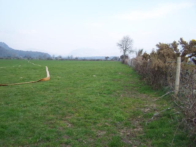
The route heads in an almost straight line south west towards Porthmadog. The abandoned earthworks of the never completed standard gauge Beddgelert Railway curve in from the right by Ch.31500. The public footpath from the main road joins at LC118 (Ch32300). This footpath continues along the east side all the way to the Network Rail boundary in Porthmadog.
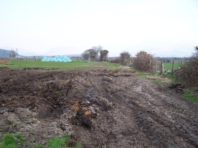
Southwest of LC118, the railway lies on a ledge on the side of the Creasy embankment. This is a sand-built seawall constructed between Portreuddyn and Porthmadog that predates The Cob. A section of the embankment appears to have been grubbed away by a local farmer and will need replacing.
The WHR(P) is extending the route north from LC121 where the headshunt lies for the existing Beddgelert siding operation. They intend to construct the route from Spring 2003 as far as Traeth Mawr and install a temporary loop there (Ch.32500 approx.). This is just south of the former Portreuddyn loop on the original Croesor Tramway.
Clearance of rubbish took place between LC121 and LC120 in August 2001 after the false start caused by the F&M epidemic in February. A local farmer has erected fencing for the railway in this area introducing a slight dog-leg into the previously straight alignment.
Gradients
The formation is almost level throughout this section. however, there is a slight rise at 1 in 239 towards LC121 at the south end of this section.
WHR(P) plans
The WHR(P) is making progress with the 2.5km Pen-y-Mount Ch.33550 to Pont Croesor section Ch.31050. It is their intention to build this in two phases :-
Phase 1 Pen-y-mount to Traeth Mawr
Phase 2 Traeth Mawr to Pont Croesor
While Portreuddyn is the site of a former Croesor Tramway loop, it is the intention to construct a temporary loop just south of this location due to a land ownership issue. The project costs are estimated to be some £400,000 and coordination with the WHLR has been good with site visits by the WHLR Manager/Engineer from 1/7/01.
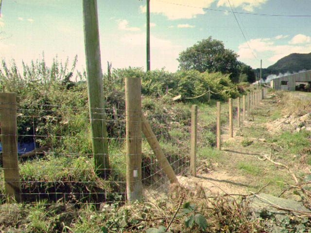
Work started in February 2001 but was immediately halted until August by the F&M epidemic restrictions. North of Pen-y-Mount, work started again a year ago clearing rubbish, removing Japanese Knotweed etc. Monthly WHR(P) working parties have fenced the line and improved the public footpath that runs alongside it to Portreuddyn, adding kissing gates etc.
During the winter, a 2m wide path was hacked through undergrowth south from Pont Croesor to a section of trackbed that was already clear at Portreuddyn. On 4/2/02, the Topographical Survey was completed on that section. After agreement with the WHLR, plans were submitted to GCC for approval and the WHR(P) hoped to be able to get down to actual construction in the Autumn of 2002.
The WHR(P) received one of the Dinas points from WHLR recently and constructed the crossover at Pen-y-Mount during their Civils' Week from 27/7/02. As well as providing access to the 'main line' of the WHR, the crossover also provides a headshunt/trap point for shunting WHR(P) internal services clear of the future WHR main line.
Phase 1 will finish at 'Traeth Mawr', some 800m north of Pen-y-mount where there is an issue about trackbed ownership.
Planning Permission granted
Dave Allan (WHR(P)) announced at the WHRS AGM (14/9/02) that receipt of planning permission was expected soon and then the WHR(P) could start to construct the route. Prior to this only clearance and fencing could be undertaken. Planning permission was finally granted on 17/3/03.
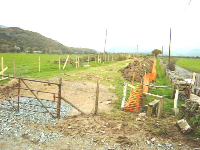
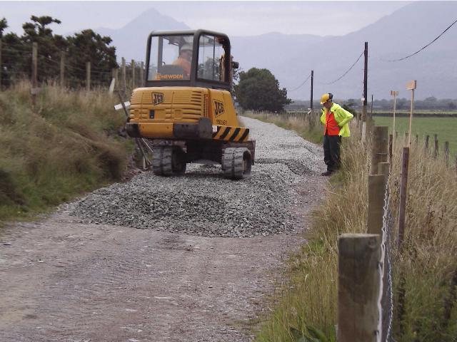
At the north end work started in September 2006 with clearance of the Pont Croesor loop site. Fencing contractors started work south from Pont Croesor in February 2007 but had not reached Traeth Mawr loop by 25/3/07. However, there was evidence of pegs marking out the alignment north of the loop.
Work started at the south end on 24/3/03. After the week-long bash with earth moving equipment, volunteer work continued during April. Earth from the continuing Japanese Knotweed excavation has to be stored for subsequent treatment. Some slate waste for consolidating the trackbed has been stored on sheeting on top of the point installed at the future junction with the WHR(P).
The first job is to create a 'haul road'. This is to allow access for the excavator/dumper and is at a lower level than the final trackbed. It does not necessarily follow the final alignment of the track. Indeed, a "jog" at Pen-y-Mount is caused by the temporary access gate not being directly on the line of the future track.
Effectively, the WHR(P) are subcontractors to the WHLR and are building the railway to common design standards. Because of lack of funds, the work will proceed with volunteers in spurts at holiday times. The excavator was noted leaving the site on 28/4/03 after the work done in the Easter break. By 27/4/03 work had reached Ch.33250 approx.
Summer/Autumn 2003 progress
Work continued during August. Volunteers are doing all the work except for the specialist Cattle Sorting Pens. Negotiations between the FR and Farmer Williams (owner of the trackbed at Portreuddyn) have been sub-contracted to the WHR(P), in the form of Chairman Dave Allan. One half of the WHR(P)'s current monthly donated Extension income is going directly to the Consultants covering Countryside issues, Badgers, Knotweed, etc.
At the end of the 9 day "Autumn Bash" (during which volunteers had at one stage 3 dumpers, 2 JCB 360s and a vibro-roller), the state of play was as follows:-
1) Formation (a better name than the previous "haul road") completed to about metre 790 (Ch.34750 approx.) with slate waste, now being supplied by a Porthmadog contractor - O.J.Jones).
2) Over half the farmer's mitigation road complete. This was provided alongside the railway as the farmer can no longer drive on the trackbed.
3) All fencing from farm land complete to end (metre 900), except for sections around accommodation crossings.
4) Footpath fencing about one third done.
5) All survey and marking out complete.
6) Work started on site of temporary "Traeth Mawr" loop (75 lb. points and rail already in stock).
7) Considerable work done on "batters" (slopes) - including a new dry stone retaining wall - now half complete.
8) Farmer's stock water supply rerouted, buried and piped.
9) Farmer's new Sorting Shed site - work begun by contractors. This mitigation is a direct replacement for previously proposed Cattle Creep.
10)Begun preparation for ballast storage area.
11) Now sourcing rail, etc.
12) Public footpath now more accessible than in years.
13) "Traeth Mawr" running-in board - in the WHR 1920s style - ready for erection.
Creasy Embankment
The Creasy Embankment is a former sea wall that predates The Cob. The embankment is largely built of sand and has been excavated in places. The Croesor Tramway first made use of the embankment and was constructed on a ledge on the southeast side. The WHR follows the same course.
The WHR(P) has improved the footpath access with kissing gates on the south east side of the formation. However, the TWO maps indicate the footpath was to move to the north west side of the formation. Apparently the footpath will move to the north west side north of Traeth Mawr loop.
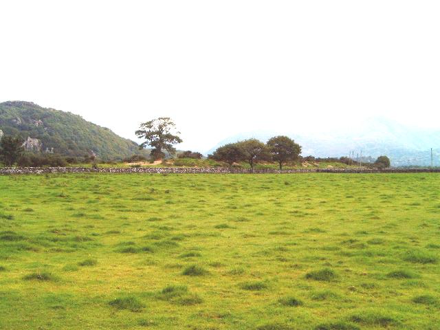
These northerly views ( 25/8/02 and 23/3/07) show the formation on a ledge on the southeast side of the Creasy sand embankment, a former sea wall that pre-dates The Cob. Work was in progress here from Spring 2003. The second view shows Gelert leading Prince and the Opening Special south across the Traeth with the Aberglaslyn Pass and snow covered mountains in the distance. Click on the images to enlarge. The first image is copyright B W Hughes and was taken on Samsung Digimax 230 camera. The second image is courtesy/copyright Andy Goodwin and was taken on a digital camera. Images post processed using iPhoto Plus4 and displayed at 96dpi.
Pont Croesor Loop
The clearance of Pont Croesor Loop site has revealed the site of the former Croesor Tramway loop. This site may require some fill to provide the 200m loop and space for platforms. If the Osprey season continues in 2007, the loop will be completed with halt style platforms in 2008. A concrete foundation of a shed found part the way along the loop may have been from a more recent cowshed.
This southerly view (29/10/06) shows the cleared site of the Pont Croesor loop, immediately south of LC114 at Pont Croesor. Click on the image to enlarge. This image is copyright B.W.Hughes and was taken on a Kodak DX6490 digital camera. Image post processed using iPhoto Plus4 and displayed at 96dpi.
This northerly view (31/10/06) shows the cleared site of the Pont Croesor loop from the south end. Click on the image to enlarge. This image is copyright B.W.Hughes and was taken on a Kodak DX6490 digital camera. Image post processed using iPhoto Plus4 and displayed at 96dpi.

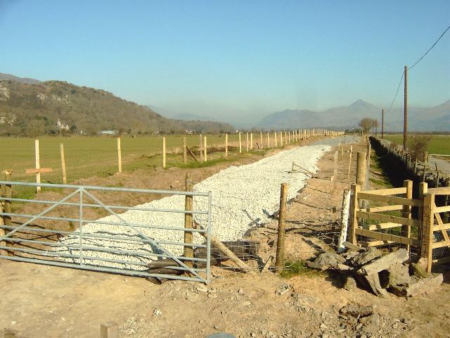
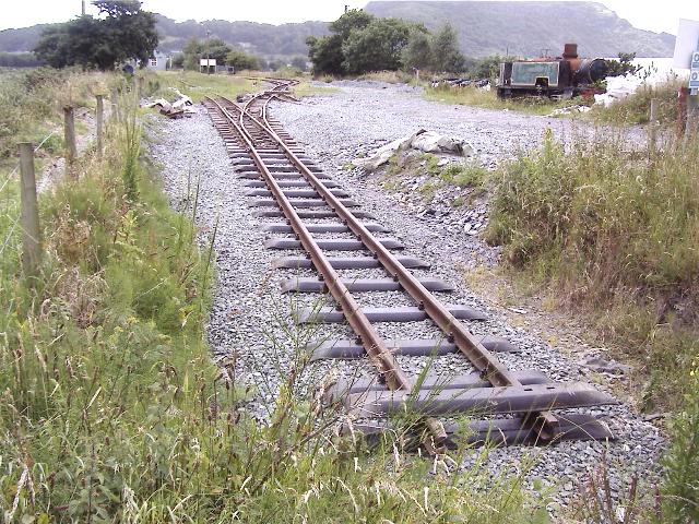
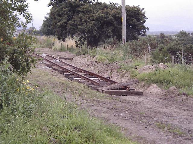
This southerly view (31/10/06) shows the trackbed south of the Pont Croesor loop. At the south end, where UB213 should be, is an excavation across the trackbed. The standard 200m loop will terminate will terminate on the new culvert. Click on the image to enlarge. This image is copyright B.W.Hughes and was taken on a Kodak DX6490 digital camera. Image post processed using iPhoto Plus4 and displayed at 96dpi.
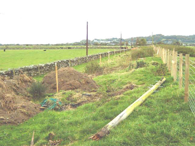
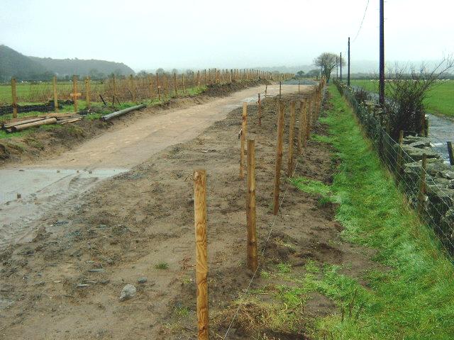
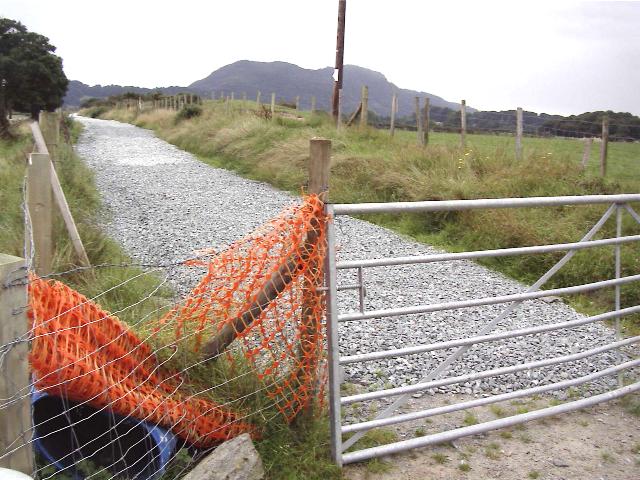
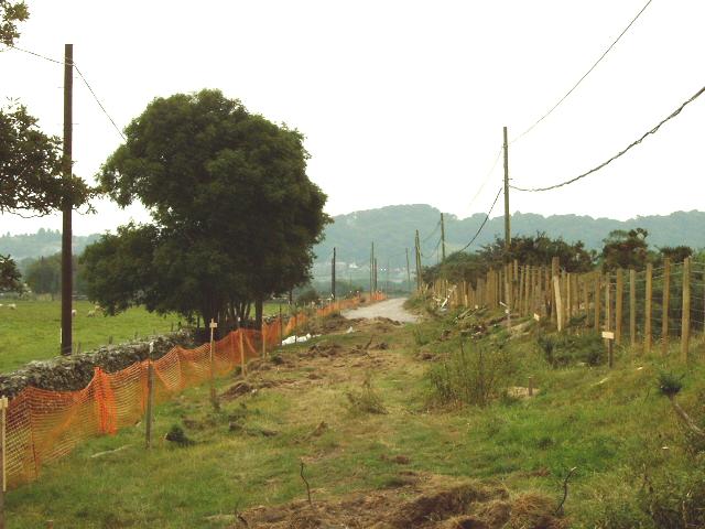
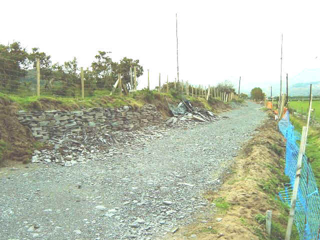
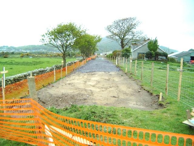
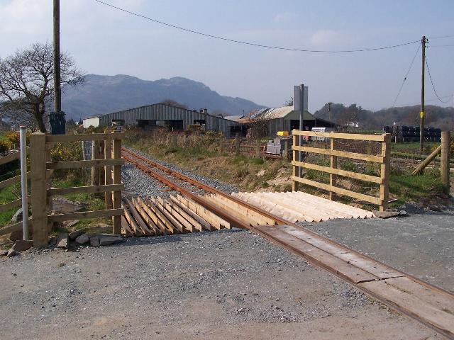
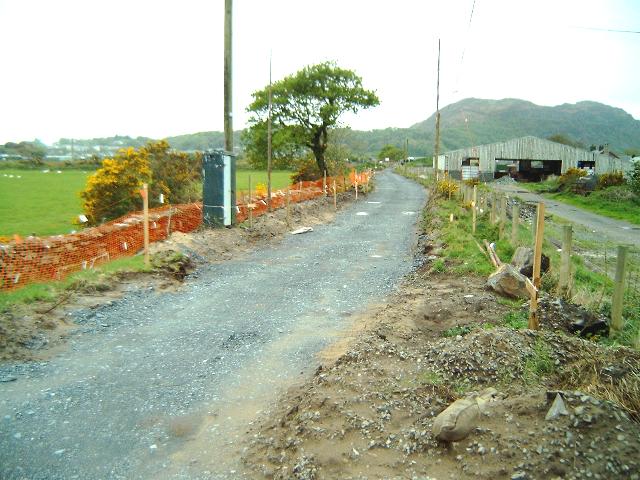
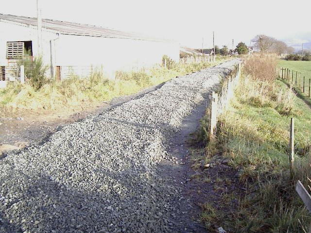
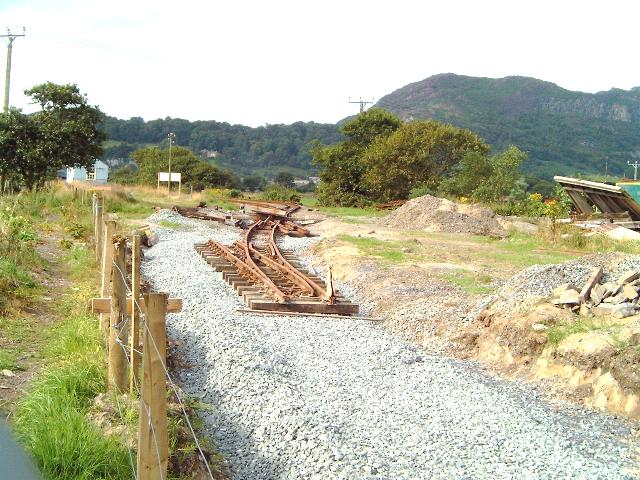
This northerly view (25/3/07) shows the trackbed at Ch.32300 approx. Pegs mark out the fence lines as the contractors approach from Pont Croesor. Click on the image to enlarge. This image is copyright B.W.Hughes and was taken on a Kodak DX6490 digital camera. Image post processed using iPhoto Plus4 and displayed at 96dpi.

This southerly view (25/3/07) shows the trackbed at Ch.32300 approx. Pegs mark out the fence lines as the contractors approach from Pont Croesor. Traeth Mawr loop is in the distance. Click on the image to enlarge. This image is copyright B.W.Hughes and was taken on a Kodak DX6490 digital camera. Image post processed using iPhoto Plus4 and displayed at 96dpi.
Traeth Mawr loop to Cynfal

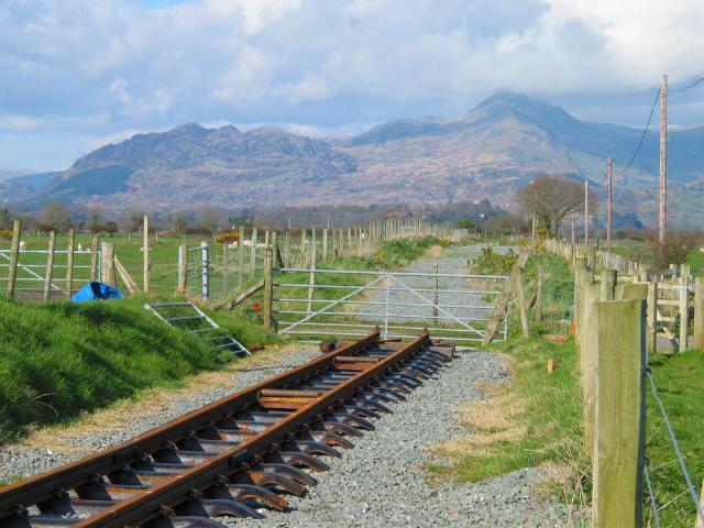
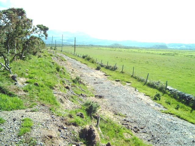
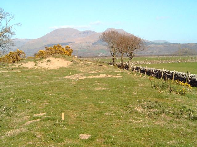
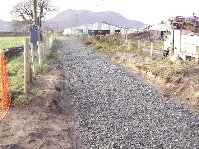
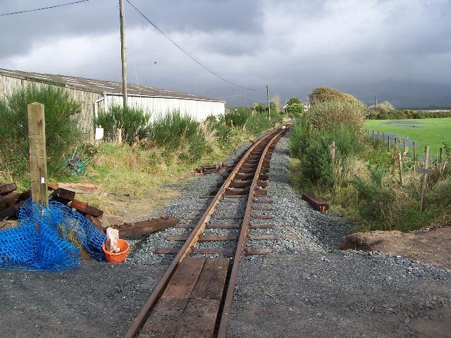
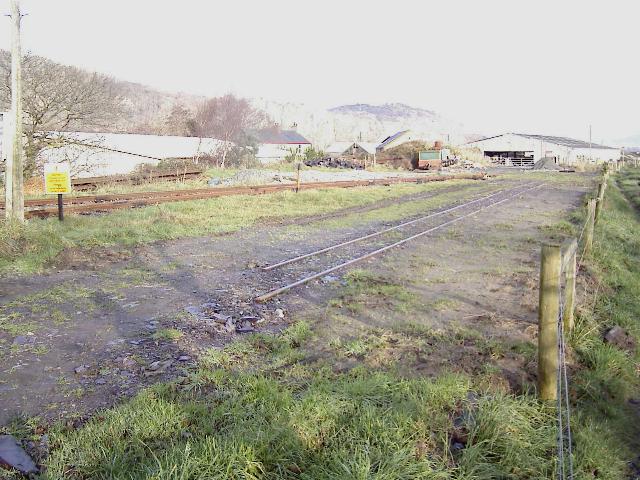
These northerly views (30/10/03 and 25/3/07) show the formation has been ploughed under in the field just past the 900m mark beyond Traeth Mawr loop. The footpath follows the fence to the right and the railway land is immediately the left of this. In the second view pegs have marked out the fence lines and the contractor is approaching with fencing from Pont Croesor. Click on image to enlarge. This image is copyright B W Hughes. Image taken on Samsung Digimax 230 camera. Image post processed with iPhotoPlus4 and displayed at 96dpi.
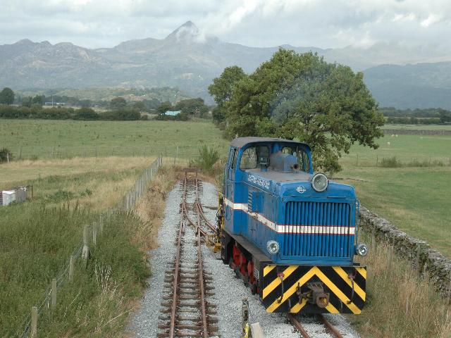
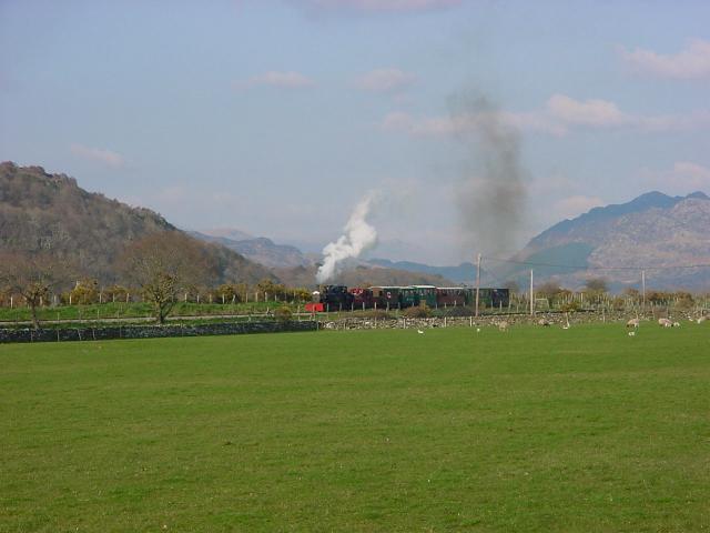
This northerly view (5/8/06) shows Cnicht forming a backdrop as Polish LYd2 diesel No. 60 Eryri moves the tamper into position at Traeth Mawr Loop. The loco is seen running around from the top of a van. Beyond this point, the embankment has been levelled out for a few hundred yards, making the exact course of the line hard to discern. Pont Croesor lies 1.5 km (about 1 mile) to the north. The northerly lineside public footpath continues to LC118 at Ch.32300 before diverging towards Prenteg. Click on the image to enlarge. This image is courtesy WHR(P) copyright Geoff Jenkins and was taken on a digital camera. Image post processed using iPhoto Plus4 and displayed at 96dpi.
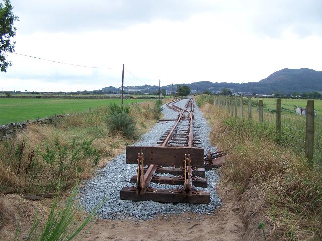
This southerly view (30/10/03) shows the reverse angle to that above with the north end of Phase I at Traeth Mawr loop, some 900m from Pen-y-Mount. The buffer stop will be adjacent to the tree. The footpath follows the wall to the left. All the land required is now fenced off. Click on image to enlarge. This image is copyright B W Hughes. Image taken on Samsung Digimax 230 camera. Image post processed with iPhotoPlus4 and displayed at 96dpi.
This southerly view (30/10/03) shows the site of the headshunt for Traeth Mawr loop. After the diversion of the pole route to follow the wall and footpath to the left, redundant poles were demolished. Click on image to enlarge. This image is copyright B W Hughes. Image taken on Samsung Digimax 230 camera. Image post processed with iPhotoPlus4 and displayed at 96dpi.

This south-westerly view (10/1/04) shows the headshunt at Ch.900 (T&W Ch.32650 approx.) as seen form UB217. A cattle underpass is planned here and the temporary loop will be regraded to slope up at 1 in 100 towards the viewpoint when the line is extended towards Pont Croesor. The geotextile prevents the ballast mixing with the vibro-rolled sand. Click on the image to enlarge. This image is copyright B W Hughes and was taken on a Samsung Digimax 200 camera. Image post processed using iPhoto Plus4 image correction technology and displayed at 96dpi.
This southerly view (10/8/06) shows the temporary buffer stop and loop at Traeth Mawr at the end of the 900m Extension from Pen-y-Mount. The point lever at this end remained to be fitted. Click on the image to enlarge. This image is copyright B.W.Hughes and was taken on a Kodak DX6490 digital camera. Image post processed using iPhoto Plus4 and displayed at 96dpi.
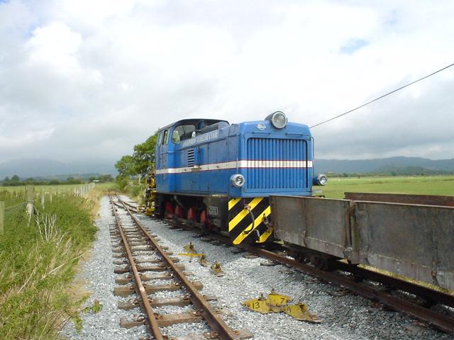
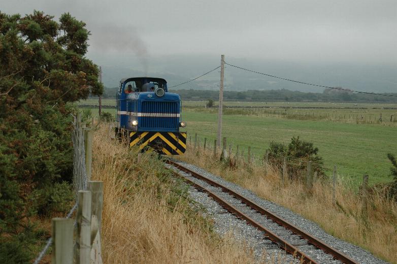
This northerly view (5/8/06) shows LyD2 diesel Eryri hauling ballast wagons at Traeth Mawr headshunt. Click on image to enlarge. This image is copyright Andrew Goodwin. Image taken on digital camera. Image post processed with iPhotoPlus4 and displayed at 96dpi.
This northerly view (5/8/06) shows LyD2 Polish diesel Eryri No. 60 bringing the works train to a stand at Traeth Mawr Loop on the WHR(P) extension. The buffer stop beyond the loco will be the end of the line for a few years until Phase Four of the Welsh Highland revival is completed. Click on image to enlarge. This image is copyright Geoff Jenkins. Image taken on digital camera. Image post processed with iPhotoPlus4 and displayed at 96dpi.
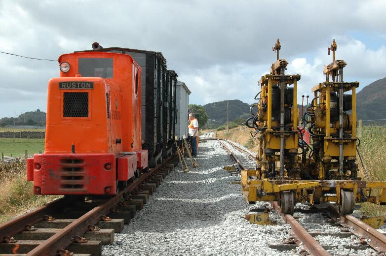
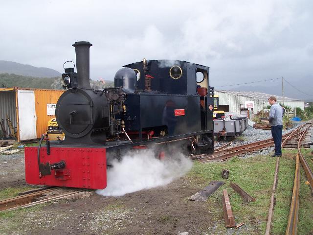
This southerly view (30/7/06) shows the works train is in the hands of Ruston & Hornsby 48DL (370555 of 1953) in the loop, while the Tal-y-Llyn Railway’s Matisa tamper (on loan and regauged from 2’3” to 2’) awaits its next turn of duty in the running line. Click on image to enlarge. This image is copyright Geoff Jenkins. Image taken on digital camera. Image post processed with iPhotoPlus4 and displayed at 96dpi.

This northerly view (30/10/03) shows the formation of the run round loop curving into the headshunt. A double width formation at this location will allow for the running line to the left and the run round loop to the right. Click on image to enlarge. This image is copyright B W Hughes. Image taken on Samsung Digimax 230 camera. Image post processed with iPhotoPlus4 and displayed at 96dpi.
This north-easterly view (10/1/04) from the public footpath shows the 80 m extent of the ballasting over the New Year. The nearer part is double width as this is the area of the loop. Click on the image to enlarge. This image is copyright B W Hughes and was taken on a Samsung Digimax 200 camera. Image post processed using iPhoto Plus4 image correction technology and displayed at 96dpi.
This southerly view (30/10/03) shows the reverse angle to that above with the wider formation for the loop under construction. The public footpath follows the wall to the left. Click on image to enlarge. This image is copyright B W Hughes. Image taken on Samsung Digimax 230 camera. Image post processed with iPhotoPlus4 and displayed at 96dpi.

This northerly view (16/9/06) at Traeth Mawr shows Gelert in the loop and a pw train in the headshunt with the prominent mountain Cnicht in the backdrop. The route is provisionally set to open to passengers in March 2007. Click on the image to enlarge. This image is courtesy/copyright Paul Bender and was taken on a Canon Powershot A20 digital camera. Image post processed using iPhoto Plus4 and displayed at 96dpi.
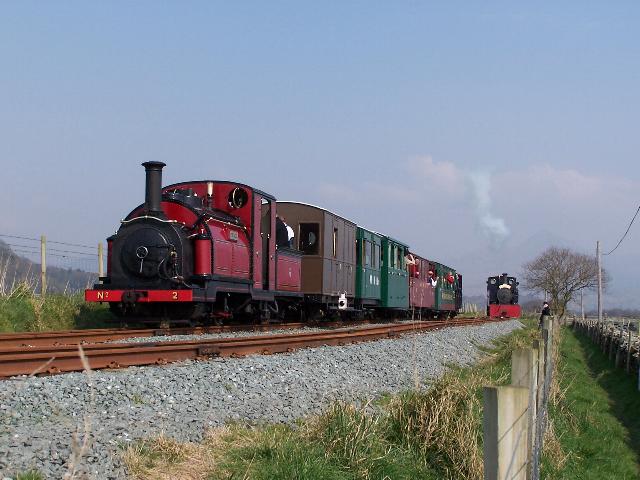
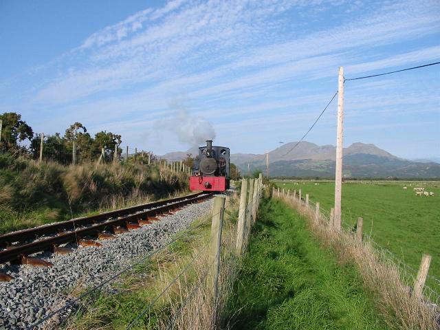
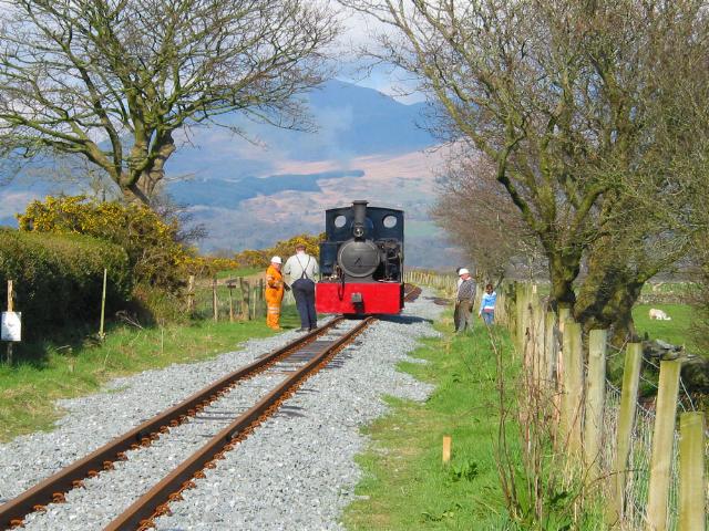
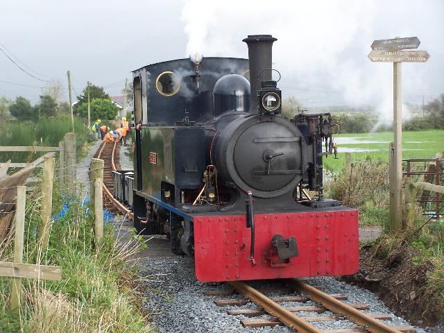
This northerly view (25/3/07) shows Prince at the Traeth Mawr loop, having run round. The WHR(P) loco Gelert is running round to head the train back to Porthmadog. Click on the image to enlarge. This image is copyright B.W.Hughes and was taken on a Kodak DX6490 digital camera. Image post processed using iPhoto Plus4 and displayed at 96dpi.
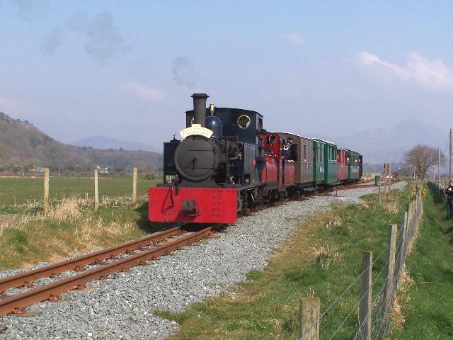
This northerly view (25/3/07) shows Gelert at the Traeth Mawr loop, having run round. The WHR(P) loco Gelert is double heading Prince back to Porthmadog. Click on the image to enlarge. This image is copyright B.W.Hughes and was taken on a Kodak DX6490 digital camera. Image post processed using iPhoto Plus4 and displayed at 96dpi.
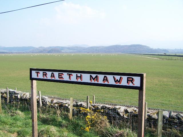
This easterly view (25/3/07) shows the Traeth Mawr loop sign. Passengers are not allowed to board or leave the train at this location. Click on the image to enlarge. This image is copyright B.W.Hughes and was taken on a Kodak DX6490 digital camera. Image post processed using iPhoto Plus4 and displayed at 96dpi.
This northerly view (30/10/03) shows the formation some 720m out from Pen-y-Mount. The point for the loop will be situated just north of this crossing. To the right is visible the Traeth Mawr Bypass', a farmer's mitigation track constructed by the RED gang. Click on image to enlarge. This image is copyright B W Hughes. Image taken on Samsung Digimax 230 camera. Image post processed with iPhotoPlus4 and displayed at 96dpi.
This north-easterly view (10/1/04) shows the south end of Traeth Mawr Loop from the stile at LC119 (Ch.32850). Click on the image to enlarge. This image is copyright B W Hughes and was taken on a Samsung Digimax 200 camera. Image post processed using iPhoto Plus4 image correction technology and displayed at 96dpi.
The loop area has not had slate waste added as the loop is temporary, prior to extending with plain line to Pont Croesor. The site will also need regrading. Geotextile has been laid and a 25cm ballast layer is being laid on top of this, working from the north back towards Pen-y-Mount. Progress had reached 80m by 5/1/04.The intrepid band of volunteers was working in the pouring rain on 1/1/04! Including the loop, the total length of works is 912m.
This north-easterly view (21/2/04) from the public footpath shows the completed ballasting of the loop. Click on the image to enlarge. This image is copyright B W Hughes and was taken on a Samsung Digimax 200 camera. Image post processed using iPhoto Plus4 image correction technology and displayed at 96dpi.
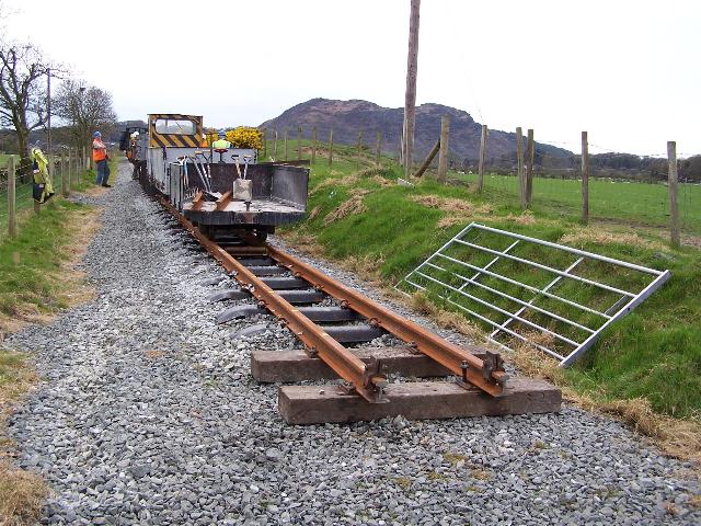
This northerly view (19/4/06) showing LC119 shows the Head of Steel as it will remain for a few weeks. The site of the new temporary Traeth Mawr loop is immediately north of the gate. Click on the image to enlarge. This image is copyright Dave Waldren and was taken on a digital camera. Image post processed using iPhoto Plus4 and displayed at 96dpi.
This northerly view (10/8/06) shows the temporary loop at Traeth Mawr from LC119. Click on the image to enlarge. This image is copyright B.W.Hughes and was taken on a Kodak DX6490 digital camera. Image post processed using iPhoto Plus4 and displayed at 96dpi.
This southerly view (30/10/03) shows the reverse angle to that above. The formation is complete to 720m from Pen-y-Mount, with the public footpath following the wall to the left. Click on image to enlarge. This image is copyright B W Hughes. Image taken on Samsung Digimax 230 camera. Image post processed with iPhotoPlus4 and displayed at 96dpi.
This southerly view (3/8/04) shows the ballast completed south of the temporary Traeth Mawr loop. Click on the image to enlarge. This image is copyright B.W.Hughes and was taken on a Concord 3340z (3.1 Mega pixel) digital camera. Image post processed using iPhoto Plus4 image correction technology and displayed at 96dpi.
This southerly view (20/4/06) from LC119 shows the Head of Steel at the end of the Easter Bash by WHR(P) volunteers. Click on the image to enlarge. This image is copyright B.W.Hughes and was taken on a Kodak DX6490 digital camera. Image post processed using iPhoto Plus4 and displayed at 96dpi.
This northerly view (31/7/06) shows the final stages of tamping just south of the Traeth Mawr loop. Click on image to enlarge. This image is copyright Andrew Goodwin. Image taken on digital camera. Image post processed with iPhotoPlus4 and displayed at 96dpi.
This southerly view (10/8/06) shows the ballasted track south of LC119. Click on the image to enlarge. This image is copyright B.W.Hughes and was taken on a Kodak DX6490 digital camera. Image post processed using iPhoto Plus4 and displayed at 96dpi.
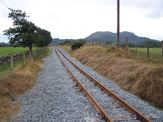
This southerly view (8/03) shows the formation on a ledge on the southeast side of the Creasy sand embankment, near the 600m marker. Click on image to enlarge. This image is copyright B W Hughes. Image taken on Samsung Digimax 230 camera. Image post processed with iPhotoPlus4 and displayed at 96dpi.
This northerly view (30/7/06) shows No.60 bedding in the extension by running several light engine trips. Click on image to enlarge. This image is copyright Geoff Jenkins. Image taken on digital camera. Image post processed with iPhotoPlus4 and displayed at 96dpi.

This northerly view (8/03) shows the formation and footpath to the right near the 600m marker. Click on image to enlarge. This image is copyright B W Hughes. Image taken on Samsung Digimax 230 camera. Image post processed with iPhotoPlus4 and displayed at 96dpi.
This northerly view (27/8/01) from Ch.33,100 approximately, north of Cynfal l/c, shows the ledge formation covered with gorse on the southeast side of the Creasy Embankment. No clearance had been done on this section at this time. Click on image to enlarge. This image is copyright B W Hughes. Image taken on Samsung Digimax 230 camera. Image post processed with iPhotoPlus4 and displayed at 96dpi.
This northerly view (30/3/03) from Ch.33,100 approximately, north of Cynfal l/c, shows the newly cleared ledge formation through former gorse on the southeast side of the Creasy Embankment. The footpath is currently to the right of the formation on the southeast side but TWO plans indicate it should be moved to the top of the sand embankment to the left. Sleeper spacings are occasionally visible on this length. Click on image to enlarge. This image is copyright B W Hughes. Image taken on Samsung Digimax 230 camera. Image post processed with iPhotoPlus4 and displayed at 96dpi.

This northerly view (28/4/03) from Ch.33,100 approximately, north of Cynfal l/c, shows the newly cleared ledge formation through former gorse on the southeast side of the Creasy Embankment. The old A-frame wooden footpath stile is visible to the right. Click on image to enlarge. This image is copyright B W Hughes. Image taken on Samsung Digimax 230 camera. Image post processed with iPhotoPlus4 and displayed at 96dpi.
This northerly view (30/10/03) shows the RED gang have been using dry stone walling techniques to support the sand of the Creasy embankment. Further along geotextile netting is visible. Click on image to enlarge. This image is copyright B W Hughes. Image taken on Samsung Digimax 230 camera. Image post processed with iPhotoPlus4 and displayed at 96dpi.
This northerly view (16/9/06) about halfway along the Extension shows Gelert testing out the recently tamped track Click on the image to enlarge. This image is courtesy/copyright Paul Bender and was taken on a Canon Powershot A20 digital camera. Image post processed using iPhoto Plus4 and displayed at 96dpi.
This southerly view (28/4/03) from Ch.33,200 approximately, north of Cynfal l/c, shows the ledge formation on the Creasy Embankment will require much reconstruction in places. This view is the opposite angle to that above. The footpath runs along the wall to the left. Click on image to enlarge. This image is copyright B W Hughes. Image taken on Samsung Digimax 230 camera. Image post processed with iPhotoPlus4 and displayed at 96dpi.
Another work party extended the clearance further north and by 7/6/03 the trackbed was made up to Ch.210 with a further 180 cleared north of that point.

This southerly view (14/6/03) shows the formation cleared down to original ballast as far as the two telegraph poles. Rabbit warrens have added some sand fill to the trackbed over the years! Click on image to enlarge. This image is copyright B W Hughes. Image taken on Samsung Digimax 230 camera. Image post processed with iPhotoPlus4 and displayed at 96dpi.
This northerly view (8/03) from the reverse angle to that above shows the poles just before they were demolished. Click on image to enlarge. This image is copyright B W Hughes. Image taken on Samsung Digimax 230 camera. Image post processed with iPhotoPlus4 and displayed at 96dpi.
This north-easterly view (29/7/04) shows the limit of ballast laying at the end of that day with Cnicht in the background. Ballast is now within sight of Pen-y-Mount. Click on the image to enlarge. This image is copyright B.W.Hughes and was taken on a Concord 3340z (3.1 Mega pixel) digital camera. Image post processed using iPhoto Plus4 image correction technology and displayed at 96dpi.

This southerly view (14/6/03) from Ch.33,160 approximately (WHR(P) Ch.390) shows the end of the newly cleared ledge formation on the southeast side of the Creasy Embankment. The original 1920s ballast is still visible with sleeper markings and the occasional remains of a sleeper! Click on image to enlarge. This image is copyright B W Hughes. Image taken on Samsung Digimax 230 camera. Image post processed with iPhotoPlus4 and displayed at 96dpi.
This northerly view (14/6/03) from Ch.33,160 approx. shows the formation cleared down to the 1920s ballast. In the distance are the two telephone poles. Click on image to enlarge. This image is copyright B W Hughes. Image taken on Samsung Digimax 230 camera. Image post processed with iPhotoPlus4 and displayed at 96dpi.
This southerly view (14/6/03) from north of Cynfal l/c, shows the newly cleared ledge formation on the southeast side of the Creasy Embankment. In the distance is the completed formation with slate waste fill to Ch.33040 (WHR(P) Ch.210). Click on image to enlarge. This image is copyright B W Hughes. Image taken on Samsung Digimax 230 camera. Image post processed with iPhotoPlus4 and displayed at 96dpi.
Talar Wen field
This southerly view (28/4/03) from Ch.33,200 approximately from the top of the Creasy Embankment, north of Cynfal l/c, shows the fence line along the newly cleared formation north of Cynfal l/c. The Head of Work is visible in the distance marked by orange plastic mesh. Some original ballast and sleeper spacings are visible to the left. Click on image to enlarge. This image is copyright B W Hughes. Image taken on Samsung Digimax 230 camera. Image post processed with iPhotoPlus4 and displayed at 96dpi.
This southerly view (28/4/03) from Ch.33,250 approximately, north of Cynfal l/c, shows the newly consolidated formation with some slate fines. The sand foundation has had to be built up on the left hand side. Click on image to enlarge. This image is copyright B W Hughes. Image taken on Samsung Digimax 230 camera. Image post processed with iPhotoPlus4 and displayed at 96dpi.
This northerly view (30/3/03) from Ch.33,250 approximately, north of Cynfal l/c, shows the newly cleared formation on the southeast side of the Creasy Embankment. The railway begins to run along the ledge to the right. The higher section of the embankment has been removed for a short length. Yellow survey posts mark the future fence line. Click on image to enlarge. This image is copyright B W Hughes. Image taken on Samsung Digimax 230 camera. Image post processed with iPhotoPlus4 and displayed at 96dpi.
This northerly view (28/4/03) from Ch.33200, north of Cynfal l/c, shows the newly consolidated trackbed approaching the Creasy Embankment. Click on image to enlarge. This image is copyright B W Hughes. Image taken on Samsung Digimax 230 camera. Image post processed with iPhotoPlus4 and displayed at 96dpi.
By November 2004, the ballast had been laid as far as 73m from the level crossing. The gap could not be closed as the farmer was using the trackbed whilst waiting for a field bridge to be built in mitigation. It was hoped this matter could be completed by Xmas 2004.
This northerly view (12/12/04) from Ch.33200, north of Cynfal l/c, shows the newly ballasted trackbed, further ballasting awaiting the completion of a mitigating farmer's access field bridge. This may be completed to Cynfal l/c at Xmas 2004. Click on image to enlarge. This image is copyright B W Hughes. Image taken on Concord 3340z camera. Image post processed with iPhotoPlus4 and displayed at 96dpi.
This northerly view (17/4/06) shows Gelert testing the recently ballasted but untamped track next to Talar Wen field. Click on image to enlarge. This image is copyright Dave Waldren. Image taken on a Canon G2 digital camera. Image post processed with iPhotoPlus4 and displayed at 96dpi.

This northerly view (5/8/06) shows LyD2 diesel Eryri hauling ballast wagons just north of Cynfal Crossing. Click on image to enlarge. This image is copyright Andrew Goodwin. Image taken on digital camera. Image post processed with iPhotoPlus4 and displayed at 96dpi.
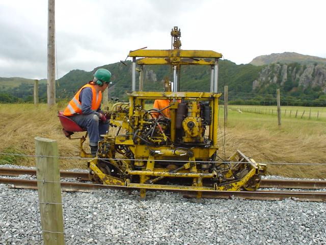
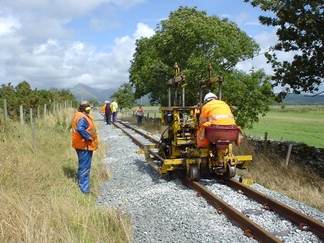
This northerly view (1/8/06) shows the regauged Tal-y-llyn tamper in action, north of Cynfal LC. Click on image to enlarge. This image is copyright Andrew Goodwin. Image taken on digital camera. Image post processed with iPhotoPlus4 and displayed at 96dpi.
Cynfal Crossing to Pen-y-Mount
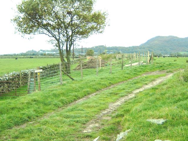
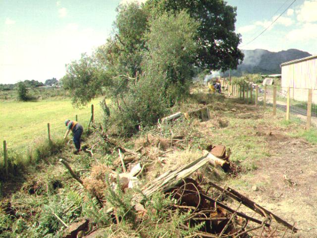
Clearance work south of Cynfal has involved removing tonnes of farm rubbish dumped on the trackbed. There is also a persistent Japanese Knotweed problem. The alignment has been changed here slightly to suit a local farmer who has fenced the new alignment for the WHR(P) as a sub-contractor.
This northerly view (25/8/02) from LC120 shows the newly cleared formation at Cynfal. The footpath is to the right of the formation. Click on image to enlarge. This image is copyright B W Hughes. Image taken on Samsung Digimax 230 camera. Image post processed with iPhotoPlus4 and displayed at 96dpi.


These northerly views (28/4/03 and 20/8/05) from a similar viewpoint to that above at Cynfal l/c show the newly cleared haul road passing Cynfal cottage. The footpath is between the wall and the orange plastic mesh fencing to the right. The second view shows the ballast completed to within a few yards of the crossing earlier in 2005. Click on images to enlarge. These images are copyright B W Hughes. Images taken on Samsung Digimax 230 camera and a Kodak DX6490 digital camera. Images post processed using iPhoto Plus4 and displayed at 96dpi.
Work continued throughout Easter week. By 22/4/03, the haul road was complete to the former gate beyond Cynfal, past the end of the long hedge seen in the above image. A fence along the northwest side of the formation was completed up to the start of the Creasy Embankment. On the southeast side, a temporary fence between the trackbed and the footpath has been erected. The haul road and fencing was completed to Traeth Mawr later in 2003. Ballasting could not be started until all earth moving was complete and the sub-base is built up, as the railway was being constructed from a single access at Pen-y-Mount.
The WHR(P) has contributed to the cost of purchasing the new Polish rail required for Phase 4. After some worries about rail deliveries, the WHRCL authorised delivery to Pen-y-Mount and lorries arrived on 20-21/10/05. A stack was built up on the east side of the future CTRL, just south of Pen-y-Mount Junction, on FR owned land. Work got underway on 22/10/04 and by 24/10/05, rails had crossed Pen-y-mount l/c.
Volunteers continued to lay rail north towards Cynfal l/c, which they reached and crossed on 27/10/05. In fact, being ahead of schedule, they laid an extra panel north of the l/c on 29/10/05. The track between the two level crossings is laid on temporary sleepers with pandrol clips awaiting the arrival of the permanent steel sleepers in November. The track will then be jacked up to slide in the new sleepers, clips will be added and top ballast laid. Subsequent volunteer parties will be able to extend rail towards Traeth Mawr loop when sufficient volunteers are available.

These northerly views (28/10/05 and 29/10/05) at Cynfal l/c show the newly cleared haul road passing Cynfal cottage. The first view shows the completed level crossing. The second view shows the extra length laid the following day as volunteers were ahead of schedule. Taxi 2 (previously used on Phase 4) was the first train to cross the crossing and is seen shunting ballast wagons north of the crossing. Click on the images to enlarge. These images are copyright B W Hughes and Chris Price. Images taken on a Kodak DX6490 digital camera and a Fuji Finepix F601Z digital camera. Images post processed using iPhoto Plus4 and displayed at 96dpi.

This northerly view (19/4/06) shows Beddgelert shunting north of LC120 for the first time now that some of the track has received top ballast. Click on the image to enlarge. This image is copyright Dave Waldren and was taken on a digital camera. Image post processed using iPhoto Plus4 and displayed at 96dpi.
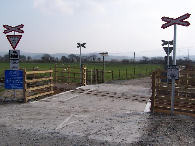
This southerly view (25/3/07) shows the completed LC120 at Cynfal. This crossing was constructed wider for horse traffic. It is currently operated on a 'Stop and Proceed' basis as the signage is yet to be fitted. Click on the image to enlarge. This image is copyright B.W.Hughes and was taken on a Kodak DX6490 digital camera. Image post processed using iPhoto Plus4 and displayed at 96dpi.
This southerly view (27/8/01) from LC120 (Cynfal l/c), shows the new fence erected by the farmer on behalf of the railway. Japanese Knotweed clumps are visible and are fenced off with tape. These arose from fly-tipped rubbish. Clearance is in progress further south near the farm shed. Click on image to enlarge. This image is copyright B W Hughes. Image taken on Samsung Digimax 230 camera. Image post processed with iPhotoPlus4 and displayed at 96dpi.
This southerly view (27/8/01) from Ch.33450, midway between LC120 and LC121, shows clearance underway and the new fence line to the right. The alignment has suffered from serious fly-tipping over the years, including redundant farm machinery. The footpath is on the extreme left in this view. Click on image to enlarge. This image is copyright B W Hughes. Image taken on Samsung Digimax 230 camera. Image post processed with iPhotoPlus4 and displayed at 96dpi.
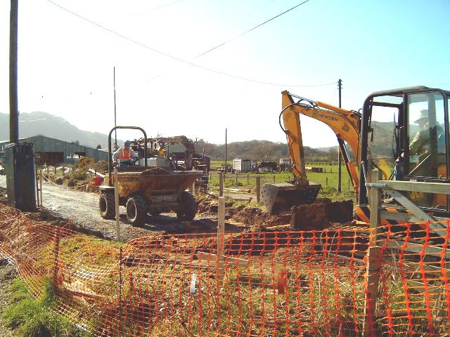
This southerly view (30/3/03) from LC120 at Cynfal shows the excavator and dumper clearing the trackbed south of the level crossing. The newly cleared formation is being hardened with slate waste and will be built up in a similar pattern to the WHR(C). The lineside footpath is to the left of the formation in this view. Click on image to enlarge. This image is copyright B W Hughes. Image taken on Samsung Digimax 230 camera. Image post processed with iPhotoPlus4 and displayed at 96dpi.
This southerly view (28/4/03) from LC120 shows the completed haul road past Pen-y-Mount farm. Click on image to enlarge. This image is copyright B W Hughes. Image taken on Samsung Digimax 230 camera. Image post processed with iPhotoPlus4 and displayed at 96dpi.
This southerly view (12/12/04) from Cynfal l/c, shows the newly ballasted trackbed. Click on image to enlarge. This image is copyright B W Hughes. Image taken on Concord 3340z camera. Image post processed with iPhotoPlus4 and displayed at 96dpi.
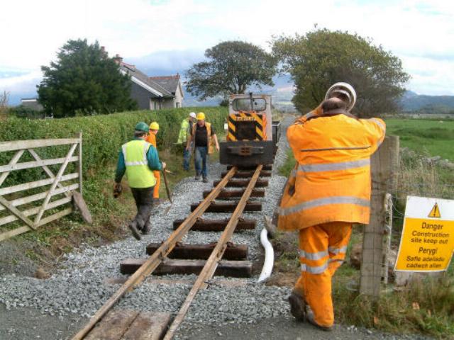
These northerly views (both 27/10/05) at Cynfal l/c show the rails being dragged into position and then screwed down on permanent Jarrah timbers through Cynfal l/c. Click on images to enlarge. These images are copyright B W Hughes and were captured using a Kodak DX6490 digital camera. Images post processed using iPhoto Plus4 and displayed at 96dpi.


These northerly views (both 25/10/05) between Pen-y-Mount and Cynfal level crossings show the rails being moved into place by RRMs then dragged forwards over rollers into position and then to be clipped down on temporary sleepers using Pandrol clips. Click on images to enlarge. These images are copyright B W Hughes and were captured using a Kodak DX6490 digital camera. Images post processed using iPhoto Plus4 and displayed at 96dpi.
Pen-y-Mount
Although clearance started in 2001 and points were laid in 2002, major work had to await the granting of Planning Permission in March 2003. The WHR(P) have designated this Ch.0 but on TWO plans it is Ch.33550 approx. Recent work here has involved the removal of the rubbish pile adjacent to the l/c on the north side.

This southerly view (14/6/03) from immediately north of Pen-y-Mount l/c shows the pile of rubbish now cleared. Click on image to enlarge. This image is copyright B W Hughes. Image taken on Samsung Digimax 230 camera. Image post processed with iPhotoPlus4 and displayed at 96dpi.

This northerly view (30/3/03) from LC121 shows the excavated trackbed at Ch.33550 between Pen-y-Mount and Cynfal with the large trees now noticeably absent compared to the view above. The haul road swerves around a 'rock' to the right. This is in fact a pile of miscellaneous rubbish (including old bedsteads, lumps of concrete, bits of broken farm machinery, etc.), which did not require removal at this stage. Click on image to enlarge. This image is copyright B W Hughes. Image taken on Samsung Digimax 230 camera. Image post processed with iPhotoPlus4 and displayed at 96dpi.
This northerly view (12/12/04) from Pen-y-Mount l/c, shows the newly ballasted trackbed between here and Cynfal l/c. Click on image to enlarge. This image is copyright B W Hughes. Image taken on Concord 3340z camera. Image post processed with iPhotoPlus4 and displayed at 96dpi.
This northerly view (25/10/05) from Pen-y-Mount level crossing shows the rail laid the previous day. Cnicht (Simplex No.36) had been the first train over the crossing. Click on images to enlarge. These images are copyright B W Hughes and were captured using a Kodak DX6490 digital camera. Images post processed using iPhoto Plus4 and displayed at 96dpi.
This easterly view (25/3/07) shows the completed crossing at Pen-y-Mount, now with rails set in a concrete base. Click on the image to enlarge. This image is copyright B.W.Hughes and was taken on a Kodak DX6490 digital camera. Image post processed using iPhoto Plus4 and displayed at 96dpi.

These northerly views (27/8/01 and 25/10/05) from Pen-y-Mount platform towards LC121 at Pen-y-Mount show the WHR headshunt with buffer stop. Volunteers can be seen clearing rubbish dumped on the trackbed on the section north of the level crossing. The second view shows Gelert shunting ballast wagons across the crossing for a photo opportunity. Click on images to enlarge. These images are copyright B W Hughes. Images taken on Samsung Digimax 230/Kodak DX6490 camera. Images post processed with iPhotoPlus4 and displayed at 96dpi.
This southerly view (27/8/01) from LC121 shows Russell approaching the buffer stops at LC121, Pen-y-Mount. This headshunt was subsequently removed as the crossover point donated by the WHR(C), needed to be placed. Click on image to enlarge. This image is copyright B W Hughes. Image taken on Samsung Digimax 230 camera. Image post processed with iPhotoPlus4 and displayed at 96dpi.
This southerly view (25/8/02) from the same viewpoint as above shows good progress with the Pen-y-Mount crossover, which was laid w/e 4/8/02. The 'main line' runs to the left of Pen-y-Mount Halt visible in the distance on the left. A public footpath runs along the east side of the trackbed. The former WHR(P) headshunt at this location has been replaced by two points which will protect the main line form 'internal' WHR(P) movements when the through route to Porthmadog is opened around 2005. The further point will give access to the new WHR(P) headshunt which will eventually run alongside the nearer point as far as the mound of gravel to the right. Click on the image to enlarge. This image is copyright B W Hughes taken on Samsung Digimax230 digital camera. Image post processed using iPhoto Plus4 image correction technology and displayed at 96dpi.

This southerly view (28/4/03) from LC121, shows slate waste stored on sheeting on top of the recently positioned point at Pen-y-Mount. The green loco in the background is stored unserviceable. Click on image to enlarge. This image is copyright B W Hughes. Image taken on Samsung Digimax 230 camera. Image post processed with iPhotoPlus4 and displayed at 96dpi.
This southerly view (3/7/04) at Pen-y-Mount, taken from the level crossing, shows the head of steel adjacent to Pen-y-Mount level crossing. This brings the track back to where the WHR(P) headshunt was in 2001 (see above)! However, this time it is laid in 60lb material that is the new standard for the whole WHR new construction. Click on the image to enlarge. This image is copyright B.W.Hughes and was taken on a Concord 3340z (3.1 Mega pixel) digital camera. Image post processed using iPhoto Plus4 image correction technology and displayed at 96dpi.
This northerly view (25/10/05) from just south of Pen-y-Mount level crossing shows Pen-y-mount Junction crossover. Gelert is shunting ballast wagons in the WHR(P) headshunt to the left of the main line. To the right is the temporary siding for loading rail on the future alignment of the WHR Cross Town Rail Link. Click on images to enlarge. These images are copyright B W Hughes and were captured using a Kodak DX6490 digital camera. Images post processed using iPhoto Plus4 and displayed at 96dpi.
'Harbour siding'
The WHR(P) construction team have built a temporary siding, jokingly called Harbour Siding, on the future alignment of the Cross Town Rail Link. The siding is being used for a rail stack and ballast loading clear of the Pen-y-Mount headshunt and passenger operations.
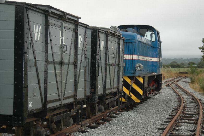
These southerly views (3/7/04 and 25/10/05) at Pen-y-Mount shows the new construction siding completed in the foreground with Pen-y-Mount Halt visible in the distance to the left. Two large rail stacks of over 50 rails each will be built either side to feed rail up to the head of steel for the 900m extension. The second image shows the shunter with RRMs on the overgrown 'Harbour Branch' and the NG15 tender in the background. Click on the images to enlarge. These images are copyright B.W.Hughes and were taken on a Concord 3340z (3.1 Mega pixel) digital camera and a Kodak DX6490 digital camera. Images post processed using iPhoto Plus4 image correction technology and displayed at 96dpi.
This southerly view (10/8/06) shows the 'Harbour Branch' siding at Pen-y-Mount in use by ballast wagons. Click on the image to enlarge. This image is copyright B.W.Hughes and was taken on a Kodak DX6490 digital camera. Image post processed using iPhoto Plus4 and displayed at 96dpi.
This northerly view (25/10/05) from Pen-y-Mount shows the RRMs lifting from the stack which is on FR property on the future alignment of the CTRL. Cnicht (Simplex No.36 'Yorkshire Water Authority') was used on most of the rail shunting duties. Click on images to enlarge. These images are copyright B W Hughes and were captured using a Kodak DX6490 digital camera. Images post processed using iPhoto Plus4 and displayed at 96dpi.
The junction point between the WHR(P) and the main line was tested with Glaslyn, the Vale of Rheidol brake van etc. The first train has also been run over the construction siding (the future line to Harbour Station) when Taxi 2 and two vans made it along the short length of siding which follows the line of the Cross Town Link. The same loco was used last Summer to haul construction trains on Phase 4 based at Rhyd Ddu, as the WHR(P) kindly lent the loco to the WHR(C) to help speed up the opening of the WHR extension to Rhyd Ddu.
This easterly view (29/7/04) shows another length of temporary track laid in the 'Harbour Branch' siding at Pen-y-Mount. The track now comes up to the Pen-y-Mount waiting shelter. Click on the image to enlarge. This image is copyright B.W.Hughes and was taken on a Concord 3340z (3.1 Mega pixel) digital camera. Image post processed using iPhoto Plus4 image correction technology and displayed at 96dpi.
This northerly view (12/12/04), at Pen-y-Mount, shows the new pw siding on the alignment of the future Cross Town Link. Click on image to enlarge. The area around the siding has been cleared for rail stacks and ballast piles. This image is copyright B W Hughes. Image taken on Concord 3340z camera. Image post processed with iPhotoPlus4 and displayed at 96dpi.
Click here to visit the WHR(P) page
Click here to return to Stop Press page
Click here for additional information direct from the WHR(P) Extension site
Site Development
If you have suggestions for development of this site, please contact me by email from the address on the Stop Press page.
Comments
Please add comments in my Guestbook.
Page Version 4.8 Dated 1/4/07