WHR
Porthmadog
Cross Town Rail Link
page
V4.11 updated 1/4/07
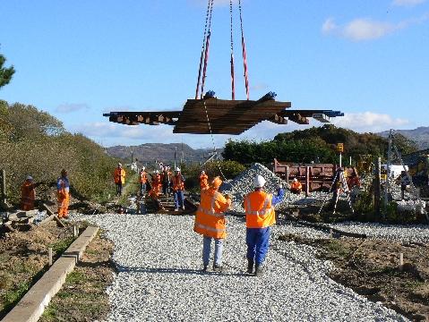
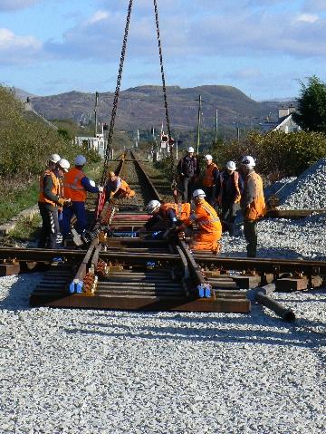
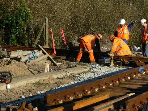
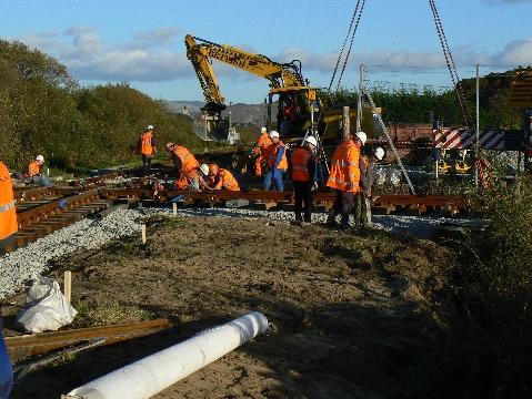
New images on this page are from 25/3/07.
Click here for start of new images
Click here for Laurence Armstrong's latest WHR South map
Click here for Steve Harris' Phase 4 gradient profiles
Click here for Steve Harris' Phase 4 TWA maps
Click here for Chainages and OS Map References
Locations
This section covers the route from Pen-y-Mount to Porthmadog Harbour station. That is from LC121 at Ch. 33560 to the new Porthmadog Harbour WHR point at Ch. 35200, which is the end of Phase 5 (Beddgelert-Porthmadog). The railway is running south west at Pen-y-Mount and follows the line of the 1864 built Croesor Tramway.
Immediately south of LC121 is the headshunt for the WHR (Porthmadog), known as WHR(P). The area to the right at Pen-y-Mount is currently occupied by the terminus and run round loop of the WHR (P). It occupies the location of the Beddgelert Railway, an abortive standard gauge effort to reach Beddgelert that nevertheless reached as far as Hafod-y-Llyn following the west bank of the Afon Glaslyn close to the main road. The site is now known as Beddgelert Siding and was occupied by a Cambrian Exchange yard with the Croesor Tramway/WHR.
A crossover will be provided into the WHR (P) site immediately south of LC121. Use of this crossover will be regulated by the FR Controller at Harbour Station in co-ordination with the WHR(P) Controller. Heritage trains will run onto the new WHR from the WHR (P) terminus at agreed times, perhaps as far as Beddgelert. WHR trains will be controlled by radio based signalling and WHR (P) trains will be controlled in the same way.
There will be a halt at Pen-y-Mount with a platform on the right to allow passengers to visit the WHR (P) Heritage site and travel on its internal trains. These will also continue to run round in the loop at the Pen-y-Mount end of the Beddgelert Siding site. If a 200 m platform is built, it will run from Ch. 33600 to Ch. 33800.
Immediately south of the WHR (P) station is the proposed site of the Porthmadog Bypass flyover at Ch. 33730. There is some doubt that this will ever be built.
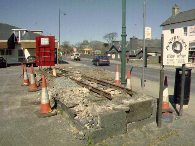
The WHR alignment keeps to the left hand edge of the railway land corridor and passes the site of the excavated Croesor Tramway weighbridge on the right. Further on to the right are the sheds of Gelert's Farm Works of the WHR (P). At Ch. 34100 approx. is the site of Porthmadoc New (1929) station. From 1929, trains terminated north of the GWR crossing to cut down on payments to the GWR. Use of the crossing persisted for empty stock movements and freight. The GWR signal box was to the right just before the crossing.
The GWR crossing (LC122) is at Ch. 34150. This will be protected by colour light signals for both narrow gauge and standard gauge routes. Immediately south of LC122 is the site of the original Porthmadoc New (1923) station. This station was sited at the north end of Porthmadog in order to be a short walk from the GWR station. A footpath ran along the south side of the GWR boundary to Porthmadog (GWR) station. The loop was to the left and there were platforms on both sides of the line.
This station was initially the interchange point between the FR and WHR, with trains for Dinas using the easterly track. There was a water tower at the north end on the west side platform. The station buildings were also on the west (right) side at a lower level and consisted of tin sheeting structures with parcels, waiting room, ticket office and toilets. There was also a tin sheeting refreshment room of a similar size, set at right angles to the railway.
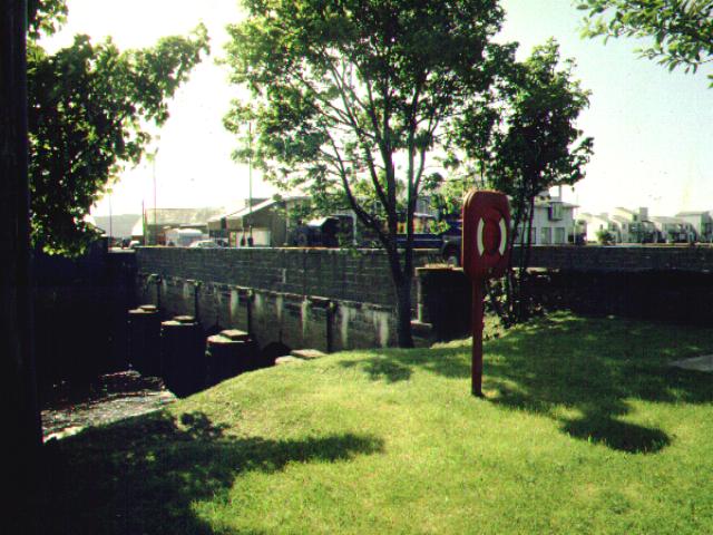
The WHR is now curving towards the south and passes over the former 'ship canal' known as 'Y Cyt' at Ch. 34320 (UB220). This canal was provided by Maddocks to link Llyn Bach and Porthmadog Harbour to a basin at Tremadog, where he had his residence. However, given the size of Britannia Bridge sea portals, only lighters would have been able to use the canal.
Immediately south of UB220 is the Flour Mill loop on the left. The junction with the former Gorseddau Tramway was towards the south of this loop on the right hand side (west). This was relaid as a siding for the North Wales Slate Co mill in Croesor Tramway days. The original 3' gauge Gorseddau Tramway was relaid in 2' gauge from 1872, opening in 1875 as the Gorseddau Junction and Portmadoc Railways. The route closed by 1890 and only the short stub into the Slate Mill remained of the Gorseddau's 1872 route.
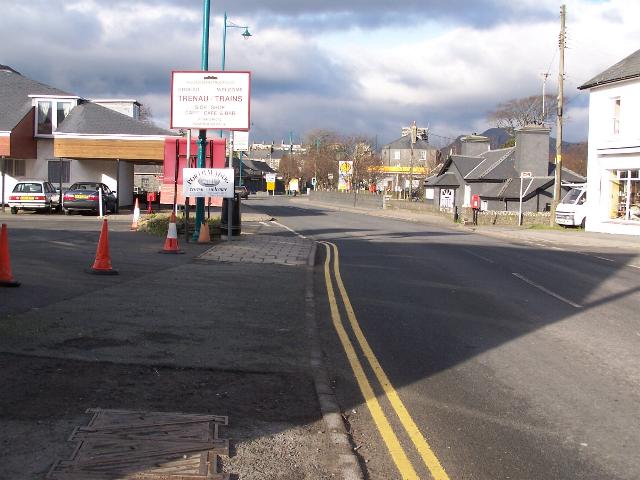
At the end of the long curve, the WHR alignment is now going south east and crosses Snowdon St. at LC123 at Ch. 34400. The reverse curve across the road is being made tighter than the original WHR/Croesor alignment and will cut into the Council Depot north of the car park access road.
South of Snowdon St, the original alignment is abandoned as it cuts across the busy central car park access, the Co-op superstore access and petrol station access. The long length of street running and multiple conflicts with both pedestrian and car users has led to a new alignment being chosen, the 'Porthmadog Deviation'.
The original WHR route followed the Croesor Tramway on the right hand side of the car park access road from Snowdon St, curving south west across the central car park and following the east side of the former Co-op shoppers' car park wall adjacent to the main car park entrance, through Garden Place. It then passed onto the FR slate wharves on the northern sides of the harbour, crossing the main road. The FR obtained an LRO to build a direct link to Harbour Station forming the third side of a triangle, which curved to the south east from a junction with the Croesor route at Ynys Tywyn, across the petrol station entrance and onto Britannia Bridge, joining the original FR harbour branch at the west end of the bridge. This curve became the WHR main line.
The Porthmadog Deviation curves sharply, first to the southeast into the 'Glandwr' Council roadworks yard then due south into the entrance of the disused Gas Works site thereby forming a 200 metre straight section across the central car park. The route emerges into the central car park from the Gas Works site about 10 metres west of the corner with the access road to Snowdon St. The 200 metre straight alignment aims for the northeast corner of the Co-op shoppers' car park to gain the Llyn Bach pathway.
This 200 metre straight length is designed to accommodate a passing loop and possibly a halt. This is the ideal location for a halt if not a full blown station as it is adjacent to the large central car park. The existing FR Harbour Station has only a small car park and most people have to walk from the central car park anyway. The new station would have footpath crossings to the north and south to allow access to the green public open space on the banks of Llyn Bach. These two crossings are LC124 at Ch. 34430 and LC125 at Ch. 34620.
Immediately south of LC124, the route curves onto the existing Llyn Bach footpath. The footpath will be rebuilt to the east, nearer to Llyn Bach. The new alignment follows the east side of the Co-op boundary wall to Ch. 34700 and then cuts the corner behind the building in a reverse curve to move further away from Llyn Bach in order to ease the subsequent curve onto Britannia Bridge. The Co-op wall will be moved to the west over a length of several metres
South of the Co-op, the Deviation follows the wall on the west side of the Llyn Bach path, which now resumes its original course. At Ch. 34800, the new alignment begins a 50m radius curve, the sharpest on the entire WHR, onto the Britannia Bridge at the northeast corner of the petrol station. The Llyn Bach pathway crosses the railway again at LC126 at Ch. 34815.
At this point the Deviation will need a new abutment and a linking span several metres long onto the Britannia Bridge. The bridge was rebuilt a few years ago with little thought for the new railway but it is anticipated that the new deck will have the required strength for modern WHR loadings. The railway crosses to the south side of the bridge in the roadway. The bridge will be a traffic light controlled level crossing (LC127), which will also encompasses the entrance to the Harbour Flats and existing FR Car Park.
East of the bridge, the railway undergoes a small reverse curve at Ch. 34900 to place itself on the footpath east of the Harbour Station access road. The railway will then pass through the site of the plinth that carried Welsh Pony (since removed) and join the gravel strip adjacent to the FR Museum/Spooner's Cafe at Ch. 34550.
The WHR runs along the north side of the Cob, paralleling the FR tracks from Ch. 35000. The junction with Harbour station tracks will be formed at Ch.35175 approx. This is some 110 metres past the existing FR headshunt.
FR tracks will need to be slewed south to create a wide enough interchange platform between the two railways. Final plans are not available but the FR/WHR joint platform will need to extended some way out onto the cob. If the WHR platform face starts at Ch. 34950 by the FR Museum, it will need to extend between 100 and 200 metres to the east as far as Ch. 35150.
The WHR loading gauge will be carried over The Cob to Boston Lodge to allow access for rolling stock and stabling and maintenance of Garratt locos. Already the Boston Lodge Headshunt wall has been rebuilt to allow clearance. An initial idea has been to build a new two-road 4-loco engine shed in the sand pits area north of Boston Lodge, opposite the old FR engine shed. This could be fitted with a turntable.
Gradients
The railway is fairly level throughout this section and levels change by less than 2 metres. Initially, the track is level from Pen-y-Mount, then falls at 1 in 500 towards the Network Rail level crossing. It then rises at 1 in 592 through the site of Porthmadog (1923) station and at 1 in 588 through the central car park and onto Llyn Bach, across Britannia Bridge to Ch. 35000. The final rise at 1 in 492 across the Cob matches the levels with the FR just before the junction.
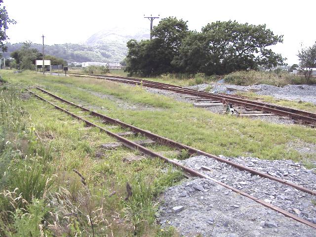
Pen-y-Mount
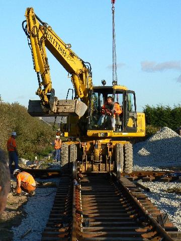
In late July 2002 the WHR(P) laid the crossover from the WHR 'main line' that will allow access to the Beddgelert Siding network. The point was donated by WHLR. The crossover will protect the 'main line' from run round movements within the Beddgelert Siding as well as giving access for WHR(P) Heritage trains in due course. In the short term it will be used by WHR(P) to run trains to Portreuddyn and then Pont Croesor where loops will be installed.
This southerly view (25/8/02) shows the crossover laid at Pen-y-mount during the WHR(P) Civils Week at the end of July 2002. The WHR 'main line' goes to the left of the white Pen-y-Mount halt building at the extreme left of the view. Click on image to enlarge. This image is copyright B.W.Hughes. Image taken using Samsung Digimax230 digital camera. Image post processed using IPhoto +4 and displayed at 96dpi.
Further progress was made extending the WHR(P) w/e 27/7/04. Track recovered from Rhyd Ddu has been laid north from the point donated by the WHR(C), reaching Pen-y-Mount level crossing.
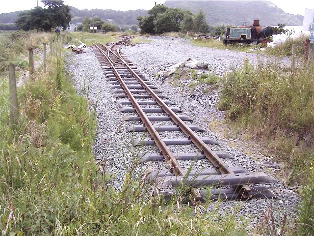
This southerly view (3/7/04) at Pen-y-Mount, taken from the level crossing, shows the head of steel adjacent to Pen-y-Mount level crossing. This brings the track back to where the WHR(P) headshunt was in 2001! However, this time it is laid in 60lb material that is the new standard for the whole WHR new construction. Click on the image to enlarge. This image is copyright B.W.Hughes and was taken on a Concord 3340z (3.1 Mega pixel) digital camera. Image post processed using iPhoto Plus4 image correction technology and displayed at 96dpi.
While this track is standard WHR 60lb rail, a siding laid back towards Porthmadog Harbour station, along the future route of the Cross Town link, is built of temporary materials. Jokingly known as 'Harbour Siding', this 40 m approx. siding will be used to keep construction trains clear of WHR(P) passenger operations during the tracklaying phase due in 2005/6. A pair of RRMs was already on site at Pen-y-Mount in Summer 2005.
This southerly view (3/7/04) at Pen-y-Mount shows the new construction siding completed in the foreground with Pen-y-Mount Halt visible in the distance to the left. Two large rail stacks of over 50 rails each will be built either side to feed rail up to the head of steel for the 900m extension. This image was taken from a public footpath. Click on the image to enlarge. This image is copyright B.W.Hughes and was taken on a Concord 3340z (3.1 Mega pixel) digital camera. Image post processed using iPhoto Plus4 image correction technology and displayed at 96dpi.
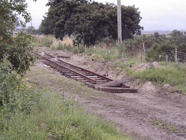
This northerly view (29/7/04) shows the further extension of the 'Harbour branch' laid south along the WHR main line at Pen-y-Mount. The newly siding will be used for rail stacks and ballast loading for the WHR(P) extension to Traeth Mawr loop. This image is copyright B.W.Hughes. Click on image to enlarge. Image taken using Concord 3340z digital camera. Image post processed using IPhoto +4 and displayed at 96dpi.
This northerly view (12/12/04) shows the further extension of the 'Harbour branch' laid south along the WHR main line at Pen-y-Mount. This cleared area will be used for rail stacks and ballast loading for the WHR(P) extension to Traeth Mawr loop. This image is copyright B.W.Hughes. Click on image to enlarge. Image taken using Concord 3340z digital camera. Image post processed using IPhoto +4 and displayed at 96dpi.

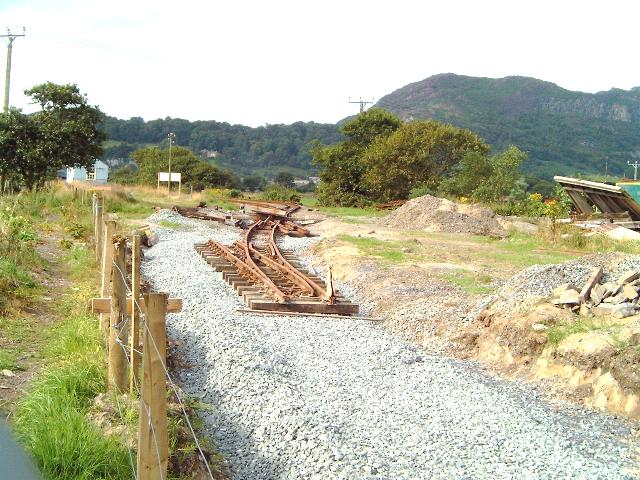
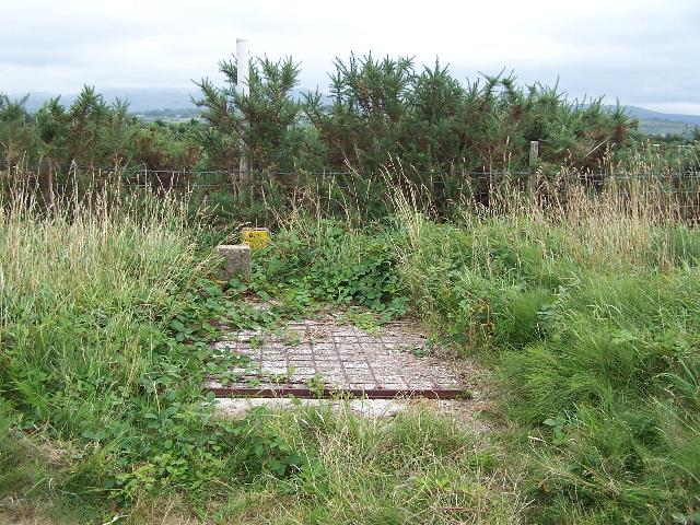
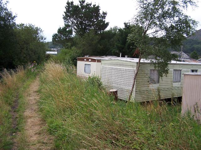
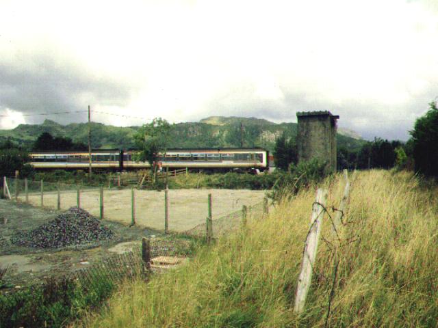
This northerly view (10/8/06) shows the excavated remains of the former Beddgelert Siding weighbridge where slate was transferred to the Cambrian Railways standard gauge wagons. Click on the image to enlarge. This image is copyright B.W.Hughes and was taken on a Kodak DX6490 digital camera. Image post processed using iPhoto Plus4 and displayed at 96dpi.
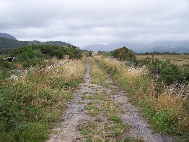
This easterly view (10/8/06) shows where a high pressure gas main crosses the trackbed. Click on the image to enlarge. This image is copyright B.W.Hughes and was taken on a Kodak DX6490 digital camera. Image post processed using iPhoto Plus4 and displayed at 96dpi.
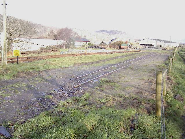
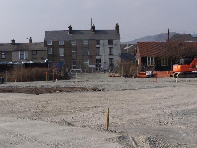
This northerly view (10/8/06) shows the trackbed at Ch.33950. This area was cleared earlier this year for surveys for the CTRL. Click on the image to enlarge. This image is copyright B.W.Hughes and was taken on a Kodak DX6490 digital camera. Image post processed using iPhoto Plus4 and displayed at 96dpi.

This southerly view (10/8/06) shows the trackbed at Ch.33950. This area was cleared earlier this year for surveys for the CTRL. The sheds to the right are part of the WHR(P)'s Beddgelert Farm complex. Click on the image to enlarge. This image is copyright B.W.Hughes and was taken on a Kodak DX6490 digital camera. Image post processed using iPhoto Plus4 and displayed at 96dpi.
Porthmadoc New
A public footpath runs along the formation north of Network Rail level crossing LC122. However the footpath south of that point has been diverted to the west, along the north side of the fence bordering Network Rail's Cambrian Coast Line, to the level crossing on the road approaching WHR(P)'s Gelert Farm works, which was upgraded in 2005/6 following an accident. This leaves the Porthmadoc New(1923) station site free for the WHR to develop as its through route into Porthmadog.

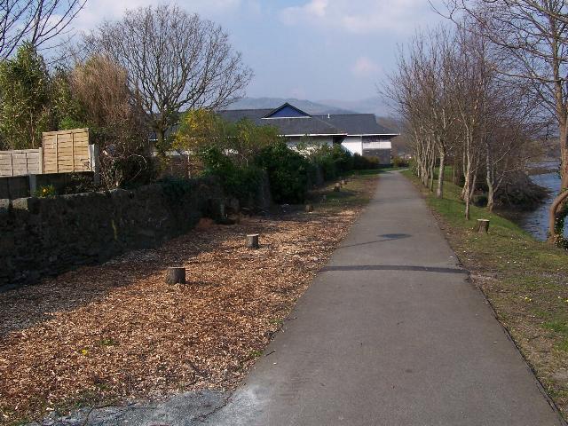
This northerly view (10/8/06) shows the trackbed at Ch.34100. This area was cleared earlier this year for surveys for the CTRL. The sheds to the right are part of the WHR(P)'s Beddgelert Farm Complex. Click on the image to enlarge. This image is copyright B.W.Hughes and was taken on a Kodak DX6490 digital camera. Image post processed using iPhoto Plus4 and displayed at 96dpi.
This southerly view from the public footpath on the trackbed at Ch.34100 shows the site of Porthmadoc New(1929). The route was cut short of the GWR l/c to save costs of paying the GWR for maintaining the l/c. The building to the right is part of the WHR(P)'s Gelert's Farm depot. Click on the image to enlarge. This image is copyright B.W.Hughes. Slide scan technology utilised is Olympus ES10 & iPhoto Plus4. Slide displayed at 96dpi.
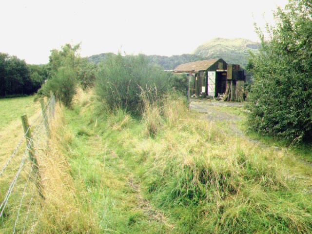
This southerly view (10/8/06) shows the trackbed just south of Ch.34100. This area was cleared earlier this year for surveys for the CTRL revealing the WHR(P)'s volunteers' caravans. Click on the image to enlarge. This image is copyright B.W.Hughes and was taken on a Kodak DX6490 digital camera. Image post processed using iPhoto Plus4 and displayed at 96dpi.
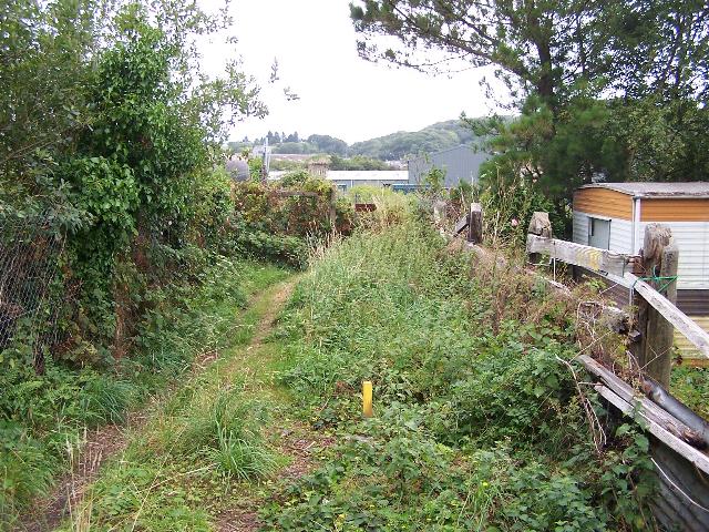
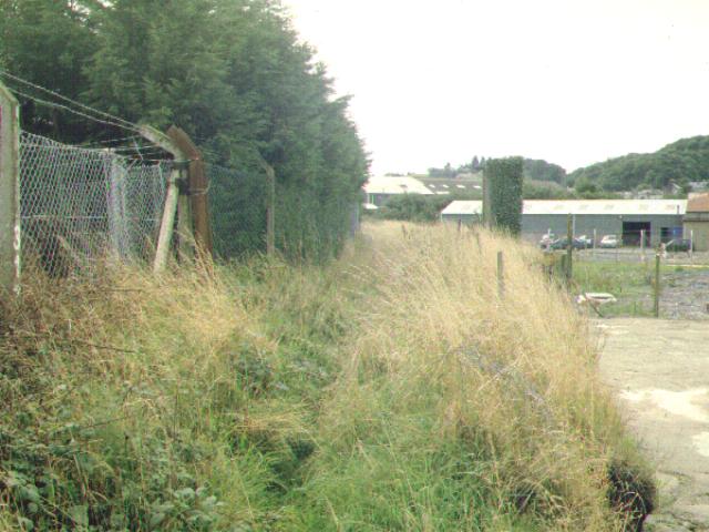
This southerly view (10/8/06) shows the trackbed just north of NR's Cambrian Coast level crossing. There is not much space for a public footpath (left), railway and the WHR(P)'s volunteers' caravans at this location! Click on the image to enlarge. This image is copyright B.W.Hughes and was taken on a Kodak DX6490 digital camera. Image post processed using iPhoto Plus4 and displayed at 96dpi.
Cambrian Crossing LC122
This crossing was originally built when the Croesor tramway entered Porthmadog, closely followed by the Aberystwyth and Welch Coast Railway. The recent rebuilding of the crossing in November 2006 appeared to confirm that the Croesor Tramway beat the A&WCR by a few months as the walled sand embankment was revealed during excavations. Planning for the new crossing started as early as 1993 following then FR's decision to rebuild the WHR.
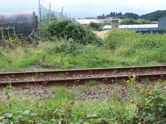
This southerly view (10/8/06) shows the trackbed crossing the Network Rail Cambrian coast Line at LC122. The railway continues south of the line to the right of the high mesh fencing. The original Porthmadoc New (1924) station was immediately across the crossing and the former water tower is visible. Click on the image to enlarge. This image is copyright B.W.Hughes and was taken on a Kodak DX6490 digital camera. Image post processed using iPhoto Plus4 and displayed at 96dpi.
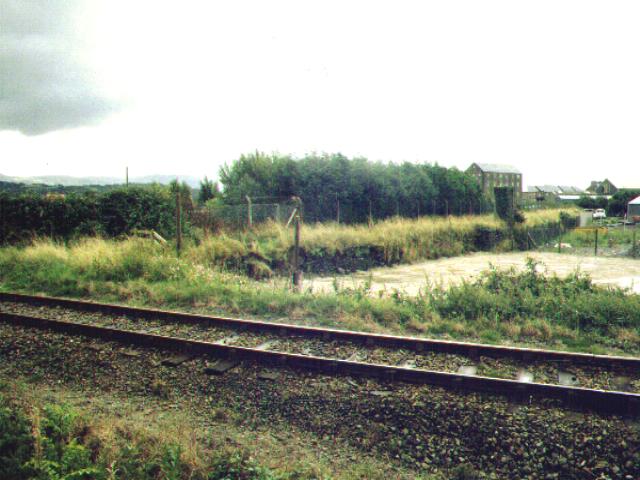
This southerly archive view from the diverted footpath north of Network Rail shows the site of the original Porthmadoc New(1923) station. The route is on a stone embankment and there was a passing loop with platforms on both tracks. For a short period from 1923, trains started from here for both Blaenau Ffestiniog and Dinas. The concrete remains of the FR water tower are visible at the north end of the station. The station buildings and refreshment rooms were in the area just south of the water tower. Click on the image to enlarge. This image is copyright B.W.Hughes. Slide scan technology utilised is Olympus ES10 & iPhoto Plus4. Slide displayed at 96dpi.
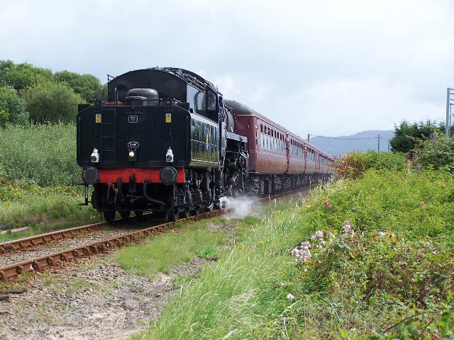
This easterly view (10/8/06) shows BR Standard No.76079 hauling the thrice weekly Cambrian Coast Express into Porthmadog at midday. This location is the Cambrian Crossing where the narrow gauge flat crossing will be reinstated at the end of October this year. The steel fence post to the right indicates the narrow gauge trackbed. Click on the image to enlarge. This image is copyright B.W.Hughes and was taken on a Kodak DX6490 digital camera. Image post processed using iPhoto Plus4 and displayed at 96dpi.
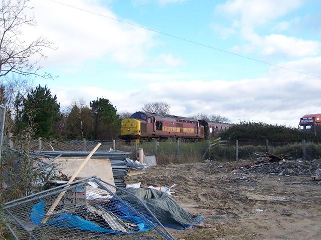
This northerly view (29/1/05) at the Network Rail level crossing shows the first loco-hauled passenger train on the Cambrian Coast for almost 10 years. The crossing is at the rear of the loco. Click on the image to enlarge. This image is copyright B.W.Hughes and was taken on a Kodak DX6490 (4.0 Mega pixel) digital camera. Image post processed using iPhoto Plus4 image correction technology and displayed at 96dpi.
Rebuilding the crossing
Network Rail's contractor Carillion prepared for the Cambrian Crossing works over 3 days from 31/10/06. The crossing went in on the Wednesday 1/11/06 and the site was handed back to Network Rail by the end of Thursday 2/11/06. Some 60 yards of the main line was also replaced either side of the crossing. Two galvanised steel hollow bearers are attached to the crossing unit which will allow signalling cables to be passed across the WHR. A similar duct was laid underneath the standard gauge track. The narrow gauge sections of the crossing unit were removed for transport from Corus, Scunthorpe, so the unit was no wider than plain line.
The permissive footpath on the WHR trackbed north of the crossing was closed and the public footpath diverted back to its original route through Gelert's farm (with the agreement of the WHR(P)). The trackbed south of Cambrian Crossing from Snowdon Mill was also closed and fenced off. The footpath across the Gelert's Farm crossing remained open and a pedestrian barrier was erected. The above measures were implemented for safety reasons.
Arriva Trains Wales (ATW) suspended the Cambrian Coast Line service from Sunday 29/10 to Friday 3/11/06, inclusive between Machynlleth and Pwllheli for PW work in addition to the Cambrian Crossing. Alternative bus services were provided.
Click here for ATW announcement
Works started on 31/10/06 with site clearance. The Cambrian Crossing was finally laid in place about midday on 1/11/06 and given fine weather, progress to connect the narrow and standard gauge tracks was swift. By the end of the day, the road rail excavator had crossed the unit. Fortunately the WHR(P)'s webcam was available for most of the daylight hours and some images are archived. Click on this link www.webcam.whr.co.uk/croesorcrossing
Good progress was made with site clearance on 31/10/06. The Carillion team excavated the crossing down to bare sand using a laser level and by the end of the afternoon had cleared both the main line and the narrow gauge approaches beyond the NR boundary. Some very rusty chairs were recovered from within the sand, possibly of A&WC or Cambrian vintage. The sandy sub base was found almost immediately under the NR tracks. Care was taken to avoid the signalling cables but two were snagged outside the cable duct on the north side. Geotextile was made ready for laying on the sand before placing the crossing unit on 1/11/06.
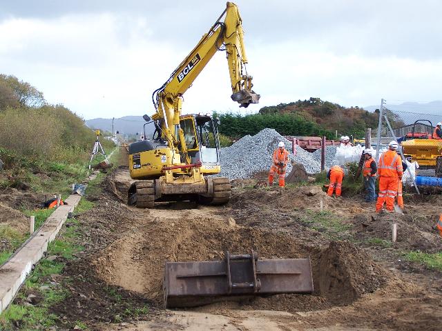


These easterly views (31/10/06) shows stages in the trackbed excavation down to the sandy sub base. In the first view, the excavator is on the site of the hole dug to reveal the Croesor Tramway formation. The second view shows laser levelling underway. The final view shows the track now levelled and engineers dealing with a cable problem on the left. The excavator is on the site of the crossing. The WHR trackbed can be seen to the right. Click on the image to enlarge. This image is copyright B.W.Hughes and was taken on a Kodak DX6490 digital camera. Image post processed using iPhoto Plus4 and displayed at 96dpi.
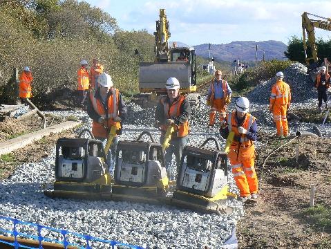
This easterly view (1/11/06) shows the three connected wacker plates compressing the ballast before the crossing unit was craned in. Click on the image to enlarge. This image is copyright Neil McMaster and was taken on a digital camera. Image post processed using iPhoto Plus4 and displayed at 72dpi.
This easterly view (1/11/06) shows the Cambrian Crossing unit being craned into position around midday with the formation ballasted on both the standard and narrow gauge routes. Click on the image to enlarge. This image is copyright Neil McMaster and was taken on a digital camera. Image post processed using iPhoto Plus4 and displayed at 72dpi.
This easterly view (1/11/06) shows the standard gauge being linked to the Cambrian Crossing unit. Click on the image to enlarge. This image is copyright Neil McMaster and was taken on a digital camera. Image post processed using iPhoto Plus4 and displayed at 72dpi.
This easterly view (1/11/06) shows the narrow gauge on the north side being linked to the Cambrian Crossing unit. Click on the image to enlarge. This image is copyright Neil McMaster and was taken on a digital camera. Image post processed using iPhoto Plus4 and displayed at 72dpi.
This easterly view (1/11/06) shows the narrow gauge on the south side being linked to the Cambrian Crossing unit. Click on the image to enlarge. This image is copyright Neil McMaster and was taken on a digital camera. Image post processed using iPhoto Plus4 and displayed at 72dpi.
This easterly view (1/11/06) shows the road rail excavator Cambrian Crossing unit with the closure rails in place on the western side of the standard gauge. Click on the image to enlarge. This image is copyright Neil McMaster and was taken on a digital camera. Image post processed using iPhoto Plus4 and displayed at 72dpi.

This northerly view (2/11/06) shows the completed unit with narrow gauge transition panels stored to the side. A WHR gauge bar can be seen next to the crossing. Click on the image to enlarge. This image is copyright Nigel Fletcher of Arup Rail and was taken on a digital camera. Image post processed using iPhoto Plus4 and displayed at 96dpi.
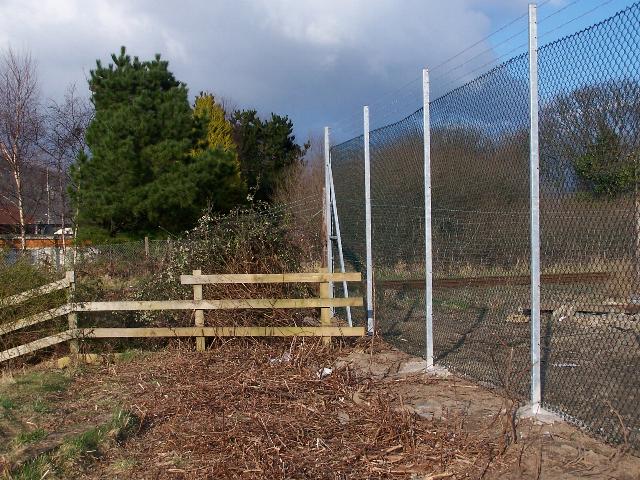
This northerly view (22/2/06) at the Network Rail level crossing shows the new security fencing for the adjacent landowner. The railway follows the line of pine trees on the far side of the crossing. Click on the image to enlarge. This image is copyright B.W.Hughes and was taken on a Kodak DX6490 (4.0 Mega pixel) digital camera. Image post processed using iPhoto Plus4 image correction technology and displayed at 96dpi.

These southerly views (2000? and 22/2/06) show the site of the joint WHR/FR Porthmadog New (1923) station, just south of the water tower. The station had two platforms with the FR platform to the right. The concrete supports of the FR water tower are still visible. There appeared to have been some encroachment onto the trackbed by the owner of the land to the left but, apparently, a change of business to caravan sales/storage has led to new security fencing on the correct land boundary and the removal of trees and the concrete posts. Click on the images to enlarge. These images are copyright B.W.Hughes. Slide scan technology utilised is Olympus ES10. Second image was taken on a Kodak DX6490 (4.0 Mega pixel) digital camera. Images post processed using iPhoto Plus4 image correction technology and displayed at 96dpi.
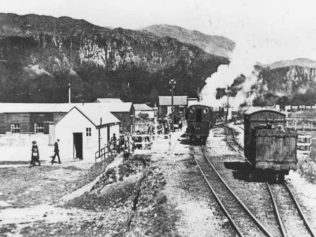
This archive image of Portmadoc New (1923) shows a wealth of detail. The white station building is seen at a lower level on the left. The refreshment room is the darker wooden building at right angles to the formation. An England loco is visible on a train bound for the FR. The right hand platform was used for WHR trains. A short goods train is visible in the loop. In the background to the left of the loco is the GWR crossing signal cabin. Image copyright WHR(P), courtesy Dave Allan.
This northerly archive view shows a Class 156 unit about to cross LC122 just north of the site of Porthmadoc New(1923). The Network Rail crossing will be light controlled with trains starting from Porthmadog Network Rail station triggering the road l/c and the railway l/c. The dual concrete piers of the former FR water tower are visible to the right. The footpath on the trackbed at this point was diverted in 2001 and the station site subsequently became very overgrown. Click on the image to enlarge. This image is copyright B.W.Hughes. Slide scan technology utilised is Olympus ES10 & iPhoto Plus4. Slide displayed at 96dpi.

This northerly view (22/2/06) at the site of Porthmadog New (1923) shows the new security fencing for the adjacent mobile home storage centre. Click on the image to enlarge. This image is copyright B.W.Hughes and was taken on a Kodak DX6490 (4.0 Mega pixel) digital camera. Image post processed using iPhoto Plus4 image correction technology and displayed at 96dpi.

This northerly view (12/12/04) shows the clearance of the overgrown trackbed north from Y Cyt bridge (UB220). The advance works were to give access to the Environmental and Topological surveyors. Click on image to enlarge. This image is copyright B.W.Hughes. Image taken using Concord 3340z digital camera. Image post processed using IPhoto +4 and displayed at 96dpi.
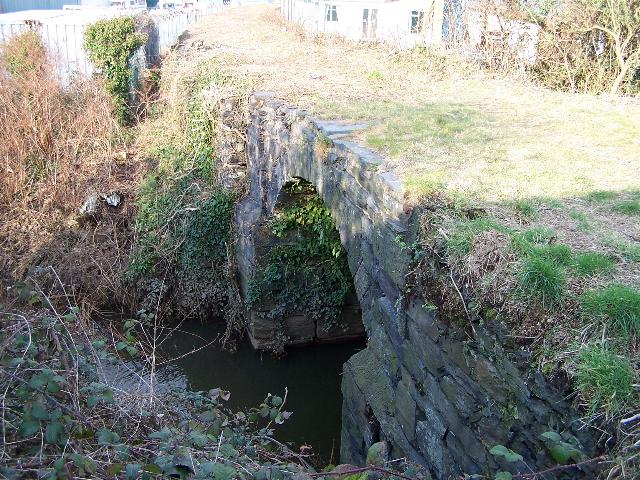
This northerly view (22/2/06) shows UB220, the stone bridge over Y Cyt, the former Tremadoc Barge Canal. Click on the image to enlarge. This image is copyright B.W.Hughes and was taken on a Kodak DX6490 (4.0 Mega pixel) digital camera. Image post processed using iPhoto Plus4 image correction technology and displayed at 96dpi.
Snowdon Street level crossing
The Porthmadog Deviation begins just north of the Snowdon Street level crossing which is taken more squarely through the use of reverse curves. As a result, the alignment will be closer to the wall of the building to the right in the view below. The alignment as shown on T&WO plans then begins a reverse curve, taking a small section of the 'Glandwr' Council Roadworks Depot, before crossing the car park access and entering the former Gas Works site. These changes make it possible to leave a straight 200 metre section of track across the car park for a passing loop and possible station, while taking fewest car parking spaces. The Gas Works site will be used as a construction base and will be converted to an extension of the existing car park as compensation for the car parking space taken for the railway. The exit from the car park to Snowdon Street will be diverted away from its existing alignment as that will be occupied by the railway. Instead, the new exit will be through the Gas Works site.
This northerly roadside view of LC123 shows the route curving round to the right between the tall white former flour mill (right) and the newer motorbike museum (left). The route will follow the wall of the museum and cross Y Cyt (UB220). Y Cyt is the remains of the former canal built by Maddocks to link his Tremadog village with the harbour. It is currently a smelly gully. Click on the image to enlarge. This image is copyright B.W.Hughes. Slide scan technology utilised is Olympus ES10 & iPhoto Plus4. Slide displayed at 96dpi.
This northerly view (3/7/04) at Porthmadog shows an example of building onto the trackbed. The newly tarmaced area in front of the cafe intrudes onto the future line of the Cross-Town link which curves from the Snowdon Street level crossing (point of view) to the right of the car into the green area. This cafe in the old Flour Mill will be quite a good spot to watch the passing trains if it survives! Click on the image to enlarge. This image is copyright B.W.Hughes and was taken on a Concord 3340z (3.1 Mega pixel) digital camera. Image post processed using iPhoto Plus4 image correction technology and displayed at 96dpi.
This southerly view (29/1/05) at the Snowdon Street l/c shows the route of the line entering into Porthmadog Central car park. The route may require the demolition of the wall of the GCC road depot to the left, before the track swings to the right into the former Gas Works site. This road access to the Central car park will be diverted to the right through the former Gasworks site to the right. Click on the image to enlarge. This image is copyright B.W.Hughes and was taken on a Kodak DX6490 (4.0 Mega pixel) digital camera. Image post processed using iPhoto Plus4 image correction technology and displayed at 96dpi.

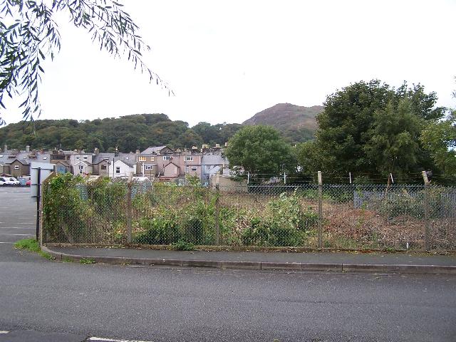
This northerly view (1/10/05) at the Snowdon Street l/c shows the clearance of the former Gasworks site to be converted into an extension of Porthmadog Central car park. The FR has given this land to the local authority to more than recompense for the route taken through the car park. Click on the image to enlarge. This image is copyright B.W.Hughes and was taken on a Kodak DX6490 (4.0 Mega pixel) digital camera. Image post processed using iPhoto Plus4 image correction technology and displayed at 96dpi.
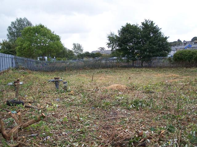
This southerly view (1/10/05) in Porthmadog shows the secure enclosure of Porthmadog's former Gasworks. The remains of the valves can be seen on the left now the site has been cleared for surveyors. The site is lower than the main car park and has contaminated ground methane ventilators. Substantial amounts of fill may be required to build up the railway formation and level the Gasworks for the car park extension. A loop is planned in this area. The roof of the now closed Leo's Co-op supermarket is visible in the background. The railway makes a straight line route from the point of view to pass to the left of Leo's. Click on the image to enlarge. This image is copyright B.W.Hughes and was taken on a Kodak DX6490 digital camera. Image post processed using iPhoto Plus4. Image displayed at 96dpi.
This northerly view (1/10/05) shows the cleared section of the Gasworks site nearest to Porthmadog Central car park. The route may emerge from the former Gasworks site around the corner of the fence. Click on the image to enlarge. This image is copyright B.W.Hughes and was taken on a Kodak DX6490 (4.0 Mega pixel) digital camera. Image post processed using iPhoto Plus4 image correction technology and displayed at 96dpi.

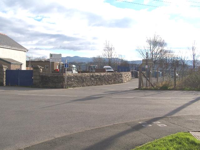
This northerly view (30/5/01) shows the junction between the north exit to the car park and Snowdon St. The railway used to swing to the right of the white Motorcycle Museum (visible centre) and behind the tall houses. At this point the Porthmadog Deviation begins, swinging first to the right into the GCC Council Roadworks Yard and then to the left into the former Gas Works site just beyond the car park height barrier. The Gas works site is surrounded by security fencing. The Deviation creates a 200 metre straight section across the central car park (for a possible loop/station). Click on the image to enlarge. This image is copyright B.W.Hughes. Slide scanned at 200 dpi using Olympus ES10 and iPhoto Plus4 image correction technology.
There have been two WHR stations in Porthmadog in addition to Harbour Station. The original one was named Porthmadoc New and is known with its suffix of (1923). This was abandoned in 1929 as the WHR could not afford the GWR's charges for operating the level crossing.
The Cambrian Railway Co. had never charged the Croesor Tramway for the passage of freight over the flat crossing between the two railways. The WHR Light Railway was therefore surprised to be charged by the GWR for passenger trains. The matter was taken to court to settle the dispute where it was shown that the Cambrian Railway received its Act in 1863 whilst the Croesor Tramway did not begin operating before 1865.
The new station to the north of the crossing was known as Porthmadog New (1929). Perhaps the possible new central station (if built) will be known as Porthmadog New (2009)!

These northerly views (20/5/01 and 25/3/07) show the former alignment of the WHR along the car park north access and its rebuilding is 2007. The new alignment will emerge from the derelict Gas works site about 10 metres to the west (left) of the sign. The second view shows the Gasworks site where the Gasworks siding will be with the car park extension works well underway. The brown vertical pipes are believed to be breather pipes for the contaminated ground of the former gasometer pits. The alignment passes across Snowdon Street and through a gap to the left of the tall building in the centre of this view. Click on the image to enlarge. These images are copyright B.W.Hughes. The first is from a slide scanned at 200 dpi using Olympus ES10. The second was taken on a Kodak DX6490 digital camera. Images post processed using iPhoto Plus4 and displayed at 96dpi.

This southerly view (20/5/01) shows the position of the possible new central station in Porthmadog. The track will run in a straight line right of the nearest car and to the left corner of the car park adjacent to the Co-op Superstore visible in the distance. Two level crossings at each end of the station will give access to the green public open space to the left on the banks of Llyn Bach, which will be extended. Click on the image to enlarge. This image is copyright B.W.Hughes. Slide scanned at 200 dpi using Olympus ES10 and iPhoto Plus4 image correction technology.
The new alignment will cut across the car park and also utilise some of the public open space. To compensate existing car park land east of the railway will be converted to public open space and all the former Gas Works site not required by the railway itself will become car parking space with a net gain in parking area.
This northerly view (25/3/07) shows the new car park exit under construction. Click on the image to enlarge. This image is copyright B.W.Hughes and was taken on a Kodak DX6490 (4.0 Mega pixel) digital camera. Image post processed using iPhoto Plus4 image correction technology and displayed at 96dpi.
Some consideration had been given to using the former Coop building (closed in 2005) as the new central station as it was ideally sited for the possible loop in this location, with the large car park adjacent. Unfortunately, the price of the property climbed out of the reach of FR funds.

This northerly view (20/5/01) shows the view from the point at which the Porthmadog Deviation leaves the central car park. It aims for a point midway between the blue and white signs and enters the derelict Gas Works site. Click on the image to enlarge. This image is copyright B.W.Hughes. Slide scanned at 200 dpi using Olympus ES10 and iPhoto Plus4 image correction technology.
Llyn Bach path
The Porthmadog Deviation runs along the side of Llyn Bach between the Co-op superstore and the Llyn Bach tidal reservoir. The path will have to be moved nearer to the sea over much of its length.
This southerly view (20/5/01) shows the Llyn Bach footpath. The alignment will follow the course of the footpath with the footpath diverted into the green area to the left. Click on the image to enlarge. This image is copyright B.W.Hughes. Slide scan technology utilised is Olympus ES10 & iPhoto Plus4. Slide scanned at 200dpi.
This southerly view (20/5/01) shows the point where the Porthmadog Deviation will swing to the west (right) in a reverse curve to hug the west wall of the Llyn Bach path, making the curve onto the Britannia Bridge easier to accomplish. The railway will be on the site of the current footpath in this location. The wall to the Co-op land will need to be shaved back over several metres and the footpath diverted to the east (left). Click on the image to enlarge. This image is copyright B.W.Hughes. Slide scanned at 200 dpi using Olympus ES10 and iPhoto Plus4 image correction technology.
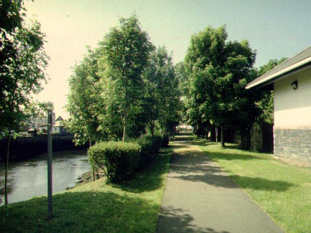
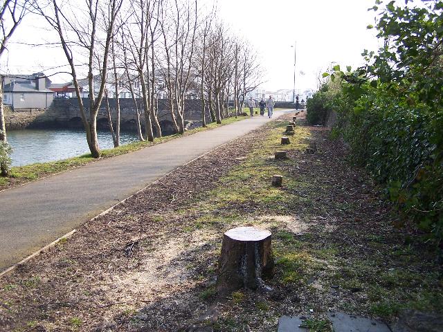
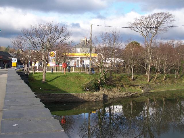
These northerly views (20/5/01 and 25/3/07) show the final section of the Llyn Bach path. The railway will occupy the space between the path and the right hand wall. The right hand row of trees will be removed to accommodate this. The tidal waters of Llyn Bach are visible to the left. The second view shows the trees cut down to make way for the railway. Click on the image to enlarge. These images are copyright B.W.Hughes. The first is from a slide scanned at 200 dpi using Olympus ES10. The second was taken on a Kodak DX6490 digital camera. Images post processed using iPhoto Plus4 and displayed at 96dpi.
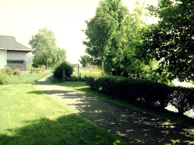
This northerly view (20/5/01) shows the south end of the Co-op superstore. At this point the Porthmadog Deviation has completed its dogleg around the corner of the Co-op shop and is now running along the left side of the view in the grass strip. Llyn Bach is visible to the east (right). The footpath will not need to be relocated on this section. Click on the image to enlarge. This image is copyright B.W.Hughes. Slide scanned at 200 dpi using Olympus ES10 and iPhoto Plus4 image correction technology.
Britannia Bridge
The Britannia Bridge was built as part of The Cob and initially carried the 3' gauge construction railway which later became the Gorseddau Tramway. Sluice gates were provided on the Llyn Bach side (visible) but these were removed in the late 19th century when sluice gates were provided at the other end of Llyn Bach where the Afon Glaslyn flows in.
The bridge was rebuilt in the late 1990s but there was no consultation between Highway Engineers for the Welsh Office and the WHR engineers as the WHR had not received its TWO at that time. It is nevertheless anticipated that the new concrete deck is able to take railway loadings and the possible short span between Llyn Bach and the bridge, needed to ease the curve, can be accommodated without too many problems.
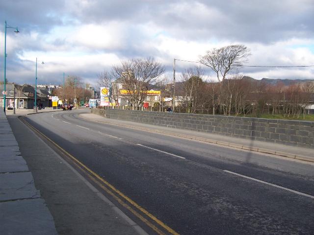
This southerly view (20/5/01) shows the Porthmadog Deviation turning east (left) onto the Britannia Bridge. A new abutment and a short span might be necessary here to cut the corner onto the bridge. This is also the location of LC126, where the Llyn Bach footpath crosses the line to join the main road to the right. Click on the image to enlarge. This image is copyright B.W.Hughes. Slide scanned at 200 dpi using Olympus ES10 and iPhoto Plus4 image correction technology.

This northerly views (29/1/05 and 25/3/07) at the north-east corner of Britannia Bridge show the surveyor's have been in action placing pegs around the seats. The route will keep to the left along the wall. The second view shows trees cut down to make way fro the railway. Click on the images to enlarge. These images are copyright B.W.Hughes and were taken on a Kodak DX6490 (4.0 Mega pixel) digital camera. Images post processed using iPhoto Plus4 image correction technology and displayed at 96dpi.

This northerly view (20/5/01) shows the location of the curve and new span from the Britannia Bridge onto the Llyn Bach footpath. The Porthmadog deviation will emerge between the two trees, (centre left) and a new abutment and a short span will be required to carry the railway onto the Britannia Bridge. Click on the image to enlarge. This image is copyright B.W.Hughes. Slide scanned at 200 dpi using Olympus ES10 and iPhoto Plus4 image correction technology.

This westerly view (29/1/05 and 25/3/07) from Britannia Bridge shows the Llyn Bach pathway which the railway route follows as the Porthmadog Deviation. The second view shows the Llyn Bach collapse. It is hoped the authorities will repair this soon as work in due to get underway on the CTRL in the Spring. Click on the images to enlarge. These images are copyright B.W.Hughes and were taken on a Kodak DX6490 (4.0 Mega pixel) digital camera. Images post processed using iPhoto Plus4 image correction technology and displayed at 96dpi.
This westerly view (29/1/05) on the Britannia Bridge shows the point where the WHR, in the left hand part of the roadway, will start to swing north onto the Llyn Bach path. Click on the image to enlarge. This image is copyright B.W.Hughes and was taken on a Kodak DX6490 (4.0 Mega pixel) digital camera. Image post processed using iPhoto Plus4 image correction technology and displayed at 96dpi.
This easterly view (20/5/01) shows where the railway will cross to the westbound carriageway of the bridge. This will be a light-controlled crossing. The railway will rejoin its original course after the Harbour Station access road, where a car is waiting to emerge. Click on the image to enlarge. This image is copyright B.W.Hughes. Slide scanned at 200 dpi using Olympus ES10 and iPhoto Plus4 image correction technology.
This easterly view (20/5/01) shows Welsh Pony on its plinth at Porthmadog Harbour. The plinth and loco were later moved as they were foul of the new WHR loading gauge. The Porthmadog Deviation rejoins the original FR route (as used by the WHR) at this point, crossing from the roadway to the footpath in a shallow reverse curve. The railway heads for the gap between the Harbour Station buildings right and the lamp post. LC127 includes the Harbour Station access road as well as the main road and will be a signal-controlled level crossing. Click on the image to enlarge. This image is copyright B.W.Hughes. Slide scanned at 200 dpi using Olympus ES10 and iPhoto Plus4 image correction technology.
This westerly view (Easter 2002) shows the plinth where Welsh Pony was displayed. The loco was removed to Minffordd yard just before Easter due to excessive rusting in the sea air. The plinth was removed and the car park extended over this area and resurfaced by the Summer. Click on image to enlarge. Image taken using Samsung Digimax230 digital camera. Image post processed using IPhoto +4 and displayed at 96dpi.
This westerly view (29/1/05) at the exit of Porthmadog Station shows the point at which the route crosses into the road, before the Harbour Station car park access. The loco of the northbound train departing from Porthmadog Harbour Station (WHR) platform will probably be waiting at this point for the Right Away after the road traffic lights trigger to cross the bridge beyond and swing right onto the Llyn Bach path. Click on the image to enlarge. This image is copyright B.W.Hughes and was taken on a Kodak DX6490 (4.0 Mega pixel) digital camera. Image post processed using iPhoto Plus4 image correction technology and displayed at 96dpi.
Work was due to start on the alterations to the Cob Records store in the spring of 2007 using a local contractor.

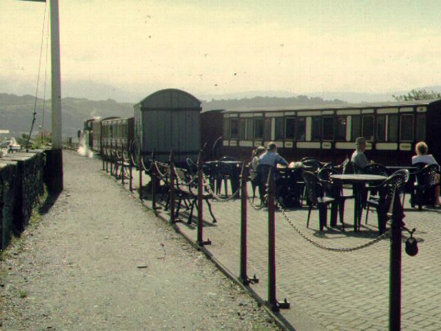
This easterly view (18/9/05) at Harbour Station shows the original FR trackbed that crossed Britannia Bridge to the harbour slate wharves and was latterly used by WHR trains when Porthmadoc New fell out of use. An original sleeper is visible in the foreground. The WHR track is to be moved to the right through the position of the red car to allow the existing Cob footpath to reach the roadside. This will involve clipping a little off the modern Goods Shed extension where the Spooner's sign is located and also a little off the Cob Records store to the right of the red car. Spooner's bar would lose its paved patio under this version of the plan but gains a wider patio on the FR side. Click on the image to enlarge. This image is copyright B.W.Hughes and was taken on a Kodak DX6490 digital camera. Image post processed using iPhoto Plus4. Image displayed at 96dpi.
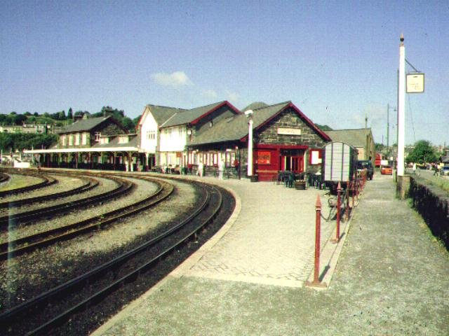
Harbour Station
Some realignment work will be required here as the WHR will hug the north wall of the cob and the platform between the WHR and the FR will have to be sufficiently wide for safety. The current FR platform face will have to curve a little further to accommodate these changes.
In a late change, the Cob footpath will be retained right through the station area, rather than having a footbridge crossing the station throat as originally suggested. This will mean that the WHR moves over to the west 2m as it passes Spooner's Bar and the FR tracks will have to curve more sharply to accommodate a platform between the FR and the WHR.
This easterly view (20/5/01) shows the point where the WHR platform will begin adjacent to Spooner's Bar/Museum. The Cob footpath will hug the left hand (north) wall of the cob. In order to allow sufficient width of platform between the FR's departure platform and the WHR's platform, the FR tracks will have to be slewed slightly to the south (right) and the WHR track will go through the patio area of Spooner's Bar, immediately to the right of the chain link fence. An original FR goods wagon (since removed) stands in the bar patio area, roughly on the alignment of the future WHR. In the background David Lloyd George is ready to depart with a long train led by some original FR coaches which may have seen use of the WHR. Click on the image to enlarge. This image is copyright B.W.Hughes. Slide scanned at 200 dpi using Olympus ES10 and iPhoto Plus4 image correction technology.

This easterly view (29/1/05) at the site of the future WHR platform at Porthmadog Harbour station shows where the new alignment will run between the fence and Spooner's Bar across the patio to the right. The FR platform will need to be moved into No.2 road so that the platform between the WHR and FR tracks is of a safe width and a suitable length (200m). Click on the image to enlarge. This image is copyright B.W.Hughes and was taken on a Kodak DX6490 (4.0 Mega pixel) digital camera. Image post processed using iPhoto Plus4 image correction technology and displayed at 96dpi.
This westerly view (20/5/01) shows the WHR formation, which used to follow the gravel strip to the right alongside the wall. The railway will head to the right of the station buildings but to the left of the chain link fence so as to retain the gravel Cob footpath to the right. The FR tracks will all move to the left to allow an adequate width of exchange platform between the FR and WHR. Click on the image to enlarge. This image is copyright B.W.Hughes. Slide scanned at 200 dpi using Olympus ES10 and iPhoto Plus4 image correction technology.
The Environment Agency has been involved in a programme strengthening The Cob with extra rock for the last few years. Additional width will be required for some 200 metres on the seaward side to allow for the new platforms and relocated FR station headshunt. The work to widen the embankment east of Harbour station has been put off to Winter 2007/8.
Boston Lodge WHR alterations
The wall adjacent to Boston Lodge headshunt was moved back around 2004. By February 2007 the newly constructed mainline point was placed further towards Porthmadog, although not in use. The reorganisation will allow an extra coach stabling siding to be constructed on the seaward side of the existing carriage sheds. There is also a long term plan to construct a new Running Shed capable of holding two Garratt or NG15 sized locos in the sandpit area opposite the old Loco Shed. These locos will stable at Porthmadog overnight to provide the first train services north each day. They cannot fit in any of the current loco sheds at Boston Lodge.
Click here to return to Stop Press page
Site Development
If you have suggestions for development of this site, please contact me by email from the address on the Stop Press page.
Comments
Please add comments in my Guestbook.
Page Version 4.11 Dated 1/4/07