WHR
Beddgelert Station Area page
(part of the Beddgelert Area page)
V4.2 updated 30/6/07
Images updated from 28/6/07.
Click here for new images on this page
Click here for Laurence Armstrong's latest WHR North map
Click here for Steve Harris' Phase 4 gradient profiles
Click here for Steve Harris' Phase 4 TWA maps
Click here for Chainages and OS Map References
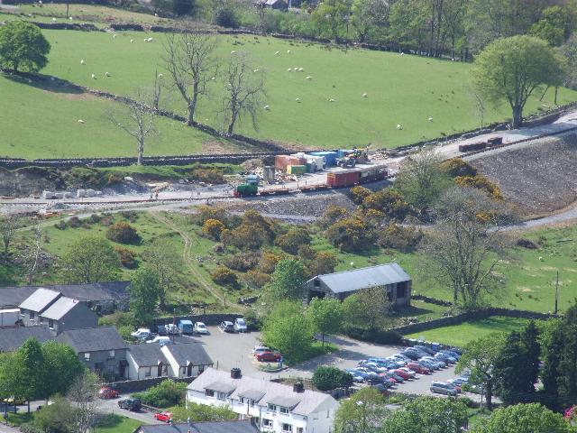
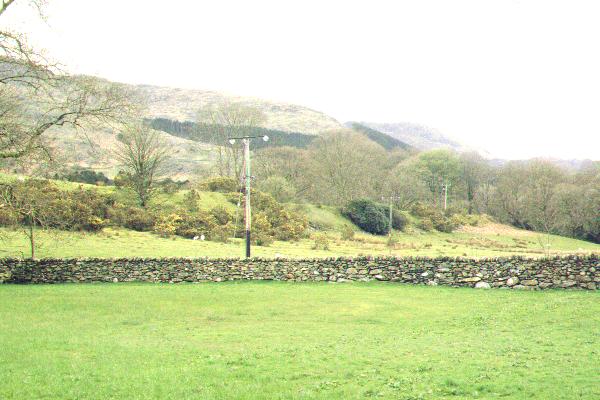
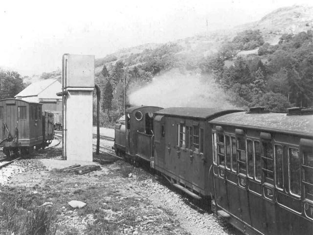
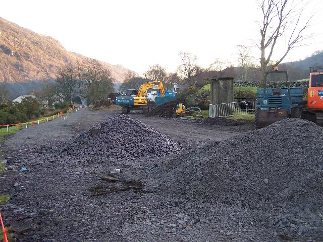
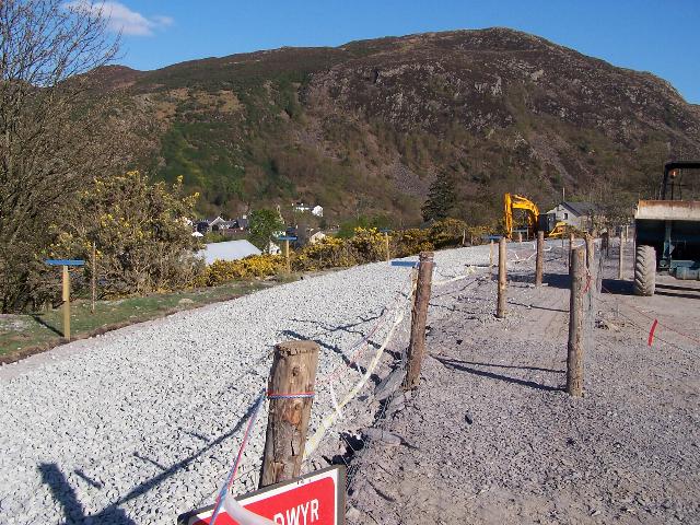
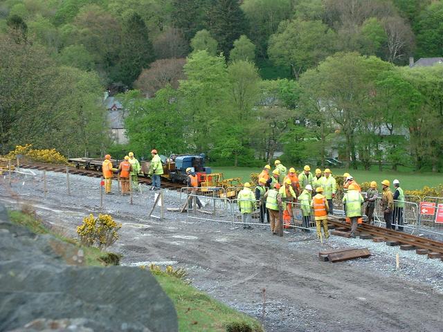
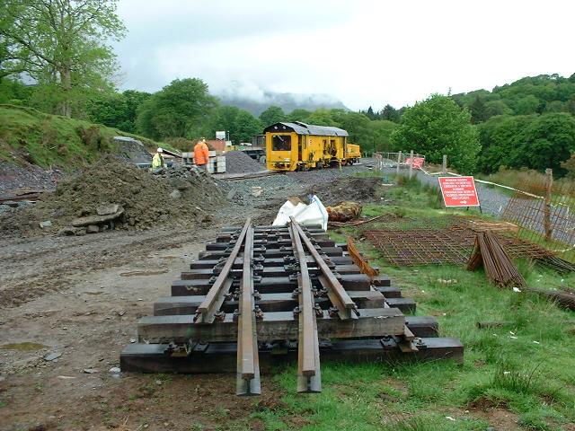
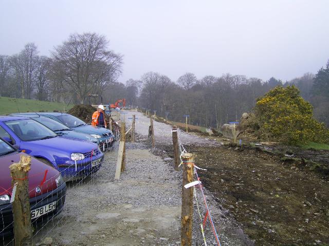
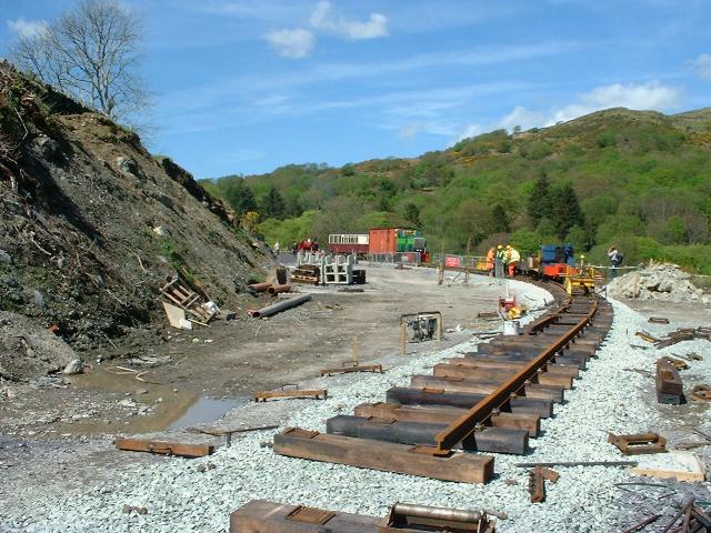
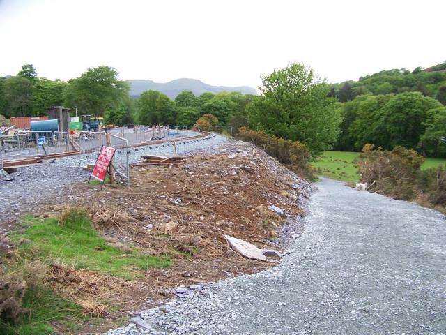
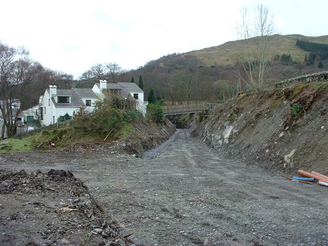
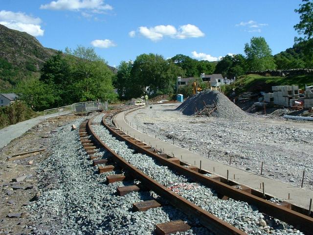
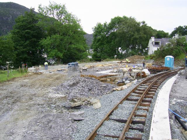
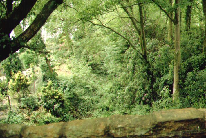
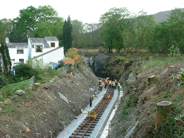
This westerly view (28/4/07) shows a general view of Beddgelert Station site and Upnor Castle on the rail train as seen from a hill on the east side of the valley. The new alignment of the public footpath can be seen at the foot of the embankment. Click on the image to enlarge. This image is copyright Chris Hopley and was taken on a digital camera. Image post processed using iPhoto Plus4 and displayed at 96dpi.Fuji 9600) from half way up the mountain on the opposite side of the valley.
First Steam in Beddgelert
After several trial runs to Cutting Mawr, a special event was organised on 26/4/07 and Beddgelert Junior school children welcomed Velinheli into the station, the first steam train since Russell's stock clearance run in 1938 almost 60 years previously!

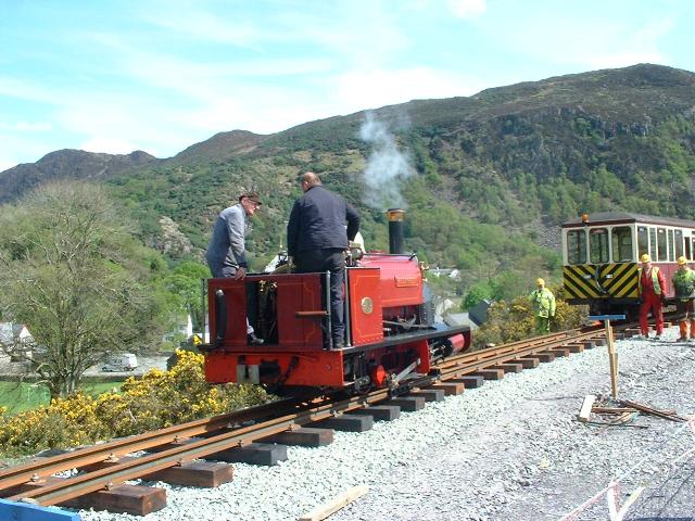
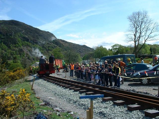
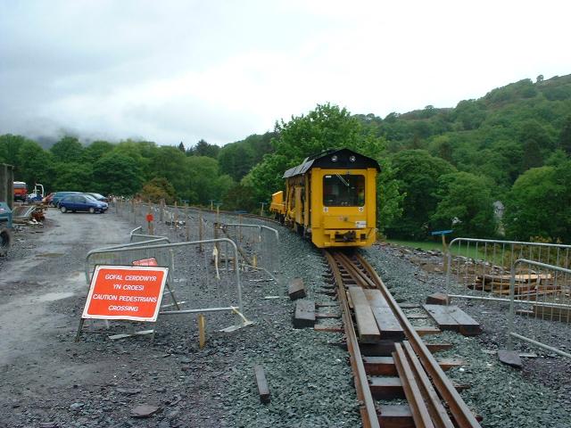
These northerly and two southerly views respectively (all 26/4/07) show Velinheli arriving in Beddgelert Station to an audience of junior school children. This was the first steam in Beddgelert since 1937, almost 70 years! The pw trains are visible beyond. Click on the images to enlarge. These images are courtesy/copyright John Ewing and were taken on a digital camera. Images post processed using iPhoto Plus4 and displayed at 96dpi.
Beddgelert Station plans
The final plans given below (but subject to change) were awaiting approval by the SNPA in September 2006. Beddgelert Station is one of the most important locations on the WHR and it is anticipated that passengers travelling to this very popular village destination by train from both directions will be a significant part of future traffic patterns. Construction of the new station requires a sensitive approach to the location and the railway's neighbours. In the 1920s and 1930s the station evolved to become a border between WHR operations and FR operations with trains running round and reversing here in both directions. As the railway is graded at 1 in 40 through the station, modern regulations prohibit these shunting manoeuvres, so trains from Porthmadog will probably continue to Rhyd Ddu to terminate instead. Trains will however cross at Beddgelert so it has a large island platform.
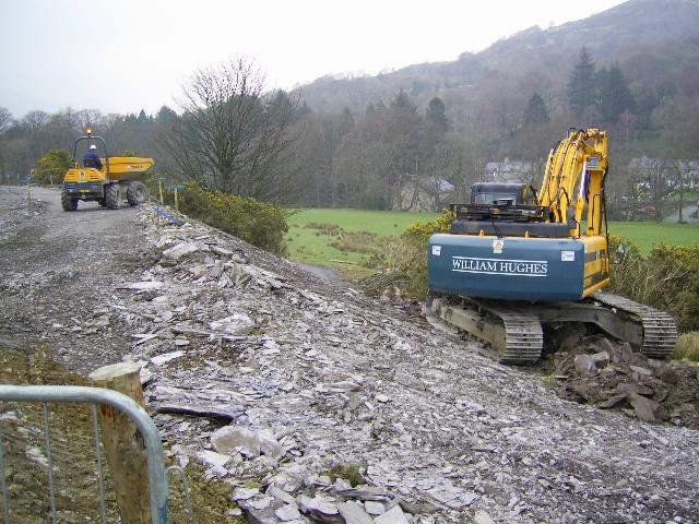
The SNPA granted permission in July 2006 for a temporary construction access from the north end of the station, just west of UB165, where the route crosses over the Pont Alun bridleway/private road. The aim is to keep construction traffic out of the village centre and use of this access will be subject to strict guidelines, as is the current use of the bridleway for access to the Nant Cwmcloch construction base used by the two contractors James Cyf. and Hughes constructing the sections immediately north of Beddgelert station. The WHR TWO includes a clause forbidding construction traffic to access the site by the original station entrance at the south end, which is now within the Oberon Wood housing estate. WHRCL construction staff, contractors and volunteer tracklayers are required not to use this entrance.
When the station opens, passenger access will be pedestrian only, via a new steep path on the east side linking the station to the village through the main SNP car park. The existing bridleway from the side of the Royal Goat Hotel up to the station site that follows the route of the original station approach road is also available for foot access. Passengers will be encouraged to travel to Beddgelert rather than start their journeys there. Beddgelert currently suffers from parking problems and traffic congestion in the tourist season and the railway may help to reduce this if passenger flows develop as anticipated.
The station will have a curved island platform. The north point has been moved north to UB166, which will require a new retaining wall on the northwest side. Widening of the formation to accommodate the north end changes will now be on the west side and the northbound track on the east side of the platform will have a straight departure from the station unlike earlier plans. This will no doubt be appreciated by drivers facing a 1 in 40 start with a wet rail and a heavy train! The northern end of the platform is at Ch.22180 with the southbound (west) face 187m long to Ch.22375 and the northbound face, 203m long to Ch.22392 (incorporating the access from the station building). The south point will be in the Goat Cutting at Ch.22430. There will be two 8m by 2.5m platform shelters, similar in style to the one at Rhyd Ddu but with stone ends. One shelter will incorporate a small lock-up room for platform staff. There will be four 18m flower beds so the pattern of flower beds (FB) and waiting shelters (WS) from north to south on the platform will be FB/WS/FB/FB/WS/FB.
The main station building will be at the south end of the site, where the coal siding once was. Details for the station building were the subject of a lengthy planning approval process which has been resolved, keeping the station's visual impact as seen from the village as low as possible within the limits of operational requirements. The water tank is also being located in a secluded spot, just north of UB167, on the west side of the station, largely screened by surrounding trees. Water will be piped to a separate water column at the north end of the island platform at Ch.22200. The tank will be of the Braithwaite type, assembled using recovered panels, the best of which were sorted at Dinas in Spring 2006. In August these were awaiting transport for de-rusting and re-galvanising. It will be a 2x4 panel tank as at Rhyd Ddu giving a capacity of about 8m3. An adequate water supply is a necessity here for trains heading north before the four miles of 1 in 40 facing drivers through the Beddgelert Forest and it is believed a 1" main will be allowed.
As previously announced, there will be a stabling siding on the west side, the south end of which will terminate over the original loco pit, which still survives as does the original concrete tower for the small water tank. The WHR Heritage Group intend to restore the tank and it would be useful for topping up smaller locos like Russell, if removed from double heading trains here during Gala events. The siding is long enough to stable, for example, a short heritage train, but as it has a sharp bend adjacent to the water tower, Garratt loco, will not be beyond that point.
The contract for the station also includes UB165 over the Pont Alun bridleway. This requires the south abutment to be rebuilt as it has collapsed, as well as a new deck. Alterations are also to be made to the public footpath that passes under the line at UB167 as the formation must be widened here to accommodate the double track and the north end of the platform. When all work at the station is complete, the temporary plant access road from Pont Alun can be removed and the embankment and trackbed restored between UB165 and UB166 to allow tracklayers to access the station from the north. However, depending on tracklaying progress, there may be a period in which the track shares the northern access. In this case the easterly track will be completed first and tracklayers will be able to proceed southwards. The platform can then be built against the as laid track. A siding at Beddgelert is an early priority during the construction phase to cut down the long pw train runs.
Construction of Beddgelert Station started in Autumn 2006 and the intention is to complete it over Winter 2006-7 before the main tourist season. Under the WHR's agreements with the SNPA, Rhyd Ddu is the only temporary terminus that will be allowed within the National Park. Beddgelert Station is therefore due to open to the public at the same time as the rest of Phase 4 in 2009. However works trains will become a familiar sight once track laying reaches Beddgelert from the north.
On 13/9/06 the SNPA's Planning Committee approved the WHRCL's final plans for Beddgelert Station including the platforms, shelters, flower beds and water tank. They also approved the details of the Cemetery level crossing (LC88) at the south end of the Goat Tunnel. Survey work and marking out of the grassy station area for construction was under way by 8/9/06. Although the station contract has not yet been awarded, the trailable point mechanisms for Beddgelert Station loop points left Porthmadog for Dinas on 17/9/06. The plans below show the platform has been reduced to a single side at the north end on the west side for a short length, matching the single sided extension at the south end on the east side that will provide access from the station building.

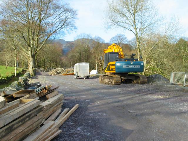
This view (10/9/06) shows the final plan for Beddgelert Station. The siding is marked 'No articulated locos beyond this point' where the sharp bend leads into the ashpit. Click on the image to enlarge. This image is copyright B.W.Hughes and was taken on a Kodak DX6490 digital camera. Image post processed using iPhoto Plus4 and displayed at 96dpi.
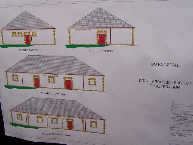
This view (10/9/06) shows the final plan for Beddgelert Station building. The building is to be rendered in local colours not white! Click on the image to enlarge. This image is copyright B.W.Hughes and was taken on a Kodak DX6490 digital camera. Image post processed using iPhoto Plus4 and displayed at 96dpi.
The station is on the hillside above Beddgelert car park. A new access will be constructed from the car park.
UB165
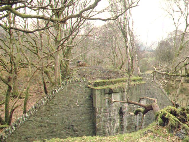
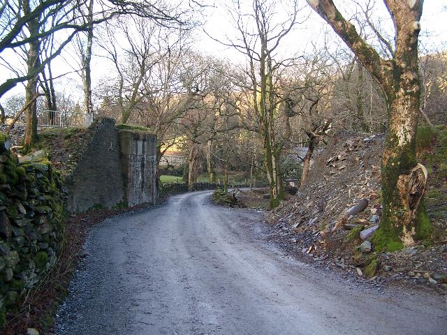
This easterly view (30/7/00) shows UB165, the bridge over the bridleway near Pont Alun. The PBSSR structure has been finished with a WHR re-inforced concrete cap. Click on the image to enlarge. This image is copyright B.W.Hughes. Slide scan technology utilised is Olympus ES10 & iPhoto Plus4. Slide scanned at 200dpi.

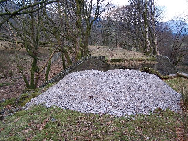
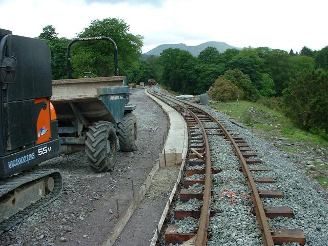
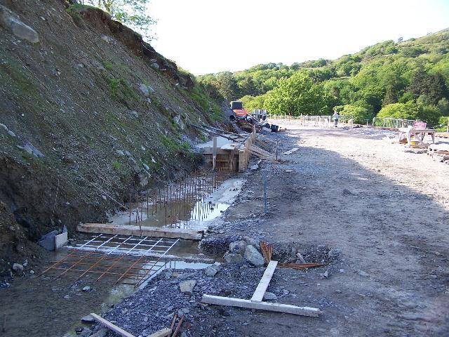
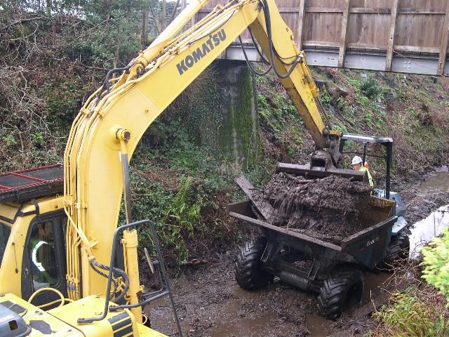
These southerly views ( 9/8/05, 10/12/06, 21/1/07, 11/2/07, 18/2/07 and 25/3/07) show the abutment of UB165 at the north end of Beddgelert Station. The first view shows the partially demolished abutment. The second view shows the removal of the abutment that was completed in early December. Beddgelert Station construction site access is on the left immediately behind the embankment. An excavator can be seen on the top of the embankment. The third view shows the foundation for the wider bridge. The fourth view shows the shuttering erected by 8/2/07 for the concrete pour. The fifth view shows the completed abutment. The sixth view shows formwork erected for the casting of the deck, whilst still allowing access by vehicles for the Cwmcloch farms. Click on the images to enlarge. These images are copyright B.W.Hughes and were taken on a Kodak DX6490 digital camera. Image post processed using iPhoto Plus4 and displayed at 96dpi.
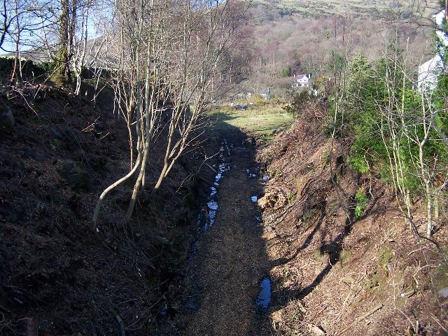
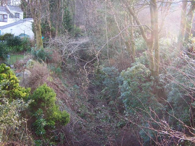
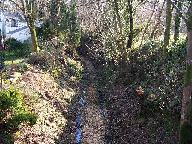
These northerly views (archive, 9/8/05, 22/2/06 and 10/9/06) show the railway embankment at UB165 covered with trees approaching Beddgelert from the northwest. A circular cattle feeder is visible at track level in the first view. The third view shows the line has been fenced but more tree clearance will be needed on this section. The pile of ballast was in association with power line diversion works by Scottish Power as the 11kV line criss-crosses the alignment in this area. The fourth view shows clearance has now reached the north abutment of UB 165. Click on the image to enlarge. These images are copyright B.W.Hughes. Slide scan technology utilised is Olympus ES10. The second, third, fourth and fifth images were captured on a Kodak DX6490 digital camera. Images post processed using Iphoto+4 and displayed at 96dpi.

These southerly views (23/12/06,11/2/07, 16,2,07 and2/3/07) show the southern abutment of UB158 cut back. The second view shows the erection of formwork and third view the completed casting. The third and fourth views show the abutment completed, being backfilled and work on the north abutment underway, with scaffolding erected. Click on the images to enlarge. The first two images are copyright B.W.Hughes and were captured on a Kodak DX6490 digital camera. The third image is copyright John Peduzzi and the fourth Chris Price. Images post processed using Iphoto+4 and displayed at 96dpi.

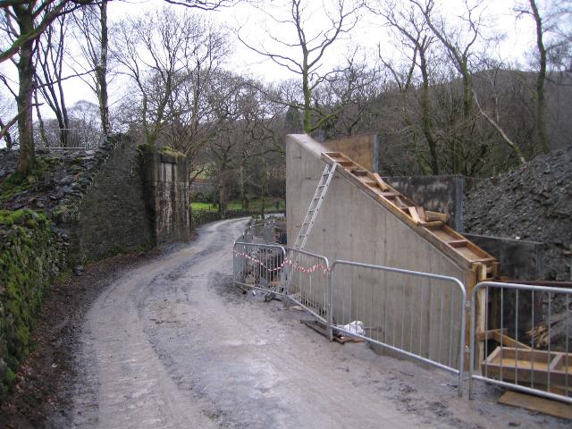
These easterly views (22/3/07 and 28/3/07) show the formwork under construction for casting the deck of UB165, whilst still allowing vehicle access for Cwmcloch farms. The second view shows the completion of formwork for UB165 over the Nant Cwmcloch bridleway. A concrete pour is imminent giving time to cure before track crosses the bridge later in the Spring. Click on the image to enlarge. This image is courtesy/copyright John Ewing and was taken on a digital camera. The second image is courtesy Alastair Stewart (WHRCL) and was taken on a digital camera. Images post processed using iPhoto Plus4 and displayed at 96dpi.
These southerly views (28/3/07 and 7/4/07) show the completion of formwork for UB165 over the Nant Cwmcloch bridleway. The embankment beyond leading into the station site still needs attention and will be attended to now that access is no longer required for UB165 works. The second view shows UB165 finished and ballast laid up to the bridge from the north. Click on the image to enlarge. The first image is courtesy Alastair Stewart (WHRCL) and was taken on a digital camera. The second image is copyright John Ewing (WHRCL) and was taken on a digital camera. Image post processed using iPhoto Plus4 and displayed at 96dpi. Images post processed using iPhoto Plus4 and displayed at 96dpi.

This northerly view (2/4/07) shows the completion of the deck of UB165, the final crossing of the Pont Alun-Nant Cwmcloch bridleway. A small tracked excavator is working at the north end of the bridge. At this date the upstands remained to be cast. Click on the image to enlarge. This image is courtesy Alasdair Stewart (WHRCL) and was taken on a digital camera. Image post processed using iPhoto Plus4 and displayed at 96dpi.
This northerly view (4/4/07) shows the completion of the ballast retaining upstands of UB165, the final crossing of the Pont Alun-Nant Cwmcloch bridleway, and the ballasted trackbed beyond, complete with piles of sleepers. Track should be constructed through here during the Rest of The World Gang 'Working Week' commencing April 21st. Click on the image to enlarge. This image is courtesy Alasdair Stewart (WHRCL) and was taken on a digital camera. Image post processed using iPhoto Plus4 and displayed at 96dpi.

These northerly and southerly views respectively (15/4/07) taken from the UB166 show the preparations to move the water main off the trackbed between UB165 and UB167 before this section was needed for tracklaying a week later! There is an inspection cover actually on the trackbed between UB165 and UB166. Click on the images to enlarge. These images are copyright B.W.Hughes and were taken on a Kodak DX6490 digital camera. Images post processed using iPhoto Plus4 and displayed at 96dpi.

These northerly and southerly views respectively (18/4/07) taken from the UB166 show work underway to make the formation between UB165 and UB167. Temporary gabions have been installed on UB166 to separate the higher trackbed from the access road. This section should be ballasted in the next few days (if not already) in anticipation of tracklaying in the week ahead. The water main inspection cover is still visible! Click on the images to enlarge. These images are copyright B.W.Hughes and were taken on a Kodak DX6490 digital camera. Images post processed using iPhoto Plus4 and displayed at 96dpi.
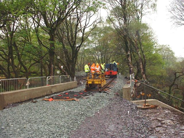
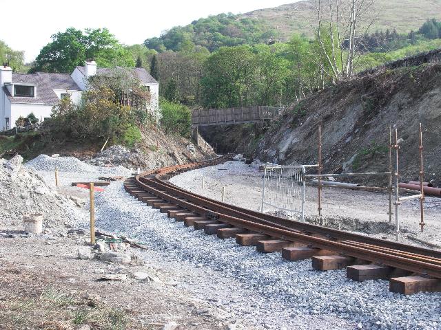
This northerly view (22/4/07) shows the soaked tracklayers having reached their objective with the Head of Steel on UB165 at the 'close of play' at 1830 on Sunday evening. Click on the image to enlarge. This image is courtesy/copyright John Ewing and was taken on a digital camera. Image post processed using iPhoto Plus4 and displayed at 96dpi.
These northerly and southerly views respectively (both 20/5/07) show the Head of Steel at that end of that weekend's tracklaying at UB171, just south of LC89. Temporary fencing is still attached to the sides of the bridge. Click on the image to enlarge. This image is copyright B.W.Hughes and was taken on a Kodak DX6490 digital camera. Image post processed using iPhoto Plus4 and displayed at 96dpi.
North loop point
The north loop point is positioned just north of UB167, which therefore carries double track.
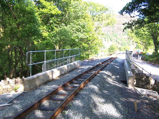
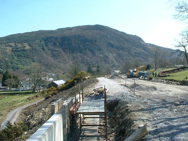
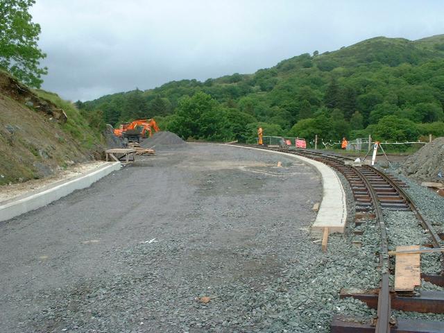
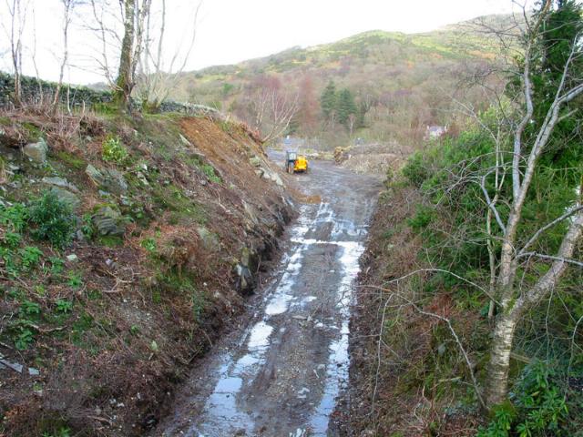
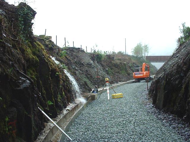
This southerly view (30/3/07) shows the trackbed between UB166, the final crossing of the Nant Cwmcloch and UB167 the widened public footpath underpass. A retaining wall can be seen under construction either side of UB167. The section of trackbed between UB165 and UB167 must be finished quickly after the contractor's Easter break as the Rest of the World Gang's Working Week is due to lay track through here from 21/4/07. This is the site of the north loop point. Click on the image to enlarge. This image is courtesy Charles Gardner and was taken on a digital camera. Image post processed using iPhoto Plus4 and displayed at 96dpi.
This northerly view (23/4/07) shows the soaked tracklayers having reached their objective with the Head of Steel on UB166 at the 'close of play' at 1730. Progress was delayed a little while the surveyors checked the point was in exactly the right position and alignment, so the point was not connected up by the end of the day. Track south of UB165 is on wooden sleepers. Click on the image to enlarge. This image is courtesy/copyright John Ewing and was taken on a digital camera. Image post processed using iPhoto Plus4 and displayed at 96dpi.
This southerly view (24/4/07) shows the completed north loop point and track advancing to the south on wooden sleepers into the easterly (northbound) loop track. Click on the image to enlarge. This image is courtesy/copyright John Ewing and was taken on a digital camera. Image post processed using iPhoto Plus4 and displayed at 96dpi.
This southerly view (25/4/07) shows the completed north loop point at Beddgelert Station. The straight track and platform will start on UB167. Click on the image to enlarge. This image is courtesy/copyright John Ewing and was taken on a digital camera. Image post processed using iPhoto Plus4 and displayed at 96dpi.
This northerly view (15/5/07) shows the Tuesday Gang hand-tamping the north loop point at Beddgelert with the KMX tamper/liner on UB165. Click on the image to enlarge. This image is copyright Tony Baker and was taken on a digital camera. Image post processed using iPhoto Plus4 and displayed at 96dpi.
This southerly view (20/5/07) shows the north loop point at Beddgelert Station. The new water tank will be to the right, just south of UB167, near the tree. Click on the image to enlarge. This image is copyright B.W.Hughes and was taken on a Kodak DX6490 digital camera. Image post processed using iPhoto Plus4 and displayed at 96dpi.
This easterly view (30/7/00) shows the railway crossing UB166 over the Afon Cwmcloch for the third and last time. The north end of Beddgelert loop starts 30 metres to the south of this. Click on the image to enlarge. This image is copyright B.W.Hughes. Slide scan technology utilised is Olympus ES10 & iPhoto Plus4. Slide scanned at 200dpi.
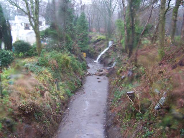
These northerly views (9/8/05) show the trackbed crossing UB166 over the Afon Cwmcloch. Trees are growing through the embankment on the bridge and may need to be removed so that they do not damage the arch. The powerline diversion consists of a ground cable on this section and has strangely been laid next to a tree that must obviously be removed as it appears to be growing into the stonework of the bridge arch! Click on the image to enlarge. This image is copyright B.W.Hughes and was captured on a Kodak DX6490 digital camera. Image post processed using Iphoto+4 and displayed at 96dpi.
Work on an access ramp to allow work to start in Beddgelert station began in early November.

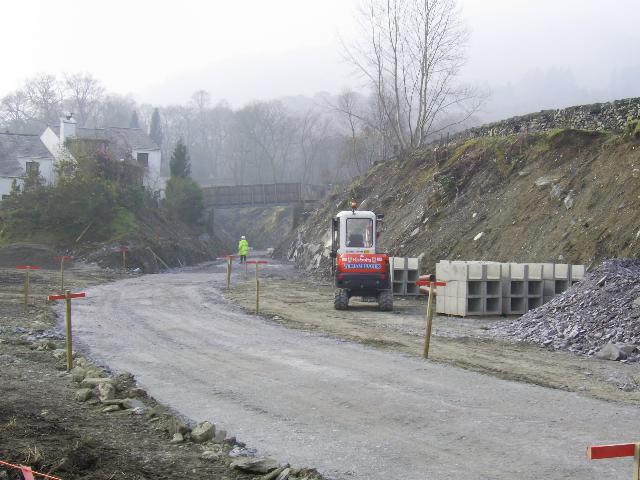
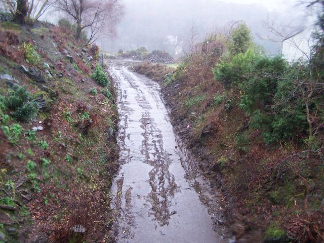
This southerly view (26/11/06) shows the access ramp under construction to permit construction vehicles access to the station site. Work on the ramp seemed to have come to a stop after a start in early November as this scene was the same on 12/11/06. Click on the image to enlarge. This image is copyright B.W.Hughes and was captured on a Kodak DX6490 digital camera. Image post processed using Iphoto+4 and displayed at 96dpi.
This northerly view (10/12/06) shows the construction access complete over UB166, the final Afon Cwmcloch bridge, with the trackbed to the right. Click on the image to enlarge. This image is copyright B.W.Hughes and was taken on a Kodak DX6490 digital camera. Image post processed using iPhoto Plus4 and displayed at 96dpi.
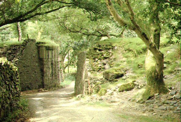
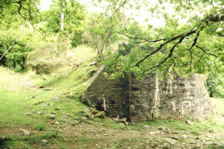
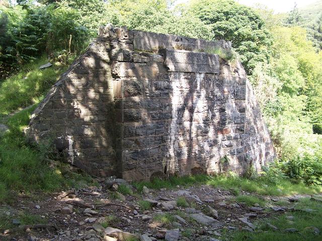
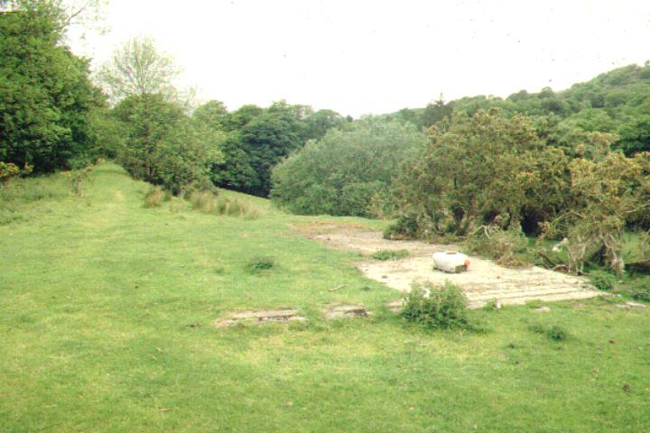
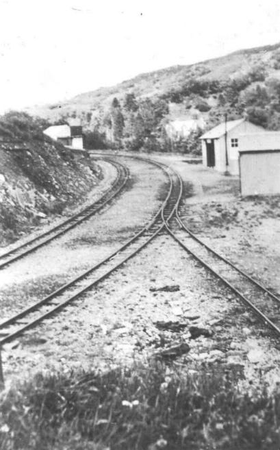
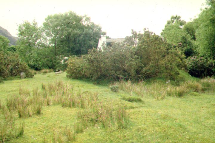
This westerly view (29/4/01) was taken from Beddgelert Car Park. The railway is on the ledge above the gorse on a wide shelf cut into the hillside. At this point there was a loop, coal siding and both a loco/goods shed and a loco pit siding. Click on the image to enlarge. This image is copyright B.W.Hughes. Slide scan technology utilised is Olympus ES10 & iPhoto Plus4. Slide scanned at 200dpi.
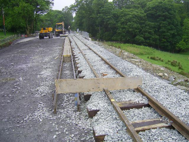
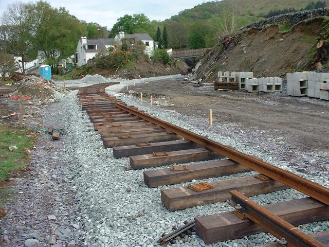
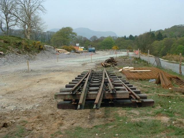
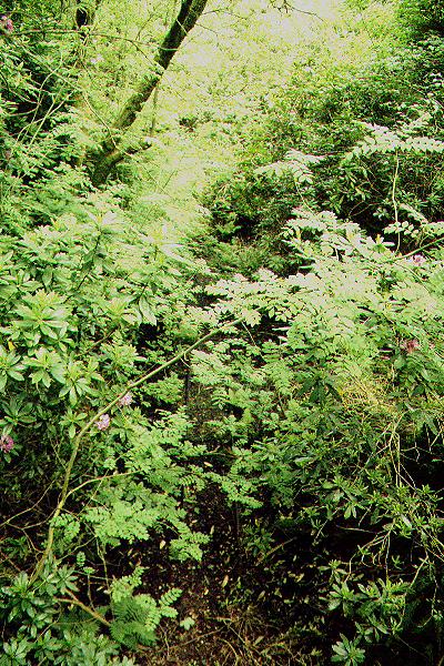
This southerly view (9/8/05) shows the trackbed at the north end of Beddgelert station. This is the position of the north end loop point of the extended 200m loop. The formation will be widened to the west (right) across the missing bridge UB167 that carries the diverted public bridleway route around the station. Click on the image to enlarge. This image is copyright B.W.Hughes and was captured on a Kodak DX6490 digital camera. Image post processed using Iphoto+4 and displayed at 96dpi.
UB167


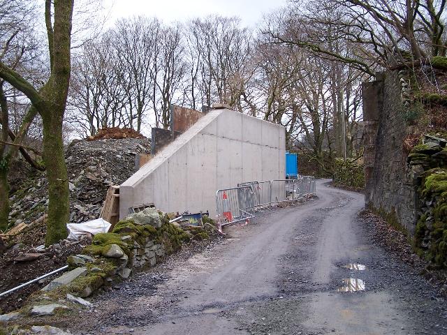
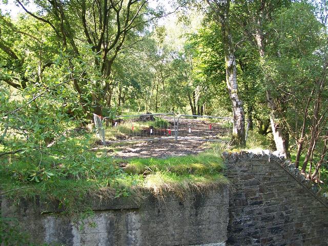
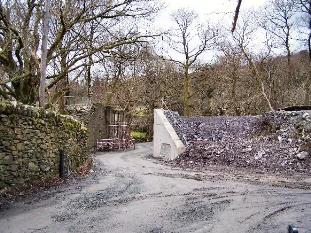
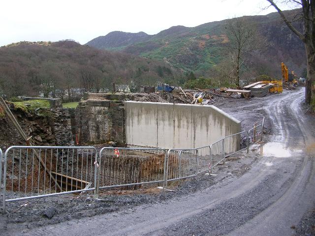
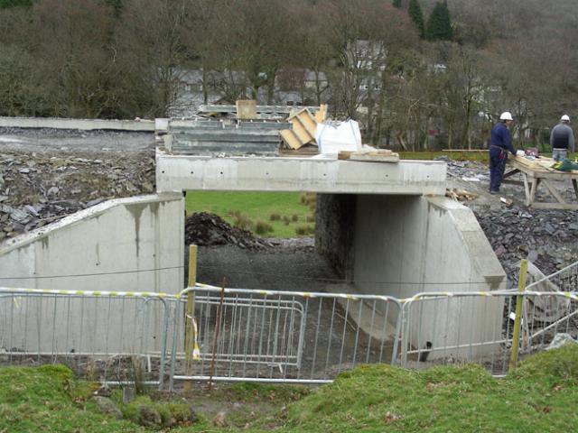
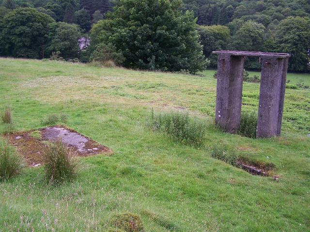
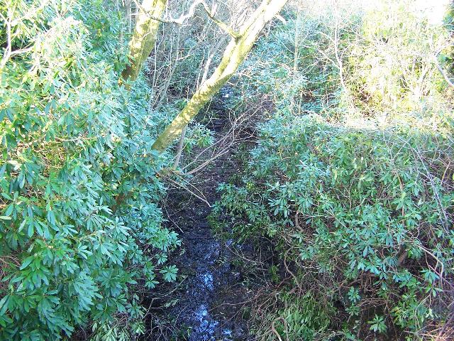
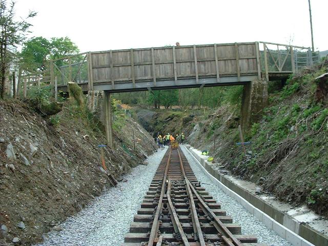
These southerly views (9/8/05, 22/2/06, 10/9/06 and 10/12/06) show the missing UB167 at the north end of Beddgelert Station. It is a PBSSR structure with a WHR 1923 concrete cap. The bridge will require a complete rebuild to widen it to the right to allow double track and platform of the loop. Immediately south of the bridge will be a newly planned point to the right (west) and siding leading to the former ashpit of Beddgelert depot. The second view shows the trees chopped down in this area. The third view shows the survey ground marks for the easterly (northbound) track. The bridge will be extended to the right to carry the second track as the platform is being extended over the bridge a few metres. The fourth view shows the construction access track built along the west side of the station. Click on the images to enlarge. These images are copyright B.W.Hughes and were captured on a Kodak DX6490 digital camera. Images post processed using Iphoto+4 and displayed at 96dpi.
These northerly views (29/5/01 and 9/8/05) show UB167 at the north end of Beddgelert station. The footpath across the station will be diverted under this bridge. The bridge will be widened to accommodate double track and platform. The bridge was a PBSSR structure with a WHR concrete cap added to strengthen the top. Click on the images to enlarge. These images are copyright B.W.Hughes. Slide scan technology utilised is Olympus ES10. Second image captured on a Kodak DX6490 digital camera. Images post processed using Iphoto+4 and displayed at 96dpi.
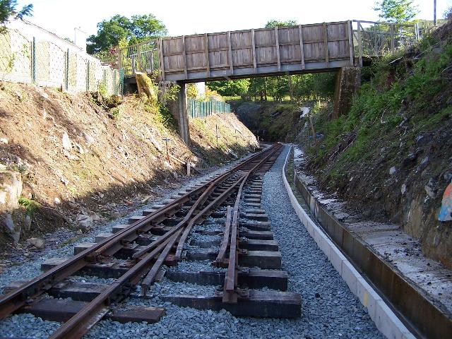
This northerly view (29/5/01) shows the trackbed at UB167 at the north end of Beddgelert station. The bridge was a 1906 PBSSR stone structure with 1923 concrete additions for the WHR. The bridge and embankment will be widened to the left (west) to accommodate the southbound track of the new lengthened 200m loop and platform which will terminate some 25m north of the bridge. Click on the image to enlarge. This image is copyright B.W.Hughes. Slide scan technology utilised is Olympus ES10 & iPhoto Plus4. Slide scanned at 200dpi.

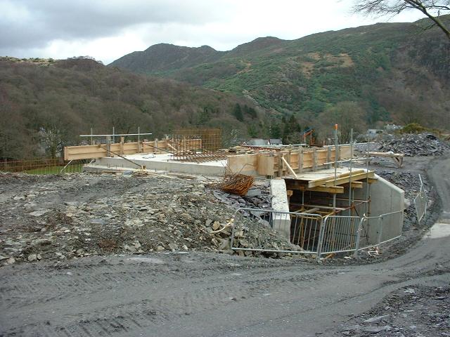
This southerly view (15/2/07) shows the extension of UB167 to the west to accommodate double track from the widened embankment north of the bridge. Click on the image to enlarge. This image is courtesy/copyright John Ewing and was taken on a digital camera. Image post processed using iPhoto Plus4 and displayed at 96dpi.

These easterly and northerly views (both 16/2/07) show progress with the southern abutment extension and wing wall of UB167. Click on the image to enlarge. This image is courtesy/copyright John Peduzzi and was taken on a digital camera. Image post processed using iPhoto Plus4 and displayed at 96dpi.
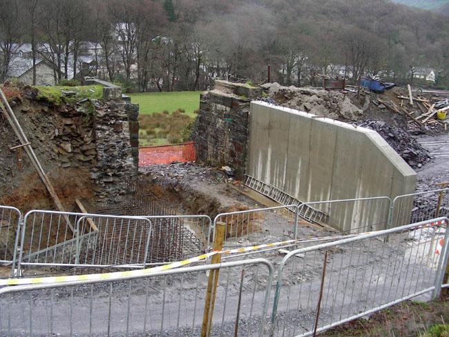
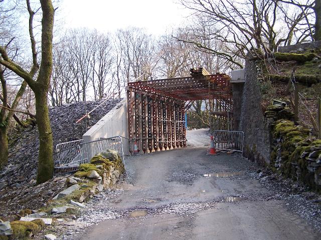
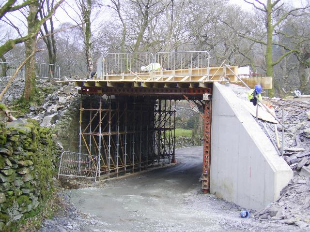
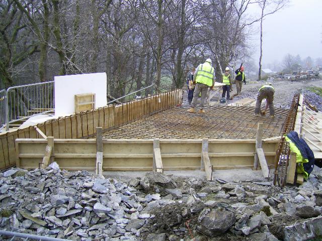
This easterly views (24/2/07, 25/2/07, 2/3/07 and 18/3/07) show stages in completion of UB167. The first view shows the completed southern abutment of UB167 extended to the west to accommodate double track and the northerly platform extension. The base for the northern abutment is also taking shape is the second view. The third view shows the northern abutment angles to the left to allow the footpath to climb alongside the railway. The fourth view shows the deck complete. Click on the images to enlarge. The first image is courtesy/copyright Mike Hart, the second image is copyright Mike Jenkins (courtesy Dave Waldren), the third image is copyright Chris Price and the fourth is courtesy John Ewing. All were taken on digital cameras. Images post processed using iPhoto Plus4 and displayed at 96dpi.
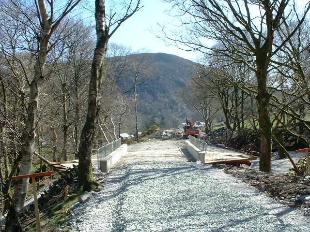
This westerly view (29/3/07) shows the complete UB167. A retaining wall has been constructed to the north on the east side of the embankment and a similar one is being constructed to the south. Click on the image to enlarge. This image is copyright Mike Jenkins and was taken on a digital camera. Image post processed using iPhoto Plus4 and displayed at 96dpi.
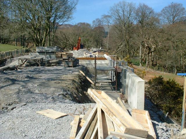
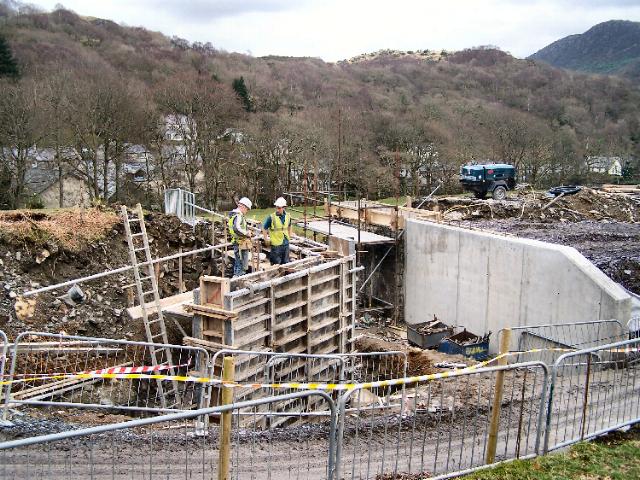
This northerly view (7/4/07) shows the construction of a retaining wall on the top 2m of the embankment for about 10m south of UB167. A similar wall extends to the north of UB167. This was necessary due to the steepness of the embankment with its narrow top. Click on the image to enlarge. This image is courtesy/copyright John Ewing and was taken on a digital camera. Image post processed using iPhoto Plus4 and displayed at 96dpi.
This southerly view (7/4/07) shows the new retaining wall south of UB167. Beyond is the completed formation for the eastern loop track. The reinforced sections of the station shelf will be planted with gorse and local species to blend in with the existing shelf plants. Click on the image to enlarge. This image is courtesy/copyright John Ewing and was taken on a digital camera. Image post processed using iPhoto Plus4 and displayed at 96dpi.
Station area
The station begins with the north loop point on UB167. The platform commences just south of UB167.
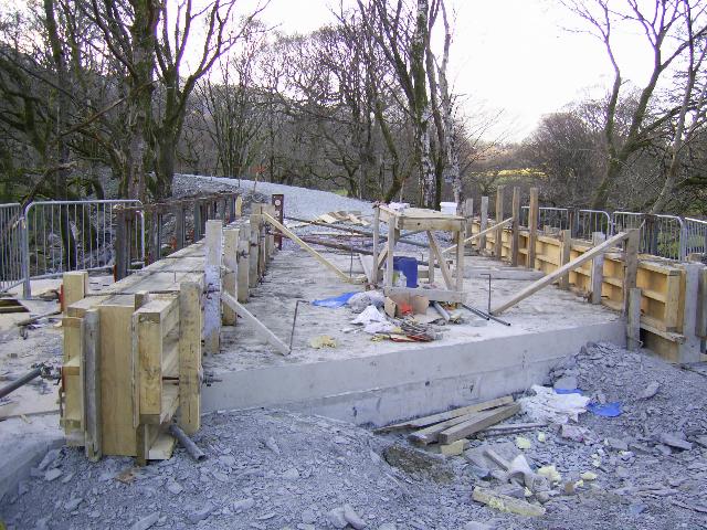
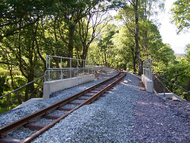
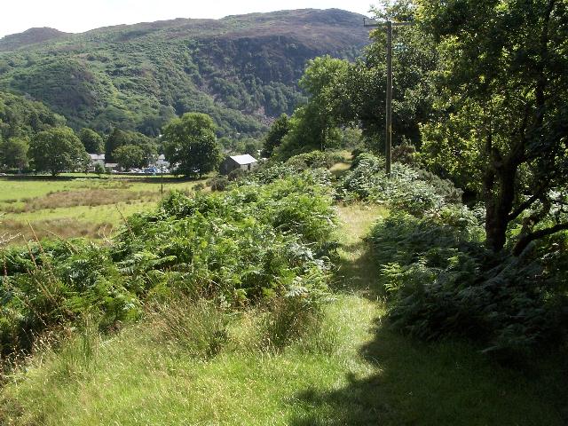
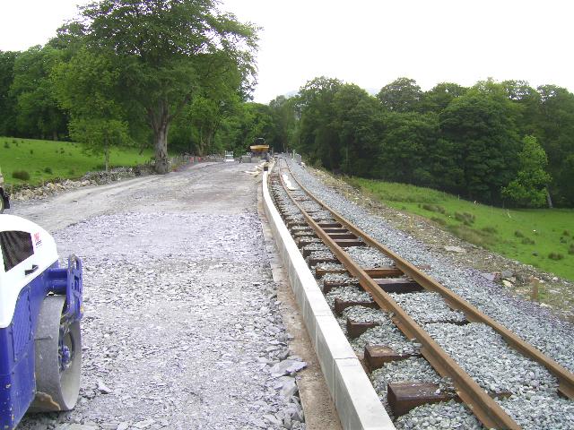
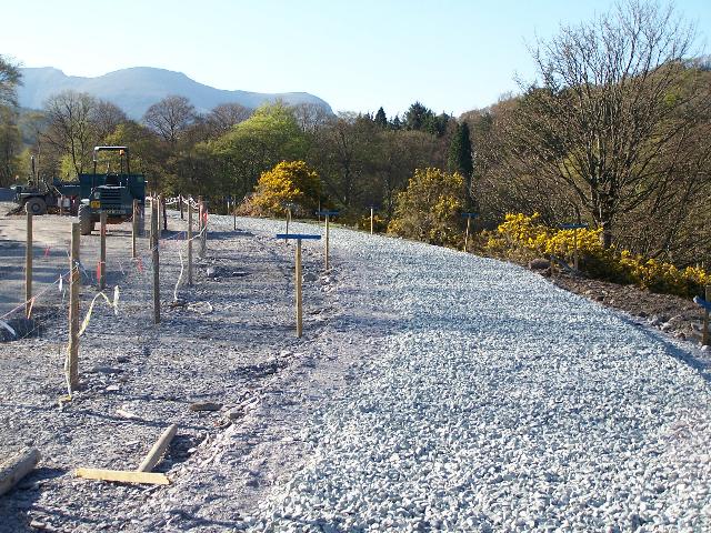
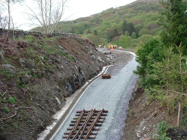
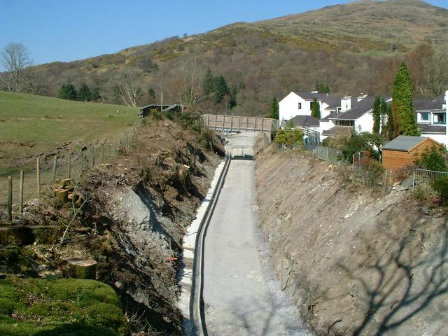
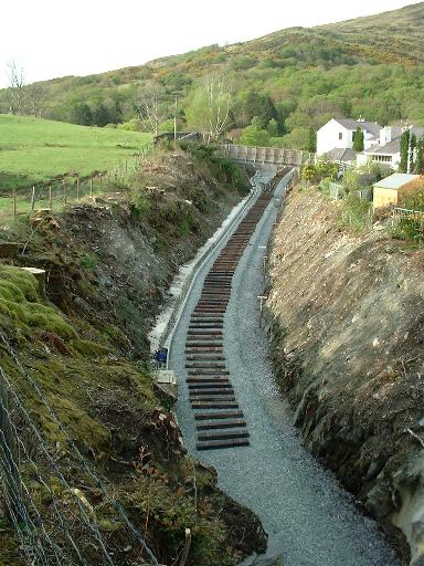
This southerly view (30/3/07) shows the formation for the easterly track complete south of UB167. The embankment beyond leading into the station site has been widened and firmed up. The future alignment of the diverted footpath can be seen to the left at the foot of the embankment. Click on the image to enlarge. This image is courtesy Alastair Stewart (WHRCL) and was taken on a digital camera. Image post processed using iPhoto Plus4 and displayed at 96dpi.

These northerly and southerly views respectively (both 24/4/07) show the Head of Steel crossing UB167 at around 1430. More progress was made towards the middle of the station before the end of the day. Click on the images to enlarge. These images are courtesy/copyright John Ewing and were taken on a digital camera. Images post processed using iPhoto Plus4 and displayed at 96dpi.
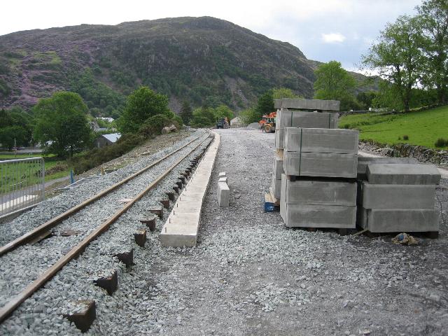
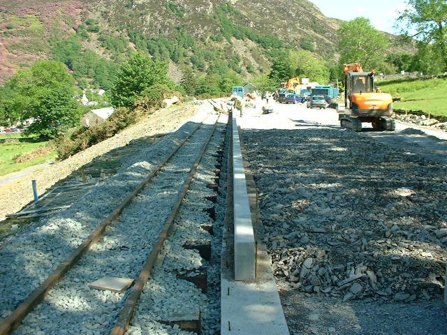
This southerly view (26/5/07) shows the foundation for the platform edge kerbing complete at the north end of Beddgelert Station. Click on the image to enlarge. This image is copyright Tony Baker and was taken on a digital camera. Image post processed using iPhoto Plus4 and displayed at 96dpi.
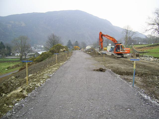
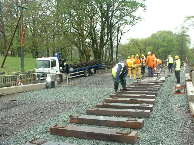
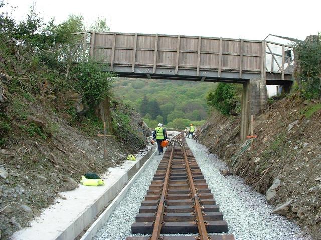
This northerly view (21/4/07) shows 192 wooden sleepers have been delivered to the north end of Beddgelert Station as well as the north end loop point, just visible beyond the pile of sleepers. The contractor had finished the trackbed and ballasted the missing section between UB165 and UB167 by this date. This means that track can now enter Beddgelert Station during the tracklaying week that commenced on 21/4/07. Click on the image to enlarge. This image is courtesy/copyright John Ewing and was taken on a digital camera. Image post processed using iPhoto Plus4 and displayed at 96dpi.
This northerly view (23/5/07) shows delivery of kerbing to Beddgelert Station and work underway on the platform edge foundation at the north end of the station. Click on the image to enlarge. This image is courtesy/copyright John Ewing and was taken on a Fuji Finepix 1400 digital camera. Image post processed using iPhoto Plus4 and displayed at 96dpi.
This northerly view (24/5/07) shows the foundation being laid for the kerbing on the east side of Beddgelert Station platform. A wooden gauge has been cut to ensure the foundation is the correct distance from the track, which can be seen to be heavily ballasted to lock it in place after the attentions of the Tuesday Gang earlier in the week. Click on the image to enlarge. This image is courtesy Alasdair Stewart (WHRCL) and was taken on a digital camera. Image post processed using iPhoto Plus4 and displayed at 96dpi.
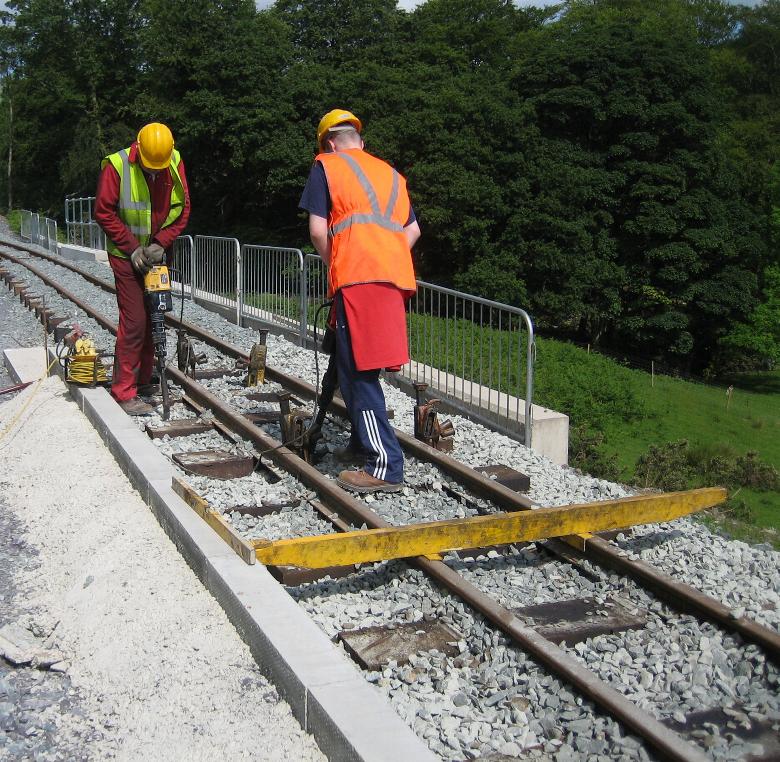
This northerly view (5/6/07) shows the Tuesday Gang packing the track manually with Kangos at the north end of Beddgelert Station. Concrete has been placed against the rear of the kerbstones to hold them in place. Temporary barriers protect workers from the steep drop where the concrete extensions to UB167 have been constructed. Click on the image to enlarge. This image is copyright Tony Baker and was taken on a digital camera. Image post processed using iPhoto Plus4 and displayed at 96dpi.
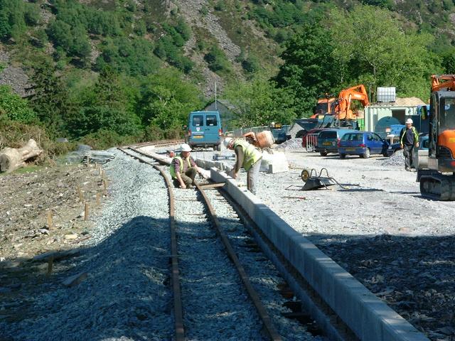
These southerly views (both 29/5/07) show the laying of the kerbstones on cement on the east face of Beddgelert Station platform foundations. Progress was made from north to south. The first view also shows backfilling behind the kerbstones which have not yet received concrete to lock them in place. Click on the images to enlarge. These images are courtesy/copyright John Ewing and were taken on a Fuji Finepix 1400 digital camera. Images post processed using iPhoto Plus4 and displayed at 96dpi.
These northerly and southerly views (both 31/5/07) show the eastern platform kerbing being placed. Backfilling has already raised the platform to the height of the foundations. Click on the images to enlarge. These images are courtesy/copyright Alasdair Stewart (WHRCL). Both were taken on a digital camera. Images post processed using iPhoto Plus4 and displayed at 96dpi.
Preparations are being made for the service duct along the platform at Beddgelert Station. A trench has been excavated alongside almost the full length of eastern platform face and marked Water Crane in one location. The water crane will be fed by a large diameter pipe from a new standard Braithwaite style water tank at the north end of the station on the west side. The trench will also accommodate other services such as the electric supply for the lamp standards and the water pipe for the station building.
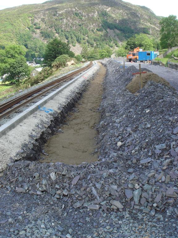
This southerly view (17/6/07) shows the trench dug for the water supply and other services down the length of Beddgelert Station platform. Click on the image to enlarge. This image is courtesy/copyright Paul Wood and was taken on a digital camera. Image post processed using iPhoto Plus4 and displayed at 96dpi.
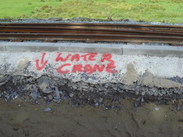
This easterly view (17/6/07) shows the trench dug for the services down the length of Beddgelert Station platform, marked where the water crane will be near the north end of the easterly platform face. Click on the image to enlarge. This image is courtesy/copyright Paul Wood and was taken on a digital camera. Image post processed using iPhoto Plus4 and displayed at 96dpi.
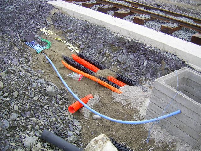
This easterly view (28/6/07) shows the draw-pit on Beddgelert station platform for the various cables that run down the platform. A 1 inch water main can also be seen, presumably the supply for the station building. Click on the image to enlarge. This image is courtesy Alasdair Stewart (WHRCL) and was taken on a digital camera. Image post processed using iPhoto Plus4 and displayed at 96dpi.
This northerly view (9/8/05) shows the area to the west of the alignment immediately south of UB167. This area will also require fill as the point for the turnout to the ashpit siding will be situated just south of UB167. Click on the image to enlarge. This image is copyright B.W.Hughes and was captured on a Kodak DX6490 digital camera. Image post processed using Iphoto+4 and displayed at 96dpi.
These northerly views (9/8/05, 10/12/06 and 20/1/07) show the area covered with ferns through which the new siding will run. Instead of joining by the water tower, the siding will turn north to run parallel with the loop and will join near UB167. This will provide stabling for a short train and give access to oiling around inside motion locos. The second view shows the first stage of clearance following the start of the contract works in early December. The third view, from the public footpath crossing shows clearance and hardening of the trackbed complete. Click on the images to enlarge. The first two images are copyright B.W.Hughes and were captured on a Kodak DX6490 digital camera. The third image is copyright Dave Waldren and was taken on a Cannon G2 digital camera. Images post processed using Iphoto+4 and displayed at 96dpi.
On the east side is the former Goods Shed with a concrete base remaining and slots for tracks and sliding doors on the south-east side. This was used as a loco shed for some turns based on Beddgelert and it is known the Baldwin stabled here regularly at one time.
These northerly views (29/5/01 and 2/7/05) show the base of the former wooden Loco Shed/Goods Shed. The trackbed is to the left and sleeper spacings are still evident and the original north end loop point was at this location. The loco shed was a headshunt off the loop. The concrete foundations are clearly visible. The double sliding door grooves are also visible extending for about 4 metres left to right. The tracks occupied the left hand (now grassed half of the shed) and the two foot gauge track slots are clearly visible in the sliding door foundation to the left. The right hand half of the shed floor was concreted. In the second view this is being overgrown. The new northbound track will pass through the site of this former building as the island platform and loop are being extended to the north to make a standard 200m loop. Click on the image to enlarge. These images are copyright B.W.Hughes. Slide scan technology utilised is Olympus ES10 & iPhoto Plus4. Slide scanned at 200dpi. Second image taken on a Kodak DX6490 digital camera. Images displayed at 96dpi.
This northerly view (15/5/07) shows the Tuesday Gang hand-tamping the eastern track of the loop at Beddgelert. Click on the image to enlarge. This image is copyright Tony Baker and was taken on a digital camera. Image post processed using iPhoto Plus4 and displayed at 96dpi.
Siding and old water tower
At the centre of the station on the west side are the clear signs of a loco siding, pit and kindling/coal store and water tower. Ron Fisher has contributed some archive images for use of this website. To see more of his 1960/1 views of the line visit his Photopic site.

This northerly archive view (27/6/61) shows the middle of Beddgelert Station with the water tower in view. Click on the image to enlarge. This image is copyright Ron Fisher and was taken on a film camera. Image post processed using iPhoto Plus4 and displayed at 96dpi.
This northerly archive view (1923) shows FR loco 'Little Giant' on a northbound train at Beddgelert. The wooden Loco shed/Goods shed, with a goods wagon parked in front, is visible in the distance to the left of the water tower. The newly erected concrete water tower supports a steel tank. To the left of the water tower is a siding which was the loco servicing point. There is a brakevan and a goods wagon stabled there on the ash-pit. Click on the image to enlarge. This image is copyright WHR(P), courtesy David Allan.

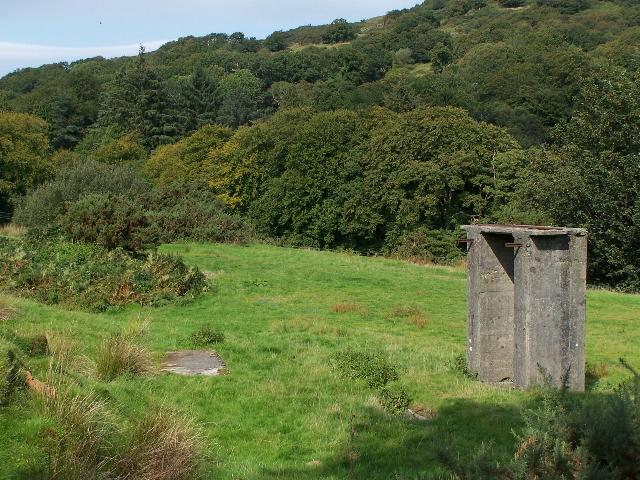
These northerly views (9/8/05, 10/12/06, 23/12/06 and 20/1/07) show the water tower at the north end of the station. The southbound loop track will follow the former trackbed close to the water tower and through the manure pile. The northbound track will be moved further east and pass through the concrete base of the former station building and Loco Shed to give a wider island platform. The second view shows the clearance begun in early December and the third view shows progress with the footpath diverted to cross the works by the green toilet and the depot ashpit fenced off. The fourth view shows the pit and tower fenced off for protection. Click on the images to enlarge. The first three images are copyright B.W.Hughes and were captured on a Kodak DX6490 digital camera. The fourth image is copyright Dave Waldren and was taken on a Cannon G2 digital camera. Images post processed using Iphoto+4 and displayed at 96dpi.
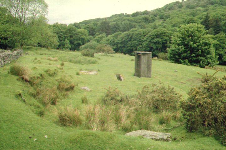
These northerly views (29/5/01, 2/7/05 and 10/9/06) show the former loco ash pit road and concrete water tower. The two loop tracks were to the right of the water tower. The concrete shed base to the left of the ash pit is the former WT stores. The loco siding extended south of the pit as far as the bush. The siding was often used in WHR days for stabling goods stock when not required for loco servicing. The 100 foot ash pit siding joined into the loop just south of the north end loop points. The third view shows painted ground marks are surveys are underway to define the alignments. Click on the image to enlarge. These images are copyright B.W.Hughes. Slide scan technology utilised is Olympus ES10 & iPhoto Plus4. Slide scanned at 200dpi. Second image taken on a Kodak DX6490 digital camera. Images displayed at 96dpi.

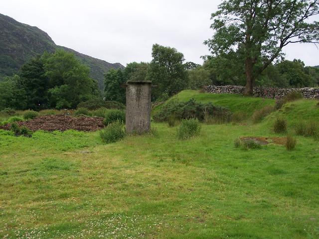
These southerly views (29/5/01, 2/7/05, 23/12/06, 20/1/07 and 28/3/07) show the general area of the WHR platforms loops and loco pit road at the centre of Beddgelert Station. The loco servicing siding is to the right of the concrete water tower base. The tracks curve to the south (right) and the concrete base of the former galvanised iron sheeting station building is visible beyond the manure pile in the earlier view. The gradient through the station is 1 in 42 and a wide island platform will be built here with possible footbridge access from Beddgelert car park (left). In the second image from the site of the future pit road point, the sleeper spacings are evident. The nettles to the right of the water tower mark the ash pit. The third image, taken from the footpath crossing, shows the clearance at the centre of the station with the ashpit to the right of the water tower now fenced off. The fourth image shows the tower and pit fenced off. The fifth image shows the footpath diverted onto the future platform and work underway to complete the eastern trackbed on which track will be laid in the Spring. Click on the images to enlarge. The first three images are copyright B.W.Hughes. Slide scan technology utilised is Olympus ES10 & iPhoto Plus4. Slide scanned at 200dpi. The second and third images were taken on a Kodak DX6490 digital camera. The fourth image is copyright Dave Waldren and was taken on a Cannon G2 digital camera. The fifth image is courtesy Alastair Stewart (WHRCL) and was taken on a digital camera. Images post processed using Iphoto+4 and displayed at 96dpi.
These northerly and southerly views respectively (18/4/07) taken from the public footpath in the middle of Beddgelert Station, adjacent to the water tower and Goods Shed, show the easterly track has been ballasted in anticipation of tracklaying in the week ahead. Click on the images to enlarge. These images are copyright B.W.Hughes and were taken on a Kodak DX6490 digital camera. Images post processed using iPhoto Plus4 and displayed at 96dpi.
These northerly and southerly views respectively (18/4/07) taken from the public footpath at the south end of Beddgelert Station show the easterly track has been ballasted in anticipation of tracklaying in the week ahead. The ballast reaches to a point close to Goat Cutting. The station building will be in the location of the ballast pile to the left. Click on the images to enlarge. These images are copyright B.W.Hughes and were taken on a Kodak DX6490 digital camera. Images post processed using iPhoto Plus4 and displayed at 96dpi.

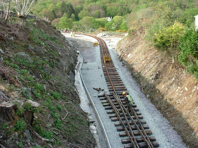
These northerly and southerly views respectively (24/4/07) show pre-drilled sleepers laid out in Beddgelert Station. The first view shows a northerly view from the south end of the station. The second view is from the middle of the station looking south. Track should be constructed through here in the next few days and enter Goat Cutting. Click on the images to enlarge. These images are courtesy Alasdair Stewart (WHRCL) and were taken on a digital camera. Images post processed using iPhoto Plus4 and displayed at 96dpi.
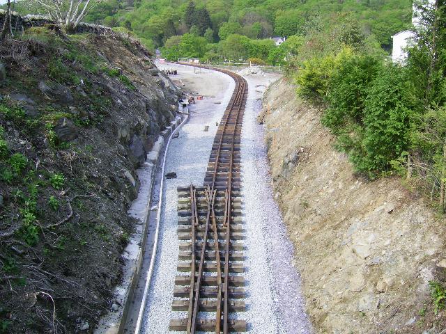
These northerly and southerly views respectively (both 25/4/07) show the Head of Steel at the end of the day. Track is being laid is staggered rail because of the curve and had reached Ch.22380 approx, just south of the temporary footpath crossing. Click on the images to enlarge. These images are courtesy/copyright John Ewing and were taken on a digital camera. Images post processed using iPhoto Plus4 and displayed at 96dpi.
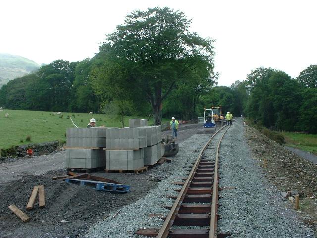
These southerly views (both 15/5/07) show the KMX, with its running truck, carefully positioning the track against the future line of the east face of the island platform now the station has been ballasted. The second view shows the western loop trackbed past the original water tower is still in use an haul road for the completion of the station building and platforms. Click on the images to enlarge. The first image is are courtesy/copyright Alasdair Stewart (WHRCL) and the second John Ewing (WHRCL). Both were taken on a digital camera. Images post processed using iPhoto Plus4 and displayed at 96dpi.
These northerly views (both 15/5/07) show the KMX at work at the south end of Beddgelert Station. In the first view the siding point is visible. In the second view, the footpath can still be seen down the middle of the future island platform. Click on the images to enlarge. These images are courtesy/copyright John Ewing and were taken on a digital camera. Images post processed using iPhoto Plus4 and displayed at 96dpi.
This southerly view (22/5/07) shows the drainage being completed along the west side of the station, alongside the old water tank, which is to be retained and fitted, courtesy the WHR Heritage Group. Click on the image to enlarge. This image is courtesy Alasdair Stewart (WHRCL) and was taken on a digital camera. Image post processed using iPhoto Plus4 and displayed at 96dpi.
These northerly views (10/9/06 and 28/3/07) shows the red ground paint survey markers for the northbound easterly track in an otherwise untouched Beddgelert Station. The second image shows the diverted footpath crossing the worksite and work underway to complete the eastern track of the loop to allow tracklaying through the station site in the Spring. Click on the images to enlarge. The first image is copyright B.W.Hughes and was taken on a Kodak DX6490 digital camera. The second image is courtesy Alastair Stewart (WHRCL) and was taken on a digital camera. Image post processed using iPhoto Plus4 and displayed at 96dpi. Images post processed using iPhoto Plus4 and displayed at 96dpi.
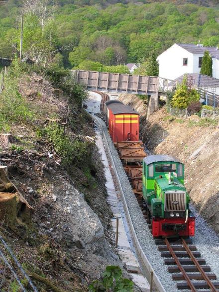
These northerly views (both 26/4/07) show Upnor Castle with the PW train in Beddgelert Station and Velinheli following. The first view is at the north end of the station and the second view is at the south end, where the temporary public footpath crossing is located. Click on the images to enlarge. These images are courtesy/copyright John Ewing and were taken on a digital camera. Images post processed using iPhoto Plus4 and displayed at 96dpi.
South end of station
The south end of the station will feature the station building and the entrance to the platforms as well as the bridleway and the zigzag path down to the car park.
These northerly views (both 26/4/07) show tracklaying at the south end of the station with the curve into Goat Cutting. The new station building will be to the right. The right hand point for the water tower siding is visible in the first view. Also visible are Dolgarrog and Upnor Castle with PW trains with Velinheli following. Click on the images to enlarge. These images are courtesy/copyright John Ewing and were taken on a digital camera. Images post processed using iPhoto Plus4 and displayed at 96dpi.
This northerly view (27/5/07) shows the foundation for the platform edging nearing completion at the south end of Beddgelert Station. Click on the image to enlarge. This image is courtesy/copyright John Ewing and was taken on a Fuji Finepix 1400 digital camera. Image post processed using iPhoto Plus4 and displayed at 96dpi.
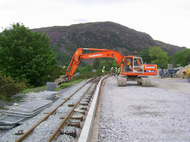
This southerly view (30/3/07) shows the firming up of the embankment towards the middle of the station. The future path of the diverted footpath can be seen to the left of the excavator. Click on the image to enlarge. This image is courtesy Alastair Stewart (WHRCL) and was taken on a digital camera. Image post processed using iPhoto Plus4 and displayed at 96dpi.
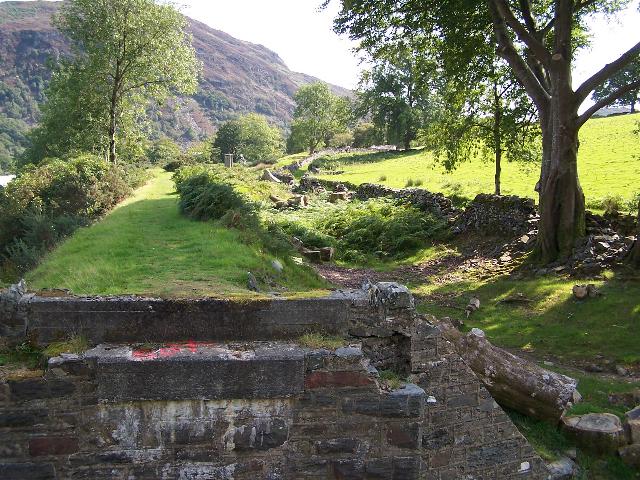
This northerly view (2/4/07) shows the completion of the slightly widened and strengthened embankment in the middle of Beddgelert Station. This will be replanted with gorse to blend in with the existing edge of the station shelf. Click on the image to enlarge. This image is courtesy Alasdair Stewart (WHRCL) and was taken on a digital camera. Image post processed using iPhoto Plus4 and displayed at 96dpi.
This northerly view (8/5/07) shows the new diversion of the public footpath that used to crossed the area of the platforms. It will pass under UB167 at the north end of the station. The diversion was opened on 21/5/07. Click on the image to enlarge. This image is copyright Colin Lea and was taken on a digital camera. Image post processed using iPhoto Plus4 and displayed at 96dpi.
This southerly view (28/3/07) shows the completion of the eastern trackbed through the station at the south end. Click on the image to enlarge. This image is courtesy Alastair Stewart (WHRCL) and was taken on a digital camera. Image post processed using iPhoto Plus4 and displayed at 96dpi.
This easterly view (23/12/06) shows the blue ground paint survey markers for the access path from the car park seen below. Click on the image to enlarge. This image is copyright B.W.Hughes and was taken on a Kodak DX6490 digital camera. Image post processed using iPhoto Plus4 and displayed at 96dpi.

These easterly views (10/9/06 and 23/12/06) show the red ground paint survey markers for the northbound easterly track on the concrete foundation of the former Beddgelert Station building and in the second view, clearance well underway. Click on the image to enlarge. This image is copyright B.W.Hughes and was taken on a Kodak DX6490 digital camera. Image post processed using iPhoto Plus4 and displayed at 96dpi.
At the south end on the east side was a coal siding for the Goat Hotel etc. The new station building will occupy the site of the siding.
This northerly view (1926) shows the former refreshment room/bookstall and station building beyond. The platform edging is just visible between the right hand loop and the station building. In the distance the black tank of the water tower is visible in front of the Loco Shed/Goods Shed. There was no platform surfacing, just ballast. Passengers getting off trains on the left hand loop had to cross the loop to get to the platform. The new WHR will have a tarmac surfaced island platform. The coal siding is visible diverging to the right. Click on the image to enlarge. Photographer K.F.Antia. This image is copyright WHR(P), courtesy David Allan.
This northerly view (31/12/02) shows a similar view to the archive view above. The former cutting side is visible to the left and the siding junction is in the foreground. Click on the image to enlarge. This image is copyright B.W.Hughes. Image captured using Samsung Digimax 230 digital camera. Image post processed using iPhoto Plus4 and displayed at 96dpi.


These southerly views (29/5/01, 2/7/05, 23/12/06 and 20/1/07) show the concrete base of the former station building. The platform and loops were to the right of the station building. The route curved sharply right into the overgrown cutting between the purple flowering rhododendron and the new white houses of Oberon Wood housing estate, a source of some opposition to the railway. Since the February 2005 clearance a fence has been erected across the entrance to Goat Cutting. The third view shows clearance works well underway and the concrete base of the former station building from the footpath. The fourth view shows clearance complete and the cutting widened to allow the loop to be extended to the south. Some T-bulb rail stored on the former station building concrete base. Click on the images to enlarge. These images are copyright B.W.Hughes. Slide scan technology utilised is Olympus ES10. Slide scanned at 200dpi. Second and third images taken on a Kodak DX6490 digital camera. The fourth image is copyright Dave Waldren and was taken on a Cannon G2 digital camera. Images post processed using Iphoto+4 and displayed at 96dpi.
These southerly views (18/3/07 and 28/3/07) show the completion of the formation for the easterly track at the south end of Beddgelert Station looking into Goat Cutting. Large piles of concrete troughing are stored to complete the station drainage. Click on the images to enlarge. The first image is courtesy John Ewing and the second image is courtesy Alastair Stewart (WHRCL) and was taken on a digital camera. Images post processed using iPhoto Plus4 and displayed at 96dpi.
This southerly view (28/4/07) shows the completed track at the south end of Beddgelert Station as it curves into Goat cutting. Click on the image to enlarge. This image is copyright Laurence Armstrong and was taken on a digital camera. Image post processed using iPhoto Plus4 and displayed at 96dpi.
These southerly views (20/5/07 and 29/507) from the south end of Beddgelert Station shows the construction of a cast concrete drain against the western cutting side. this will also cope with any thrust from the bank. The track was fettled a few days later to form a smooth curve at the south end of the station and then ballasted to hold it in place, as its position was being used to set the alignment for edge of the platform. the second view shows the construction of the foundation for the eastern platform edge. Click on the images to enlarge. The first image is copyright B.W.Hughes and was taken on a Kodak DX6490 digital camera. The second image is copyright John Ewing and was taken on a Fuji Finepix digital camera. Images post processed using iPhoto Plus4 and displayed at 96dpi.


These easterly views (9/8/05 and 10/12/06) show the concrete foundation of the former Beddgelert Station building. The new station access will zigzag down to the Beddgelert central car park visible behind. The second view shows the first stages of clearance work but the farmer still had not cleared his midden on this date. Click on the images to enlarge. These images are copyright B.W.Hughes and were captured on a Kodak DX6490 digital camera. Images post processed using Iphoto+4 and displayed at 96dpi.
This southerly view (29/5/01) shows the site of the 96 foot coal siding added in 1924. The main line curved to the right into the cutting. This was the site of the south end loop points. The coal siding came off the loop. Initial plans show the new station building occupying the siding site. Click on the image to enlarge. This image is copyright B.W.Hughes. Slide scan technology utilised is Olympus ES10 & iPhoto Plus4. Slide scanned at 200dpi.
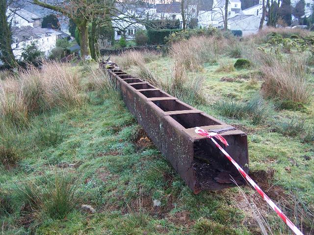
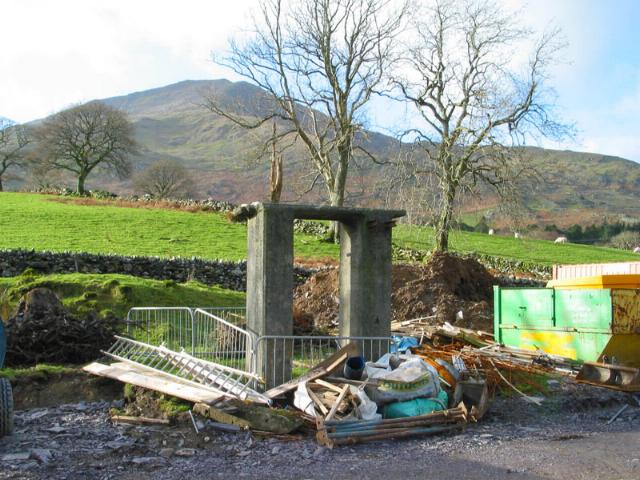
This southerly view (23/12/06) shows the aqueduct stored alongside the now fenced public footpath across the station site. This item will be preserved. Click on the image to enlarge. This image is copyright B.W.Hughes and was taken on a Kodak DX6490 digital camera. Image post processed using iPhoto Plus4 and displayed at 96dpi.
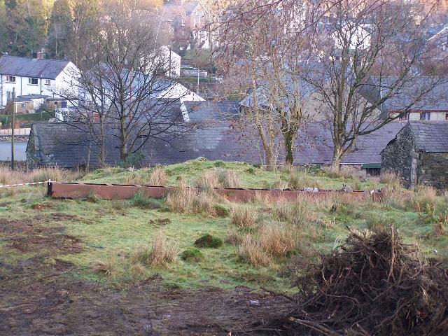
This easterly view (23/12/06) shows the aqueduct stored alongside the now fenced public footpath across the station site. Click on the image to enlarge. This image is copyright B.W.Hughes and was taken on a Kodak DX6490 digital camera. Image post processed using iPhoto Plus4 and displayed at 96dpi.
This northerly view (26/3/07) shows the right hand point delivered to the south end of Beddgelert Station. A siding will be established on the westerly loop track at the south end of the station to stable PW stock and reduce the length of PW runs from Rhyd Ddu. Click on the image to enlarge. This image is courtesy/copyright John Ewing and was taken on a digital camera. Image post processed using iPhoto Plus4 and displayed at 96dpi.
This northerly view (20/5/07) shows drainage under construction along the west side of the station at the south end. This section is being cast to prevent any thrust from the earth bank cutting. Click on the image to enlarge. This image is copyright B.W.Hughes and was taken on a Kodak DX6490 digital camera. Image post processed using iPhoto Plus4 and displayed at 96dpi.
This southerly view (24/4/07) shows the completion of the ballast at the south end of the station and into Goat Cutting and the delivery of the south loop point. Click on the image to enlarge. This image is courtesy Alasdair Stewart (WHRCL) and was taken on a digital camera. Image post processed using iPhoto Plus4 and displayed at 96dpi.
This northerly view (31/5/07) shows the south end of Beddgelert Station showing the limit of the platform where the foundation terminates. The southbound track will be hard against the cast drain on the left (west) side of this view. The platform access will be a level crossing from here to the station building on the right. Click on the image to enlarge. This image is courtesy/copyright John Ewing and was taken on a Fuji Finepix 1400 digital camera. Image post processed using iPhoto Plus4 and displayed at 96dpi.

This northerly view (17/6/07) shows the trench dug for the services down the length of Beddgelert Station platform from the south end of the station. Click on the image to enlarge. This image is courtesy/copyright Paul Wood and was taken on a digital camera. Image post processed using iPhoto Plus4 and displayed at 96dpi.
New station building
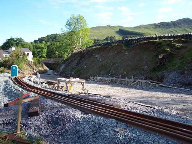
Work started in June for casting the foundation ring beam of the new station building. William Hughes are doing that part of the job as they have the plant on site. The main contract for the station building will be let later. By 13/6/07, shuttering was in place for the concrete base. The building is rectangular in shape with its long side facing the railway and parallel with the tracks at the south end of the station. There are two small extensions either side of the building on the side facing the platform. The toilet block will be on the north side. Access can be gained by the bridleway under UB167, freeing up the trackbed for construction of the western loop when that is no longer required by construction plant.

This view (13/6/07) shows work taking place on the new station building at Beddgelert. The foundation shuttering marks out the shape of the building. Click on the image to enlarge. This image is courtesy/copyright John Ewing and was taken on a Fuji Finepix 1400 digital camera. Image post processed using iPhoto Plus4 and displayed at 96dpi.
This southerly view (19/6/07) shows progress being made with Beddgelert Station building foundation, the rear of which now appears complete. This image is courtesy Alasdair Stewart (WHRCL) and was taken on a digital camera. Image post processed using iPhoto Plus4 and displayed at 96dpi.
Goat Cutting
The Beddgelert Station site was an early preservation location for the WHR (1964) Co. and Goat Cutting was cleared and rails laid south from Beddgelert Station. However, the focus shifted to the Beddgelert Siding site in Porthmadog and the rails were left to rust. They were recovered from the cutting in 2006 during clearance work.
This archive view (1978) shows Goat Cutting as it was left with temporary track laid by the '64Co. volunteers. Remains of this track were recovered from the site during the last few months of 2006. Click on the image to enlarge. This image is courtesy/copyright Simon Foster. Image post processed using iPhoto Plus4 and displayed at 96dpi.

This southerly view (29/5/01) shows the start of the Goat Cutting at the south end of Beddgelert station. The new south end loop points will be here, in a similar location to the original WHR points. The loop will be lengthened to the north giving a standard 200m length. Click on the image to enlarge. This image is copyright B.W.Hughes. Slide scan technology utilised is Olympus ES10 & iPhoto Plus4. Slide scanned at 200dpi.


These southerly views (29/1/05, 19/3/05 and 24/2/07) from Beddgelert Station show clearance has been completed in this area. In the background the trackbed passes under the Goat Cutting footbridge and curves to the left into the deep rock cutting approaching the Goat Tunnel. Sleepers and rail from the WHR(P)'s attempts to restore the railway south from here are still present in the cutting. The third view shows the completed widening of the north end of Goat Cutting to accommodate the southern extension of the station loop. some rockwork was required on the west side (right). Click on the images to enlarge. The first two images are copyright R.J.Edwards and B.W.Hughes and were captured on a Kodak DX6490 digital camera. The third view is courtesy/copyright Mike Hart and was taken on a digital camera. Image post processed using iPhoto Plus4 and displayed at 96dpi.Image post processed using Iphoto+4 and displayed at 96dpi.

This southerly view (15/5/07) shows the Tuesday Gang hand-tamping the south loop point at Beddgelert. Fencing of the east side of the cutting along the rear of the Oberon wood residences has now reached the footbridge from Goat Tunnel. Click on the image to enlarge. This image is copyright Tony Baker and was taken on a digital camera. Image post processed using iPhoto Plus4 and displayed at 96dpi.
This northerly view (28/3/07) shows the north end of the widened Goat Cutting where the south end loop point will be positioned. The trackbed is now complete and awaits ballast. Click on the image to enlarge. This image is courtesy Alastair Stewart (WHRCL) and was taken on a digital camera. Image post processed using iPhoto Plus4 and displayed at 96dpi.
This northerly view (29/5/01) shows the view from OB168, the Oberon Wood footpath bridge, behind the Goat Hotel. The overgrown cutting runs behind the new housing development to the right. The track laid by the 1964 Co. about 30 years ago south from Beddgelert station is just visible terminating at this location in the leaf mould of this wet cutting. It came from the Cowlyd reservoir railway, yet another link with Dolgarrog! Click on the image to enlarge. This image is copyright B.W.Hughes. Slide scan technology utilised is Olympus ES10 & iPhoto Plus4. Slide scanned at 200dpi.
These northerly views (29/1/05, 19/3/05 10/12/06 and 20/1/07) from the footbridge over the Goat Cutting show clearance has been completed in this area. In the background Beddgelert Station can now be seen. In the third view, clearance has been completed following start of work on the main contract in early December. The fourth view shows clearance complete. Click on the image to enlarge. The first image is copyright R.J.Edwards. The second and third images are copyright B.W.Hughes and were captured on a Kodak DX6490 digital camera. The fourth image is copyright Dave Waldren and was taken on a Cannon G2 digital camera. Images post processed using Iphoto+4 and displayed at 96dpi.
This northerly view (25/4/07) shows the southern loop point with the toe placed just under the Goat Cutting footbridge. Click on the image to enlarge. This image is courtesy/copyright John Ewing and was taken on a digital camera. Image post processed using iPhoto Plus4 and displayed at 96dpi.
This northerly view (26/4/07) shows the Head of Steel at the end of that day, with the track finally joined to the southern loop point under Goat Cutting footbridge. Click on the image to enlarge. This image is courtesy/copyright John Ewing and was taken on a digital camera. Image post processed using iPhoto Plus4 and displayed at 96dpi.
This northerly view (29/4/07) shows the completed track at the south loop point. Click on the image to enlarge. This image is courtesy Alasdair Stewart (WHRCL) and was taken on a digital camera. Image post processed using iPhoto Plus4 and displayed at 96dpi.
This southerly view (29/5/01) shows the view in the other direction from OB168, the Oberon Wood footpath bridge. The overgrown cutting runs behind the new housing development to the left. The crumbling brick bridge parapet is in view. Click on the image to enlarge. This image is copyright B.W.Hughes. Slide scan technology utilised is Olympus ES10 & iPhoto Plus4. Slide scanned at 200dpi.
These southerly views (29/1/05, 19/3/05 and 10/12/06) from the footbridge over the Goat Cutting show clearance has been completed in this area. In the background the trackbed curves to the left into the deep rock cutting approaching the Goat Tunnel. In the third view, the trackbed is almost cleared but local streams have flooded the cutting. Click on the images to enlarge. The first image is copyright R.J.Edwards. Remaining images are copyright B.W.Hughes and were captured on a Kodak DX6490 digital camera. Images post processed using Iphoto+4 and displayed at 96dpi.
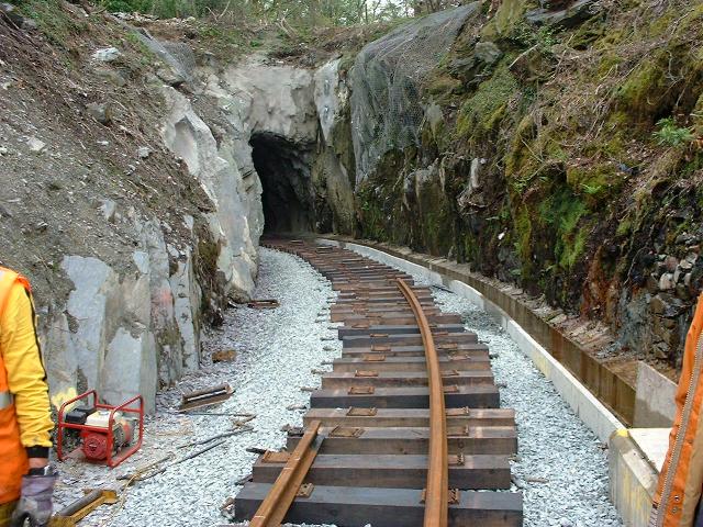
This southerly view (27/4/07) shows the Head of Steel at the end of that day, on the curve into Goat Tunnel. Click on the image to enlarge. This image is courtesy/copyright John Ewing and was taken on a digital camera. Image post processed using iPhoto Plus4 and displayed at 96dpi.
The new lengthened 200 metre loop terminates on the entrance to the Goat Cutting at Ch. 22,400 and the station building will be to the east here over the course of the coal siding. Rough track remained in the cutting from the '64 Co.'s attempts to build the line over 30 years ago but some was removed in February 2005 as Achnashean spent their last week of tree felling clearing the trackbed through the station and southwards, before the Bird Nesting closed season began on 1/3/05.
This northerly view (5/12/06) shows the contractor clearing the very wet north approach cutting that leads to Goat Tunnel. GCC replaced the deck of the footbridge a few years ago. Click on the image to enlarge. This image is courtesy John Ewing/copyright Yvonne Ainsworth Nikon Coolpix 4300 digital camera. Image post processed using iPhoto Plus4 and displayed at 96dpi.
This southerly view (20/5/07) shows Goat Cutting footbridge and the completed fencing along the edge of Goat Cutting. Residents of the Oberon Wood estate have been making their own additions including wooden panels and planting bushes. The southern loop point is in view. Track will soon be laid north from here for a short distance to form a temporary PW siding on the line of the western loop track. Click on the image to enlarge. This image is copyright B.W.Hughes and was taken on a Kodak DX6490 digital camera. Image post processed using iPhoto Plus4 and displayed at 96dpi.
These northerly and southerly views respectively (both 27/4/07) show tracklaying progress on the straight beyond the south loop point in Goat Cutting. The toe of the point is about 5m north of the footbridge. Click on the images to enlarge. These images are courtesy/copyright John Ewing and were taken on a digital camera. Images post processed using iPhoto Plus4 and displayed at 96dpi.
Goat Tunnel approaches
It was decided to extend wooden sleepered track all the way through Goat Cutting and Tunnel as far as Cemetery Crossing. Although later concerns about clearance in Goat Tunnel have seen this plan changed to one involving steel sleepers to reduce rail heights.
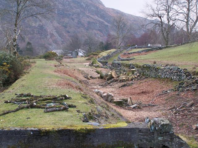
This northerly view (7/4/07) shows the completion of drainage in Goat Cutting. The concrete trough sections have been cemented against the rock face on the west side. Fencing still remains to be erected as a permanent boundary to Oberon Wood properties. Click on the image to enlarge. This image is courtesy/copyright John Ewing and was taken on a digital camera. Image post processed using iPhoto Plus4 and displayed at 96dpi.
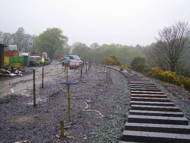
These northerly views (26/4/07 and 28/4/07) shows sleepers laid out in Goat Cutting (as seen from above the portal of Goat Tunnel) ready for Friday's tracklaying. Two days later Upnor Castle is seen on the completed track. Click on the images to enlarge. The first image is courtesy/copyright John Ewing and was taken on a digital camera. The second image is copyright Laurence Armstrong and was taken on a digital camera. Images post processed using iPhoto Plus4 and displayed at 96dpi.
The Goat Hotel used to have a reservoir, the outflow of which crossed Goat Cutting by means of an aqueduct. Occasionally, heavy flows can result into Goat Cutting so these have been channelled into a new down-pipe leading to Goat Tunnel's drainage.
This northerly view (24/4/07) shows the completed ballasting in Goat Cutting with the former Goat Reservoir outfall in spate. Surveying is underway to set out the alignment through the cutting and tight bend that curves into Goat Tunnel. Click on the image to enlarge. This image is courtesy/copyright John Ewing and was taken on a digital camera. Image post processed using iPhoto Plus4 and displayed at 96dpi.
This easterly view (8/5/07) shows construction of the intake for the former Goat Reservoir outflow. The former concrete channel abutment can be seen within the formwork. This job was completed by the following weekend. Click on the image to enlarge. This image is copyright Colin Lea and was taken on a digital camera. Image post processed using iPhoto Plus4 and displayed at 96dpi.
This easterly view (18/5/07) shows the completed Goat Reservoir overflow intake, with Goat Cutting behind. This image is courtesy Huw Davies and was taken on a digital phone camera. Image post processed using iPhoto Plus4 and displayed at 96dpi.
This northerly view (10/5/07) shows the installation of new fencing from the Goat Tunnel northwards along the east side of Goat Cutting. The fencing protects the rear gardens of Oberon Wood housing estate residents. Click on the image to enlarge. This image is courtesy Alasdair Stewart (WHRCL) and was taken on a digital camera. Image post processed using iPhoto Plus4 and displayed at 96dpi.

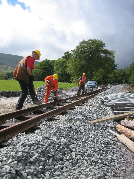
This southerly view (28/4/07) shows the North Wales Track Gang with Dolgarrog propelling rails around the curve into Goat Tunnel for tracklaying in the tunnel itself. Click on the image to enlarge. This image is courtesy/copyright Tim Evans and was taken on a digital camera. Image post processed using iPhoto Plus4 and displayed at 96dpi.

These northerly and southerly views respectively (both 27/4/07) show tracklaying progress on the curve into Goat Tunnel. The Head of Steel is about 1 length short of the tunnel portal. Click on the images to enlarge. These images are courtesy/copyright John Ewing and were taken on a digital camera. Images post processed using iPhoto Plus4 and displayed at 96dpi.

This southerly view (27/4/07) shows the Rest of The World Gang on completion of their Working Week with the Head of Steel at the north portal of Goat Tunnel. Click on the image to enlarge. This image is courtesy/copyright Tim Evans and was taken on a digital camera. Image post processed using iPhoto Plus4 and displayed at 96dpi.
Click here to visit Beddgelert to Bryn-y-felin page
Click here to return to the Stop Press Page
Site Development
If you have suggestions for development of this site, please contact me by email at the address on the Stop Press page.
Comments
Please add comments in my Guestbook on the Stop Press page.
Page Version 4.2 Dated 30/6/07